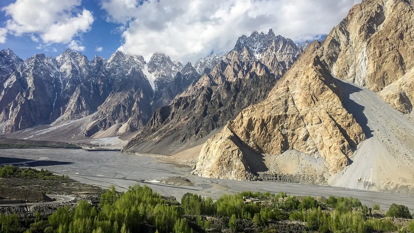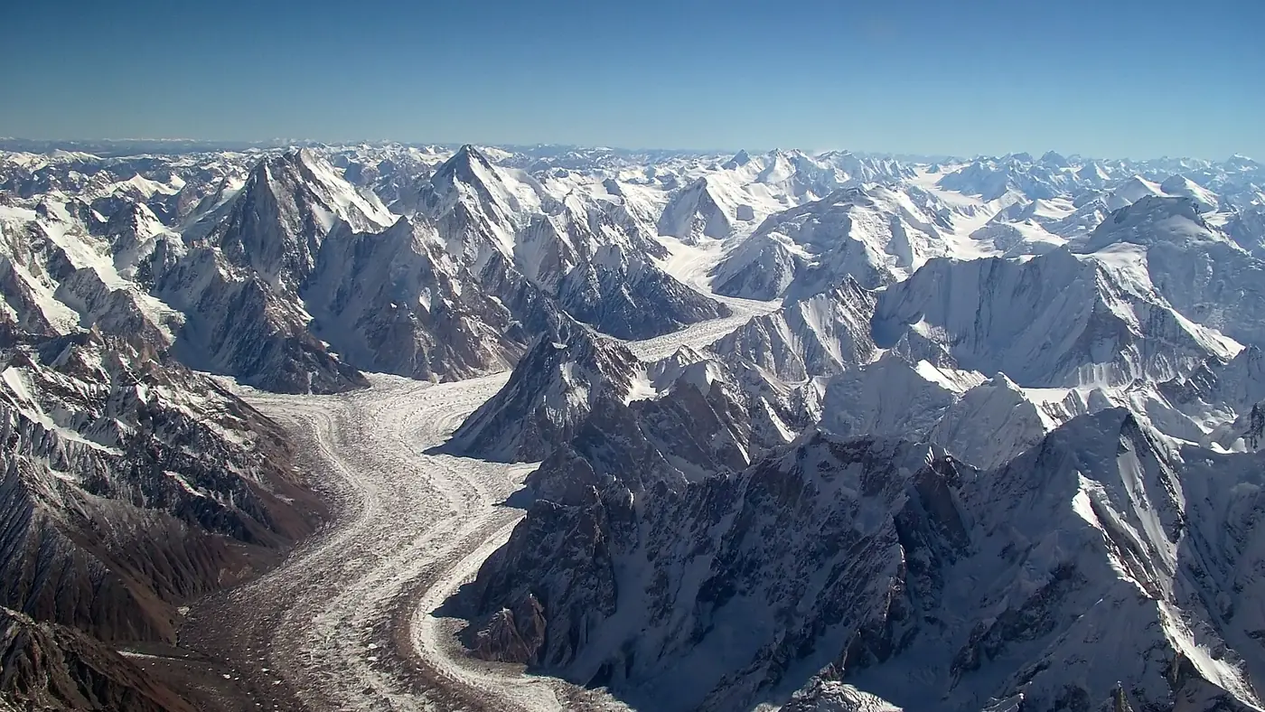
The Karakoram is the mountain range that runs through northern Pakistan, into a corner of India and along Pakistan's border with China, and it is where almost all of Gilgit-Baltistan's famous scenery sits: K2, the Baltoro glacier, Hunza, Nagar and the Karakoram Highway that gives the range its name. It is a separate range from the Himalaya, though the two are often confused, and it is one of the most heavily glaciated places on Earth outside the poles.
This guide covers where the Karakoram runs, what makes its peaks and glaciers different from the Himalaya, and the parts of it a Gilgit-Baltistan trip actually touches.
| At a glance | |
|---|---|
| Length | About 500 km |
| Highest peak | K2, 8,611 m, the world's second-highest mountain |
| 8,000 m peaks | 4 of the world's 14 |
| Countries | Pakistan, China, India, with edges into Afghanistan and Tajikistan |
| Longest glaciers | Siachen (about 76 km), Biafo (about 63 km) |
| Main road through it | Karakoram Highway, Islamabad to the Khunjerab Pass |
Where the Karakoram runs
The Karakoram stretches roughly 500 kilometres, mostly through Gilgit-Baltistan, along the northern edge of Pakistan-administered Kashmir and India's Ladakh, and up to the Chinese border. It sits at the boundary of the Indian and Eurasian tectonic plates, the same collision that built the Himalaya further south, which is why the whole region is still rising and still shaken by earthquakes.
For a Gilgit-Baltistan traveller, the Karakoram is what you are driving through on the Karakoram Highway between Chilas and Khunjerab, and what you are walking into on any trek out of Skardu, Hunza or Nagar. Our Karakoram Highway coverage and Baltoro glacier guide cover specific stretches in more detail.
The Karakoram's giant peaks
Four of the world's fourteen 8,000-metre peaks stand in the Karakoram, all in Pakistan: K2 (8,611 m), Gasherbrum I (8,080 m), Broad Peak (8,051 m) and Gasherbrum II (8,035 m), clustered around the head of the Baltoro glacier. The range also holds eighteen summits above 7,500 metres, among them Masherbrum, Chogolisa and Distaghil Sar, and dozens more above 7,000 metres, including Rakaposhi and Nanga Parbat's Karakoram neighbours.
K2 itself is the range's defining peak: steeper and, by most climbers' accounts, harder than Everest, and visible from Concordia after about a week's trek from Askole. Our 8,000-metre peaks of Pakistan guide covers all five (Nanga Parbat, further west, belongs to the Himalaya rather than the Karakoram) with where to see each one.
Why the glaciers are so big
Between 28 and 50 percent of the Karakoram's surface is under ice, against 8 to 12 percent for the Himalaya, and its glaciers include some of the longest outside the polar regions: the Siachen at about 76 kilometres, and the Biafo at about 63 kilometres, which meets the Hispar glacier at the Hispar La to form one of the classic long treks in the range. Karakoram glaciers also carry a thick coat of rock debris that insulates the ice beneath, which is part of why many of them have stayed stable or even advanced in recent decades while glaciers elsewhere retreat, a pattern researchers call the Karakoram Anomaly.
The Baltoro, Biafo, Hispar and Chogo Lungma are the glaciers most Gilgit-Baltistan trekkers will actually walk on, whether heading for K2 base camp, Snow Lake or Spantik.
Karakoram or Himalaya: what's the difference?
They are neighbouring but distinct ranges. The Himalaya runs in a long arc from Kashmir through Nepal and Bhutan; the Karakoram sits to its north-west, separated by the Indus river valley, and is generally considered to begin around Nanga Parbat's western side. In practice:
- Karakoram peaks are steeper and rockier, with less snow cover on their faces than the softer, more heavily glaciated Himalayan giants.
- Karakoram glaciers are debris-covered and unusually stable, where Himalayan glaciers are mostly retreating.
- Access is harder. Most Karakoram base camps, including K2's, are five or more days' walk from the nearest road, further than the equivalent Himalayan approaches in Nepal.
- Nanga Parbat, Pakistan's other 8,000-metre giant, is usually classed as the western anchor of the Himalaya, not the Karakoram, despite sitting inside Gilgit-Baltistan alongside it.
What this means for planning a trip
Nearly everything in a Gilgit-Baltistan itinerary, from Hunza's valleys to the Baltoro treks out of Skardu, sits inside or against the Karakoram, so understanding the range helps explain why the region looks the way it does: sheer granite walls, huge debris-covered glaciers, and villages that sit in narrow valleys between them. It also explains the short trekking season. Above about 4,000 metres in the Karakoram, snow and glacier travel are workable only from June to September in most years, which is why treks to Baltoro, Snow Lake and the range's other high places cluster in those months. See our trekking season guide for month-by-month detail.
Frequently asked questions
Is K2 in the Himalaya or the Karakoram?
The Karakoram. K2 stands at the head of the Baltoro glacier in Gilgit-Baltistan, in the Karakoram range, not the Himalaya.
How many 8,000-metre peaks are in the Karakoram?
Four: K2, Gasherbrum I, Broad Peak and Gasherbrum II. Pakistan's fifth 8,000-metre peak, Nanga Parbat, is usually classed as part of the Himalaya.
What is the longest glacier in the Karakoram?
The Siachen, at about 76 kilometres, though it lies in a disputed, closed military zone. The Biafo, at about 63 kilometres, is the longest glacier Gilgit-Baltistan trekkers can actually walk.
Why don't Karakoram glaciers seem to be shrinking like others?
Their thick rock-debris cover insulates the ice from summer heat, and the range's own climate pattern has kept many glaciers stable or slightly advancing, a phenomenon known as the Karakoram Anomaly.
Which parts of the Karakoram can ordinary travellers visit?
The Hunza and Nagar valleys, the Karakoram Highway up to Khunjerab, and the trekking routes out of Skardu and Askole are all open to travellers, with no special permit needed for the standard routes. See our travel planning guide for how to put a trip together.