The K2 base camp trek is a walk of about 12 to 14 days from Askole, the last village in the Braldu valley, up the Baltoro glacier to Concordia at about 4,600 metres and on to K2 base camp at about 5,000 metres, then back the same way. Add a jeep day from Skardu at each end and a spare day or two for weather, and most people need 15 to 17 days from Skardu. It is not technical, but it is long, rough and remote, with a week of nights above 4,000 metres, and the season is short: July and August, with June and September possible.
This guide goes through the route stage by stage, then covers how hard it really is, when to go, what the paperwork involves and who should think twice.
| At a glance | |
|---|---|
| Start and finish | Askole, 3,050 m, about 6 hours by jeep from Skardu |
| Highest point | K2 base camp, about 5,000 m |
| Key camp | Concordia, about 4,600 m, where the Baltoro and Godwin-Austen glaciers meet |
| Walking days | About 12 to 14, there and back from Askole |
| Skardu to Skardu | About 15 to 17 days with spare days |
| Distance on foot | Roughly 180 km in total |
| Season | July and August; June and September possible |
| Difficulty | Strenuous but non-technical; altitude and terrain are the challenge |
What is the K2 base camp trek?
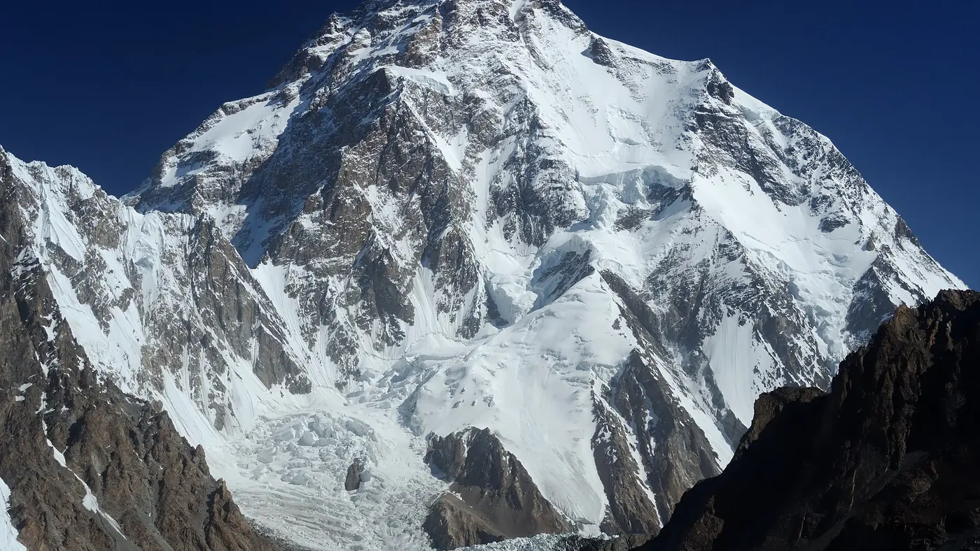
K2, at 8,611 metres, is the second-highest mountain on earth, and it cannot be seen from any road or village. The mountain is hidden from Askole, the highest settlement on the way to it. The only way to see it is to walk in.
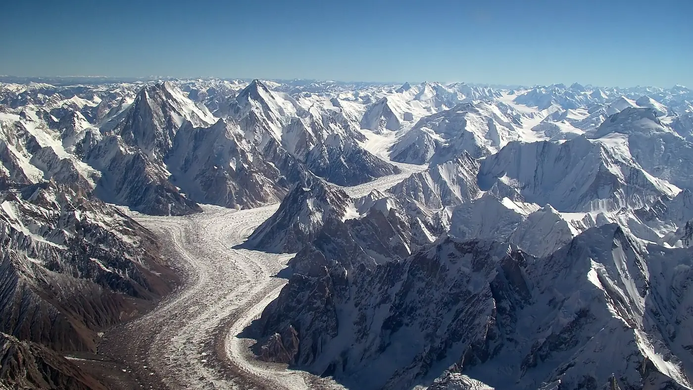
The trek follows the Braldu river from Askole to the snout of the Baltoro glacier, then climbs gradually up the glacier itself, about 62 km long, past the Trango Towers, Masherbrum and the Gasherbrum peaks. At Concordia the Baltoro meets the Godwin-Austen glacier, and K2 comes into full view at the head of it. Four of the world's fourteen 8,000-metre peaks stand around this upper Baltoro: K2, Broad Peak, Gasherbrum I and Gasherbrum II.
For most trekkers the goal is Concordia and the view of K2 from there, with a long day on to base camp itself. The whole route lies inside the Central Karakoram National Park.
How many days does the K2 base camp trek take?
A typical itinerary from Skardu looks like this. Walking times are typical for a fit, acclimatising group and vary with the conditions.
| Day | Stage | Camp altitude | Typical time |
|---|---|---|---|
| 1 | Skardu to Askole by jeep | 3,050 m | About 6 hours |
| 2 | Askole to Jhola | 3,200 m | 6 to 7 hours |
| 3 | Jhola to Paiju | 3,450 m | 6 to 7 hours |
| 4 | Rest day at Paiju | 3,450 m | |
| 5 | Paiju to Urdukas | 3,990 m | 7 to 8 hours |
| 6 | Urdukas to Goro II | 4,380 m | 6 to 7 hours |
| 7 | Goro II to Concordia | 4,620 m | 5 to 6 hours |
| 8 | Concordia to K2 base camp, back to Broad Peak base camp or Concordia | about 5,000 m at the top | 8 to 10 hours |
| 9 to 12 | Back down the glacier to Paiju and Jhola | Longer stages downhill | |
| 13 | Jhola to Askole | 3,050 m | 5 to 6 hours |
| 14 | Askole to Skardu by jeep | 2,226 m | About 6 hours |
Add at least one spare day at Concordia for bad weather, and one in Skardu for the jeep road or flights. That is where the 15 to 17 days comes from. From Islamabad, allow a day or two more to reach Skardu and back.
The jeep track has been pushed further up the valley in recent years, and in 2025 some groups were driving on beyond Askole towards Jhola, which saves a day of walking in each direction. Whether that is possible depends on the state of the track in your season, so ask when you plan.
Stage by stage: Askole to K2 base camp
Skardu to Askole
The jeep leaves Skardu, crosses into the Shigar valley and follows the Braldu river to Askole at about 3,050 metres, the last village. It takes about six hours when the track is clear, longer after rain or rockfall. Askole is where the porters are hired, loads are weighed and the trek begins.
Askole to Jhola
The first walking day follows the Braldu upstream through dry, hot country. The path crosses the snout of the Biafo glacier, one of the longest glaciers outside the polar regions, and continues past the small camp at Korophon to Jhola, at about 3,200 metres, where there are toilets and water.
Jhola to Paiju
Another long day along the river, often hot and dusty in the middle of the day, past Bardumal to Paiju at about 3,450 metres. Paiju is a well-used campsite close to the snout of the Baltoro, with toilets and water, and drinks on sale at high prices. Nearly every group spends a rest day here, both for acclimatisation and because the porters traditionally prepare food for the glacier days ahead.
Paiju to Urdukas
The route climbs onto the Baltoro glacier. From here the walking is on moraine: a rubble of rock and gravel over ice, with constant small climbs and drops. The Trango Towers appear across the glacier. Some groups stop at Khoburtse; most continue to Urdukas at about 3,990 metres, a grassy ledge above the ice with toilets and a proper campsite.
Urdukas to Goro II
The day moves into the middle of the glacier, with Masherbrum across the valley and Gasherbrum IV ahead. Goro II, at about 4,380 metres, is a camp on the ice itself. It is cold, stony and exposed, and this is often the first night that people feel the altitude.
Goro II to Concordia
A shorter day up the glacier to Concordia at about 4,600 metres, where the Baltoro and the Godwin-Austen glaciers meet. K2 fills the head of the valley to the north, with Broad Peak beside it and the Gasherbrums to the east. For many trekkers, this campsite and this view are the point of the whole trek.
Concordia to K2 base camp
The last stage runs north up the Godwin-Austen glacier past Broad Peak base camp, at about 4,800 metres, to K2 base camp at about 5,000 metres. The Gilkey Memorial, a stone cairn with plaques for climbers who have died on K2, stands near the base camp. It is a long day there and back. Some groups sleep at Broad Peak base camp to break it up. The upper glacier has crevasses and changing ice, so your guide chooses the line, and nobody should wander off it.
The way back
Most groups return the way they came, often in longer stages because it is downhill and everyone is acclimatised: Concordia to Urdukas, Urdukas to Paiju, then Jhola and Askole.
The alternative is to cross the Gondogoro La, at 5,585 metres, from near Concordia down to Hushe. It is a genuine mountaineering pass, climbed with crampons, a harness and fixed ropes, normally only in July and August, and it needs a guide who knows it. It is a separate decision with its own risks.
How difficult is the K2 base camp trek?
It needs no climbing skills, but it is one of the hardest treks in Pakistan that doesn't. The difficulty comes from five things together:
- Length. Two weeks of walking, most days five to eight hours, with no road out after Askole.
- Terrain. Several days on moraine, which is slow, uneven and tiring on the ankles and knees. It is harder going than a trail of the same length.
- Altitude. A week of nights between about 4,000 and 4,600 metres, and a day at 5,000. Headaches, poor sleep and loss of appetite are normal. Anyone whose symptoms get worse, not better, has to go down.
- Heat and cold. The lower Braldu valley can be very hot in July; the glacier camps drop below freezing at night, even in midsummer.
- Hygiene. Stomach illness is one of the commonest reasons people fall ill or turn back. Treat all water, wash your hands and eat carefully cooked food.
If something goes wrong high on the glacier, the way out is slow. A sick trekker is usually brought down on foot or by horse, and helicopter rescue is possible but expensive, has to be arranged in advance with the operator, and depends on the weather.
Our travel guide covers altitude sickness across the north in more detail.
When can you do the K2 base camp trek?
The season is short. July and August are the main months, when the route is clear of snow and the expedition teams are on the mountain. June can still have snow on the upper glacier, and September brings colder nights and the first autumn storms. Rescue arrangements are geared to the climbing season, which winds down from late August.
If you are choosing the month for a wider trip to the north, our seasonal guide shows what is open when.
Permits, guides and porters
Foreign trekkers must go with an approved guide through a licensed Pakistani operator, and pay the Central Karakoram National Park fee, which has been charged in US dollars for foreigners.
Pakistani trekkers should expect to pay the park fee too, and to show their CNIC at checkposts on the way in. The rules and the fees have changed more than once in recent years, so confirm what currently applies before you commit, either with the Gilgit-Baltistan tourism department or with an established operator in Skardu.
Whatever your nationality, you will not carry everything yourself. Tents, fuel and two weeks of food mean porters, hired at Askole or through your operator, with a cook and a guide who knows the glacier. Porters are paid by the stage, at rates set officially in Gilgit-Baltistan, and they need proper clothing, shoes and shelter for the glacier. A good operator takes care of that; if you organise the trek yourself, it becomes your responsibility.
Who should, and shouldn't, attempt it?
It suits fit walkers who have already done multi-day treks at altitude and want the biggest mountain landscape in Pakistan. If you have walked to Rakaposhi base camp, Fairy Meadows and beyond, or a long trek in Nepal, and enjoyed it, you are the right kind of person.
It doesn't suit first-time trekkers, anyone who struggles at altitude, or anyone with a heart or lung condition. It is also a poor choice if you have less than three weeks in total, because there is no short version.
If you want the mountains without the full trek, there are good alternatives. A night or two at Askole and a day's walk up the Braldu gives a taste of the approach. Around Skardu itself, the high valleys, Deosai and the lakes are open to anyone, and our Skardu destination page shows what is within a day's drive.
If you want help planning the trek, the season or the logistics, send us your dates and group size through our planning page.
Frequently asked questions
How many days is the K2 base camp trek?
About 12 to 14 walking days from Askole and back, and 15 to 17 days from Skardu once you add the jeep days and spare days for weather.
How high is K2 base camp?
About 5,000 metres. Concordia, where most people get their first full view of K2, is at about 4,600 metres.
Is the K2 base camp trek difficult?
It is strenuous but non-technical. The hard parts are the length, several days walking on rough glacier moraine, and a week of nights above 4,000 metres.
When is the best time for the K2 base camp trek?
July and August. June and September are possible, but with more snow early in the season and colder nights and storms later.
Can Pakistanis do the K2 base camp trek?
Yes. Pakistani trekkers show their CNIC and pay the Central Karakoram National Park fee. Confirm the current rules and fee in Skardu before you go, as they have changed in recent years.
Can you see K2 without trekking?
Not from any road or village. You have to walk at least as far as Concordia, about a week from Askole, to see it properly.