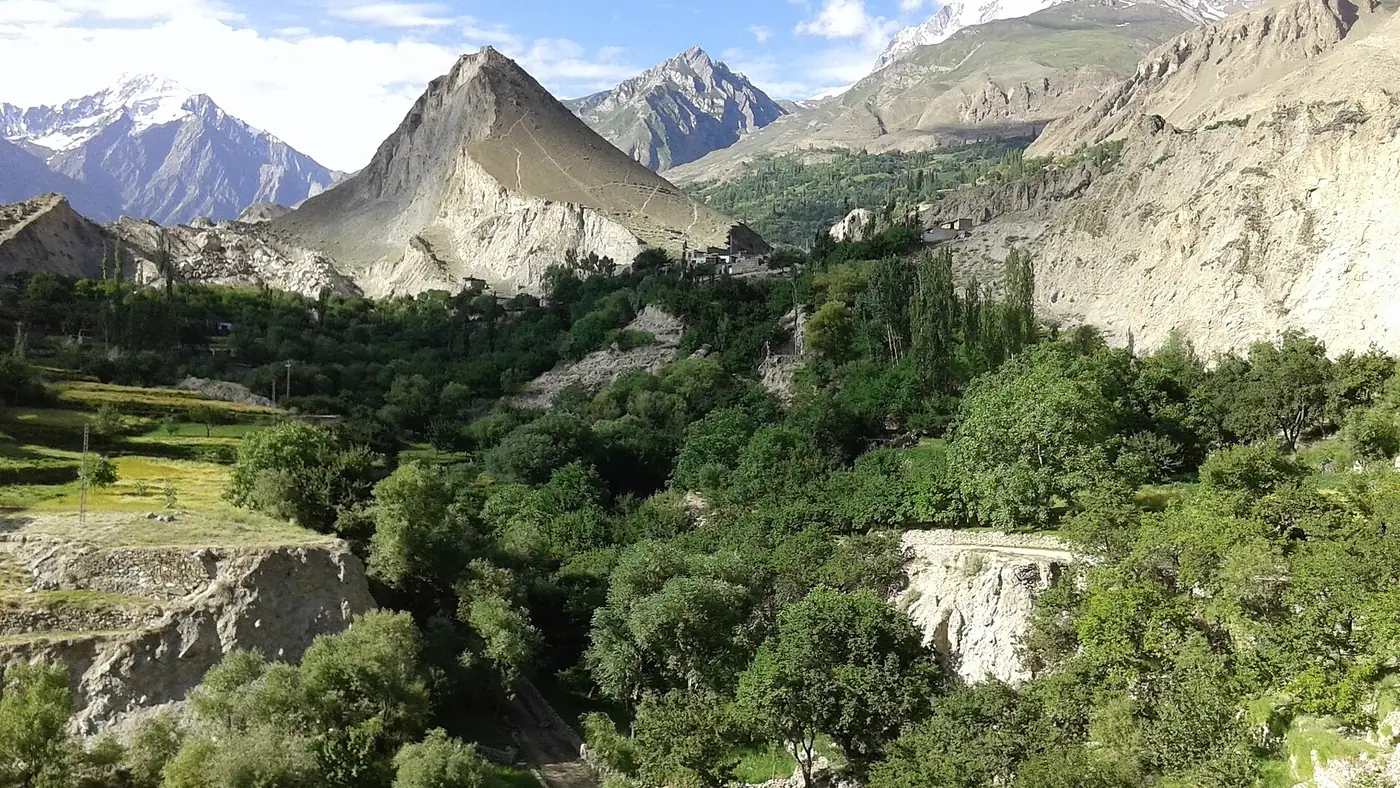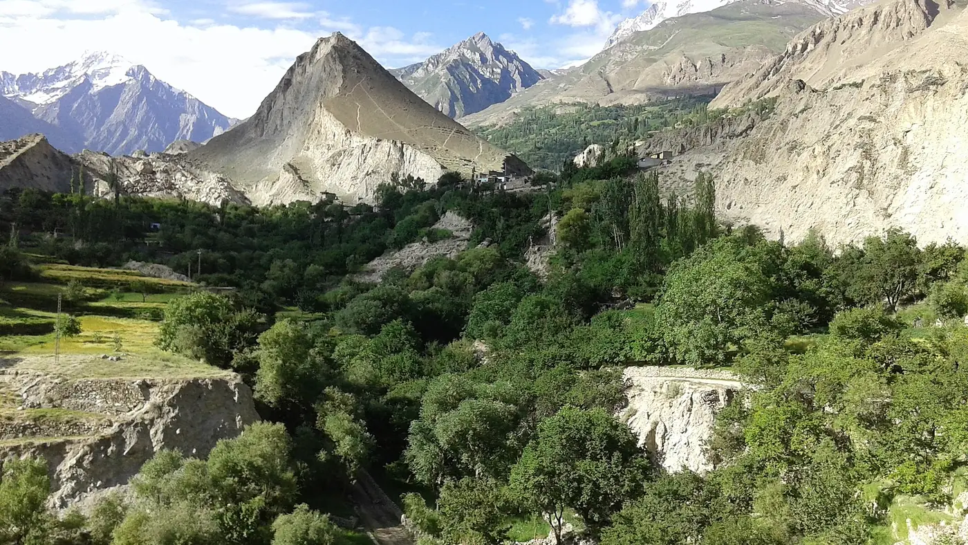
Diran Peak is a 7,266-metre mountain immediately east of Rakaposhi, standing between Nagar's Minapin valley and the Bagrot valley on the Gilgit side. Its clean, pyramid-shaped summit looks like one of the more straightforward 7,000-metre peaks in the Karakoram, but it has turned back strong expeditions and killed experienced climbers, which is why mountaineers treat it with more respect than its shape suggests.
This guide covers the mountain's height and setting, the climbing record that gives it its reputation, and where to see it from the valleys on either side.
| At a glance | |
|---|---|
| Height | 7,266 m |
| Range | Rakaposhi-Haramosh group, Karakoram |
| Location | Between Nagar's Minapin valley and Bagrot valley, east of Rakaposhi |
| First ascent | 1968, three Austrian climbers, alpine style |
| Reputation | Deceptively difficult; deep snow, crevasses and avalanche risk |
| Viewpoints | Minapin (Nagar side); upper Bagrot valley (Gilgit side) |
| Trek season | May to September |
Where is Diran Peak?
Diran sits in the Rakaposhi-Haramosh group of the Karakoram, sharing a long ridge of snow and ice with Rakaposhi just to its west. The two peaks are connected by a ridge roughly 16 km long, fed by the Minapin glacier on the Nagar side and dropping towards Bagrot on the other.
That puts Diran on the boundary between two valleys most visitors see separately. From Minapin, a village off the Karakoram Highway in Nagar, the mountain rises beyond the head of the Minapin glacier. From Bagrot, reached from Gilgit rather than Hunza, it appears from the opposite side, above quieter pastures that see far fewer visitors than Hunza and Nagar. Our guides to Bagrot valley and to Rakaposhi mountain, Diran's larger neighbour, cover both approaches in more detail.
Climbing history: an easy shape, a hard mountain
Diran's regular route, up the north ridge from the Minapin glacier, looks like one of the more approachable lines on a 7,000-metre Karakoram peak, and it is sometimes described as the second-easiest of the range's 7,000-metre summits after Spantik. That reputation has misled more than one expedition.
The climbing record:
- 1958. A British expedition made an early attempt and was turned back.
- 1959. A German expedition also failed to reach the summit.
- 1964. An Australian attempt was driven back by bad weather, deep snow and avalanches.
- 1968. Three Austrian climbers, Rainer Goeschl, Rudolph Pischinger and Hanns Schell, made the first ascent by the north ridge, climbing in alpine style without fixed camps.
Since then, Diran has continued to see more failed and abandoned expeditions than its modest technical grade would suggest, including seasons when teams have called off attempts because of avalanche danger on the upper slopes. The mountain's easy-looking snow ridges hide crevasses and unstable, wind-loaded snow, and its accident record is a genuine warning rather than a footnote in a guidebook. Climbing Diran needs solid glacier travel and avalanche judgement, not just fitness, and it remains a serious undertaking requiring an expedition permit.
Where to see Diran from Minapin
Minapin, a village a short way off the Karakoram Highway in Nagar, is the trailhead for the walk to Rakaposhi base camp, and Diran comes into view as the trail climbs beside the Minapin glacier. Most trekking parties see it from the same route and campsites used for Rakaposhi, since the two mountains share the same glacier system at the top of the valley.
The walk from Minapin runs over two to three days for most parties, camping partway up before reaching the base camp meadow beneath the peaks. Going further, onto the glacier towards Diran's own base camp, needs an experienced local guide because of crevassing on the ice. Our guide to camping in Gilgit-Baltistan covers what a night on this route involves.
Where to see Diran from Bagrot
The Bagrot valley, reached by road from Gilgit rather than from Hunza, shows Diran from its other side, above the Hinarchi glacier. It is a quieter approach than Minapin, with far fewer visitors, and it is best treated as a separate day or overnight trip from Gilgit rather than an add-on to a Hunza itinerary. Our Bagrot valley guide explains how to get there and what the valley offers beyond the mountain view.
Is Diran worth the trip?
For a roadside view, no single stop shows Diran on its own the way the Rakaposhi View Point shows Rakaposhi; it is best seen as part of a walk from either Minapin or Bagrot, or as a companion peak from wider viewpoints such as Eagle's Nest above Karimabad. For walkers with two or three spare days and reasonable fitness, the Minapin route is the easier way to stand close to it, since it follows the same trail used for Rakaposhi base camp.
Climbing it is a different matter altogether, and one for experienced mountaineers with a proper expedition, not a subject for casual planning. For how Diran compares in height with the other giants around Hunza and Nagar, see our guide to the highest peaks in Gilgit-Baltistan.
Frequently asked questions
How high is Diran Peak?
Diran is 7,266 metres high, standing immediately east of Rakaposhi in the Rakaposhi-Haramosh group of the Karakoram.
Who first climbed Diran Peak?
Three Austrian climbers, Rainer Goeschl, Rudolph Pischinger and Hanns Schell, made the first ascent in 1968 by the north ridge, in alpine style. Earlier attempts in 1958, 1959 and 1964 had all failed.
Why is Diran considered dangerous to climb?
Its slopes look gentle but hide crevasses and unstable, avalanche-prone snow. Several experienced expeditions have been turned back or suffered accidents on a mountain that looks easier than it climbs.
Where can you see Diran Peak?
From Minapin in Nagar, on the trail towards Rakaposhi base camp, and from the Bagrot valley on the Gilgit side, which shows the mountain from the opposite face.
Is Diran Peak in Nagar or Gilgit district?
The summit sits on the boundary of the Rakaposhi-Haramosh group, with Minapin on the Nagar side and Bagrot on the Gilgit side, so both districts have a claim to a view of it.