The Rakaposhi base camp trek climbs from Minapin, a village just off the Karakoram Highway in Nagar, to Tagaphari, a meadow on the edge of the Minapin glacier directly below Rakaposhi and Diran. It is usually done over two days, with a night at the base camp, and gains around 1,300 metres on a steep but well-used path. There are no technical sections, the season runs from about June to September, and it is one of the best first treks in Gilgit-Baltistan.
This guide covers the route stage by stage, what a night at Tagaphari involves, how hard the climb really is, and when a guide is needed.
| At a glance | |
|---|---|
| Start | Minapin, Nagar, about 2,000 m |
| From Gilgit | About 75 km on the Karakoram Highway |
| From Karimabad | About 25 km back down the highway |
| Halfway camp | Hapakun, about 3 to 4 hours up |
| Base camp | Tagaphari, usually given as about 3,300 m |
| Hapakun to base camp | About 2 to 4 hours, steep |
| Usual length | 2 days; 3 with a night at Hapakun |
| Season | June to September; late May and early October possible |
| Difficulty | Moderate; steep, non-technical |
Where does the trek start?
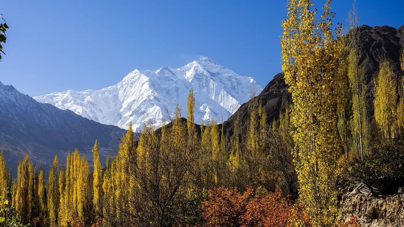
Minapin sits a short way off the highway on the Nagar side of the Hunza river, about 75 km from Gilgit and roughly 25 km short of Karimabad. The village looks straight up at Rakaposhi, 7,788 metres, whose north side rises almost 6,000 metres from the valley floor. It is the same mountain that everyone stops to photograph at Ghulmet, a few kilometres down the road.
Minapin and neighbouring Pisan have a handful of guesthouses and campsites. Sleeping there the night before means an early start in the cool of the morning, which matters on a climb that faces the sun. If you are coming from Karimabad, the drive is short enough to leave after breakfast, but you will then climb in the heat of the day.
The route, stage by stage
Minapin to Hapakun
The path leaves the village through irrigated fields and orchards and begins to climb almost at once, zigzagging up a dry, stony slope before entering a stretch of forest. It is easy to follow for most of the way; the last part before Hapakun can be confusing, so ask in the village or walk with someone who knows it.
Most walkers take three to four hours, depending on fitness and how hot the day is. Hapakun is a grassy clearing with a stream, used by shepherds and trekkers, and in season there is a basic camp where you can get tea and a simple meal.
Hapakun to Tagaphari
This is the hard part. The path climbs steeply through forest and then out onto open ground, and the gradient barely eases until the top. Allow two to four hours; it is only a few kilometres, but most of the height of the trek is gained here.
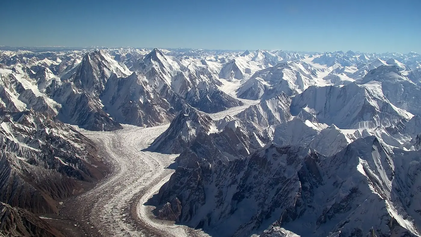
It ends on the grassy ridge of Tagaphari, above the Minapin glacier. Rakaposhi fills the sky on one side and Diran, 7,266 metres, on the other, with the glacier below them a wide field of broken ice and rubble.
A night at Tagaphari
Sleeping at base camp is the point of the trek. The views are at their best in the evening and first thing in the morning, when the day walkers have gone and the cloud that often builds around Rakaposhi by midday has not yet formed.
What to expect:
- Somewhere to sleep. From about June to September, local families run seasonal camps at Hapakun and Tagaphari with tents, bedding and simple meals. You can also carry your own tent and pitch it at the fixed campsite.
- Water from nearby streams. Treat or boil it.
- Cold nights. You are about 1,300 metres higher than Minapin, and nights are cold even in July, colder in June and September. Bring a warm jacket and a sleeping bag, or ask what bedding the camp provides.
- No signal and no shops. Carry snacks, a torch and anything you need for the night.
Before you go down, climb one of the small rises above the camp. From there the whole Minapin glacier opens out below you, with Rakaposhi and Diran on either side.
Two days or three?
Two days suits most fit adults: up to Tagaphari on the first day, with lunch at Hapakun, and down to Minapin the next morning. The descent takes roughly three to five hours and is hard on the knees.
Three days, with a night at Hapakun on the way up, is kinder. It splits the climb into two manageable halves, gives your body more time with the altitude, and suits older walkers, anyone new to trekking, and families with teenagers.
Very fit walkers sometimes go up and back in a single day. It is a long, punishing day with little time at the top, and it misses the evening and morning views that make the place special. We don't recommend it.
How hard is the Rakaposhi base camp trek?
It is a moderate trek made harder by its steepness. There is no glacier crossing, no scrambling and no exposure on the main path, and the altitude, at around 3,300 metres, is modest by Karakoram standards. What makes it tiring is the relentless climb: around 1,300 metres of height in a few hours of walking, much of it on loose, dusty ground in the sun.
It suits:
- Fit adults who walk regularly and are comfortable on a long, steep hill
- Teenagers who are used to walking, with a three-day plan
- First-time trekkers who want to see what a Karakoram trek is like before trying something longer
It is harder going for anyone who struggles on stairs, has bad knees, or has not been active for a while. If that is you, a morning walk above Minapin with the mountain in view is a better plan than turning back halfway up a steep slope.
Altitude sickness is less likely here than on higher treks, but headaches and poor sleep at base camp are not unusual. Our guide to altitude sickness in Gilgit-Baltistan explains what to watch for.
Do you need a guide?
For the main trail to Tagaphari, not strictly. The path is well used, and many walkers go without one. A local guide is still worth having if it is your first trek, if you are walking early or late in the season, or if you want someone to handle the camp, the food and the route through the confusing section below Hapakun.
Porters can be hired in Minapin to carry tents and bags. Rates are set locally, and the village elders or your guesthouse can arrange them; agree the price and the loads before you start.
Beyond base camp you do need a guide. Two popular extensions start from Tagaphari:
- Diran base camp, across the Minapin glacier, a return trip of around five hours. The glacier has deep crevasses and the route across it changes every year.
- Kacheli Lake, a high lake on the far side of the glacier, a long day on the ice.
Neither should be attempted without a local guide who knows the current line across the glacier.
When to go
June to September is the season. The seasonal camps are open, the path is clear, and the days are long. July and August are the warmest, and the lower slopes can be very hot in the middle of the day, so start early.
Late May and early October are possible in settled weather, with cold nights and the chance that the camps are not running. Snow lies on the upper slopes into spring, and from late October the trek is out of season.
For how Rakaposhi fits into the wider calendar, see our guide to the trekking season in Gilgit-Baltistan.
Is it worth it?
Yes, for anyone fit enough to enjoy a steep climb. Few treks in Pakistan put you this close to a 7,000-metre peak in a day and a half from a paved road, and the night at Tagaphari, with Rakaposhi and Diran turning orange above the glacier, is something most visitors to Hunza never see.
If the trek isn't for your group, you can still see Rakaposhi properly from the roadside at Ghulmet. Our nine-day Gilgit, Hunza and Khunjerab tour stops there on the drive up, and our guide to easy treks in Gilgit-Baltistan sets Rakaposhi alongside other good first treks.
Frequently asked questions
How long is the Rakaposhi base camp trek?
Usually two days from Minapin: four to eight hours up to Tagaphari with a stop at Hapakun, a night at base camp, and three to five hours down. A three-day version adds a night at Hapakun.
How high is Rakaposhi base camp?
Tagaphari is usually given as about 3,300 metres, around 1,300 metres above Minapin. Some GPS readings put it a little higher.
Is the Rakaposhi base camp trek difficult?
It is moderate and non-technical, but steep, with most of the height gained in the section between Hapakun and base camp. Regular walkers manage it well over two or three days.
Do I need a guide for Rakaposhi base camp?
Not for the main trail, which is well used, though a guide helps on a first trek. For Diran base camp or Kacheli Lake, which cross the Minapin glacier, a local guide is essential.
Can you stay overnight at Rakaposhi base camp?
Yes. From about June to September, seasonal camps at Tagaphari offer tents, bedding and simple meals, and you can also pitch your own tent at the campsite.
How do I get to Minapin?
Minapin is about 75 km from Gilgit on the Karakoram Highway, a short way off the road on the Nagar side, and about 25 km before Karimabad. Any car or jeep heading up the highway can drop you there.