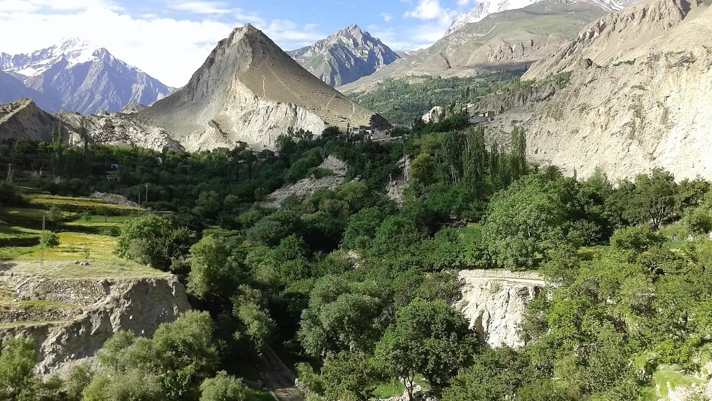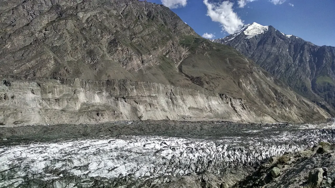
The main places to visit in Nagar valley are the Hopper glacier, the Rakaposhi View Point at Ghulmet, the village of Minapin and its trail to Rakaposhi base camp, the remote Hispar valley, and the quiet side valleys above Chalt. Nagar faces Hunza across the Hunza river, so almost all of it can be seen from a base in Karimabad: the viewpoint on the drive in, Hopper in half a day, and Minapin or Hispar if you have longer.
Many visitors drive through Nagar without noticing it on the way to Hunza. This guide takes the district place by place, with how long each one needs and who it suits.
| Place | What it is | From Karimabad | Time needed |
|---|---|---|---|
| Rakaposhi View Point | Roadside view of Rakaposhi at Ghulmet | About 30 km | 30 to 60 minutes |
| Minapin | Village below Rakaposhi, base camp trailhead | About 30 km | Two or three days for the trek |
| Nagar Khas | District headquarters, on the way to Hopper | About 11 km | A short stop |
| Hopper | Glacier viewpoint, Rush Lake trailhead | About 22 km | Half a day |
| Hispar | Remote valley at the end of the road | About 44 km, by jeep | A full day |
| Chalt, Chaprot and Bar | Farming valleys where Nagar begins | About 55 km | A day, or on the way in |
How is Nagar laid out?
Nagar is its own district, separate from Hunza, with its headquarters at Nagar Khas. It was a princely state, ruled by its own Mirs, until 1972. Burushaski and Shina are the local languages, and the villages are conservative: dress modestly, and ask before photographing people, especially women.
For a visitor the district falls into two parts:
- Lower Nagar runs along the south bank of the Hunza river beside the Karakoram Highway, from Chalt through Nilt, Thol, Ghulmet and Pisan to Minapin. You drive through it on the way from Gilgit to Hunza.
- Upper Nagar lies across the river from Karimabad, reached by a road that leaves the highway just past Ganish. Nagar Khas, Hopper and the long road to Hispar are here, close to the big glaciers.
For mobile signal, SCOM is the most reliable network in Nagar. For the wider region, including Hunza and Gojal, see our Gilgit and Hunza page.
Rakaposhi View Point at Ghulmet
The one place in Nagar nearly everyone sees. At Ghulmet the highway passes right beneath the north face of Rakaposhi, 7,788 metres high and only about 11 km away, and a cluster of cafés and small hotels stands beside a glacier stream with the mountain filling the sky above. People sit on terraces by the water with tea and chapshuro, many with their feet in the stream.
Stop for half an hour to an hour, ideally in the early morning or late afternoon, when the light is best and the summit is most often clear. Our Rakaposhi View Point guide covers timing and photographs, and our Rakaposhi mountain guide tells the story of the peak and its first ascent in 1958.
Minapin and the trail to Rakaposhi base camp
Minapin is a quiet village a few kilometres beyond Ghulmet, just off the highway on a short side road. It sits at about 2,000 metres below Rakaposhi and Diran, with a handful of guesthouses and none of the bustle of Karimabad. It is a good place to spend a night simply for the peace.
It is also where the walk to Rakaposhi base camp begins. The trail climbs beside the Minapin glacier to a campsite at Hapakun and on to Tagaphari, the base camp meadow beneath the north faces of Rakaposhi and Diran. Most people take two days up and one down, and guides and porters can be hired in the village. Our guide to camping in Gilgit-Baltistan has more on the campsites and what to carry.
Next door to Minapin, above Pisan, the Gilgit-Baltistan tourism department promotes a natural cricket ground at about 2,600 metres, reached by a walk of around an hour above the Pisan bazaar. It is a flat green field under the shoulders of Rakaposhi and Diran, and a pleasant walk for anyone staying nearby.
Nagar Khas and Hopper
Across the river from Karimabad, the Nagar road climbs from the bridge below Ganish to Nagar Khas, the old capital of the Mirs of Nagar and now the district headquarters. Most visitors pass straight through it on the way to Hopper, but it is worth slowing down for the terraced fields and the view back across the river to Karimabad.
Hopper, about 22 km from Karimabad, is a cluster of five villages at around 2,800 metres at the end of the road. From the viewpoint there you look down on the Bualtar glacier, grey-black with rock and audible on a warm day. It makes a half-day trip from Hunza, and it is the trailhead for the multi-day trek to Rush Lake at 4,694 metres. Our guide to Hopper valley covers the drive, the walk down to the ice, and where to stay.
Hispar valley
Hispar is the last valley in Nagar and the most remote place in the district you can reach by road. A narrow jeep road of roughly 40 km runs from the highway through Nagar Khas and up the gorge of the Hispar river to Hispar village, at about 3,100 metres, a couple of kilometres below the snout of the Hispar glacier.
The glacier is 49 km long. At its head, the Hispar La, a pass of 5,128 metres, joins it to the Biafo glacier, which runs down the other side to Askole in Shigar. Together they make a glacier route of about 100 km, trekked by organised expeditions over one to two weeks.
For a visitor without trekking plans, Hispar is a long day out:
- Go by jeep with a local driver. The road is narrow and exposed, and slides are frequent. It is no place for a family car.
- Allow a full day from Karimabad for the round trip, with time in the village.
- Take food and water. Don't count on finding a restaurant or a hotel; if you want to stay, arrange it in advance through your hotel or a trekking operator.
- Check the road first. Ask in Karimabad or Nagar Khas whether it is open, particularly after rain.
Chalt and its side valleys
Chalt, about 50 km from Gilgit, is where Nagar begins. The British reinforced a fort here in 1890, and in December 1891 their troops set out from Chalt against Hunza and Nagar and stormed the fort at Nilt, a few kilometres up the road, in the first big action of the campaign.
From Chalt, jeep roads lead north into side valleys that very few visitors see:
- Chaprot, a short drive above Chalt, a green farming valley that the tourism department recommends to visitors.
- Bar, a village further north up the valley, at the end of a longer jeep road.
- Daintar, a high side valley above Chaprot whose pass leads over towards Naltar.
These are places for a slow day out, a picnic by the fields and a walk, rather than for sights. The roads are rough and change with the weather, so go with a driver who knows them.
How much time do you need in Nagar?
Nagar fits around a stay in Hunza rather than needing its own base:
- On the drive from Gilgit: stop at the Rakaposhi View Point, and at Chalt if you have time.
- Half a day from Karimabad: Nagar Khas and Hopper.
- Two or three days: the Rakaposhi base camp walk from Minapin, with a night in the village before or after.
- A full day: Hispar by jeep, for those with a week or more in the area.
Two practical points. Nagar is largely Shia, and during Muharram, especially on the 9th and 10th, processions close parts of the highway through the district and mobile service is often suspended; Ashura falls in mid-June in 2027, so avoid driving through on those days. And in summer heatwaves the authorities issue glacial flood alerts for Gilgit-Baltistan; when one is in force, keep away from glacier streams and follow local advice. The Gilgit-Baltistan tourism department's Nagar page lists the district's attractions.
Which places suit you?
- Families and short trips: the Rakaposhi View Point and Hopper. Both are reached by road, need no real walking, and fit into a normal day.
- Walkers: Minapin and Rakaposhi base camp, with a night under the mountain.
- Trekkers: Rush Lake from Hopper, or the long Hispar route with a proper expedition.
- Anyone who wants to get off the tourist trail: Hispar, or the valleys above Chalt, with a local driver.
If your time in the north is short, don't try to see all of Nagar. The viewpoint and Hopper give you the best of it in a few hours, and both are part of our nine-day Gilgit, Hunza and Khunjerab tour.
Frequently asked questions
What is Nagar valley famous for?
Rakaposhi, which rises from the Nagar side of the Hunza river, and the big glaciers of upper Nagar, especially the Hopper and Hispar glaciers. The Rakaposhi View Point at Ghulmet is its best-known stop.
Is Nagar part of Hunza?
No. Nagar is a separate district with its own history as a princely state, although visitors usually see it from a base in Hunza. The two face each other across the Hunza river.
How far is Nagar from Karimabad?
Nagar Khas is about 11 km from Karimabad, across the river, and Hopper about 22 km. The Rakaposhi View Point is about 30 km back down the highway towards Gilgit.
Can you see Nagar valley in one day?
You can see the highlights: the Rakaposhi View Point on the drive in and a half-day trip to Hopper. Minapin's base camp trek and Hispar each need extra time.
Is Nagar valley safe to visit?
Yes, Nagar is visited by many Pakistani families every summer. Avoid travelling through on the 9th and 10th of Muharram, check for flood alerts in heatwaves, and take a local driver for the jeep roads to Hispar and the Chalt valleys.