The best stops on the Karakoram Highway between Gilgit and Khunjerab are, in order: Danyor for the Chinese cemetery, the Rakaposhi View Point at Ghulmet, the Sacred Rock near Ganish, Attabad Lake, Gulmit, the Hussaini suspension bridge, the Passu Cones, apricot cake in Passu, the Batura glacier, and the border itself. The 278 km take five and a half to six hours of pure driving, so don't try to fit every stop into one day. Spread over three days from Gilgit, with nights in Karimabad and Passu, the road becomes the trip.
This guide lists the stops as you meet them heading north, with how long to give each and when the light is best.
| At a glance | |
|---|---|
| Distance | 278 km, Gilgit to the Khunjerab Pass |
| Driving time | 5.5 to 6 hours without stops |
| With stops | Best over three days |
| Fuel | Gilgit, Aliabad and Sost; Sost is the last |
| Best months | May to October; the top is open to visitors roughly May to November |
| Morning stops | Rakaposhi, the Passu Cones |
| Afternoon stops | Attabad Lake, the Hussaini bridge |
The stops at a glance
Distances are from Gilgit, from the Gilgit-Baltistan tourism department's chart where it gives them.
| Stop | From Gilgit | Allow | Best time |
|---|---|---|---|
| Danyor: Chinese cemetery and rock inscription | About 14 km | 30 minutes | Any time |
| Rakaposhi View Point, Ghulmet | About 75 km | 30 to 45 minutes | Morning |
| Aliabad: fuel and cash | About 88 km | 15 minutes | Any time |
| Ganish and the Sacred Rock | About 98 km | 45 minutes to an hour | Morning or late afternoon |
| Attabad Lake landing | About 30 to 40 minutes past Karimabad | 1 to 2 hours | Early or late |
| Gulmit | About 138 km | 1 hour to half a day | Lunch |
| Hussaini bridge | A few km short of Passu | 1 hour | Afternoon |
| Passu Cones viewpoint | Just south of Passu | 10 to 20 minutes | Early or late |
| Passu | About 152 km | 30 minutes for cake | Any time |
| Batura glacier | Just north of Passu | 10 minutes | Any time |
| Sost | About 172 km | 20 minutes | On the way up |
| Khunjerab Pass | 278 km | Under an hour | Late morning |
Gilgit to Karimabad
Danyor
Across the river from Gilgit, where the highway turns north, Danyor is worth a short stop. The Chinese cemetery, with 88 graves, is where Chinese workers who died building the highway in the 1960s and 1970s are buried; the headstones carry Chinese inscriptions, and it is a quiet place to pause before the drive. Nearby are an old rock inscription and a suspension bridge over the river. Half an hour covers them.
The Rakaposhi View Point at Ghulmet
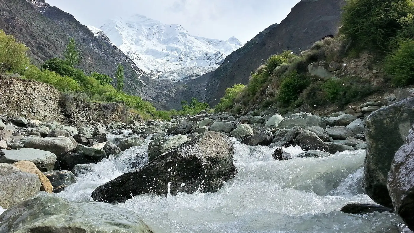
The one stop nobody should miss. At Ghulmet, about 75 km from Gilgit, the highway runs directly beneath Rakaposhi, 7,788 metres high, and you look almost straight up at it from the car park. Small hotels and tea stalls have terraces facing the mountain, and a cold stream runs down beside them.
Stop here in the morning if the summit is clear, because cloud tends to gather as the day goes on. Park fully off the highway, which is narrow here. Our guide to the Gilgit to Hunza drive covers the villages on either side.
Aliabad
The market town of central Hunza is not a sight, but it is the place to fill the tank and take out cash.
Ganish and the Sacred Rock of Hunza
Below Karimabad, beside the highway, Ganish is thought to be the oldest settlement in Hunza, with carved wooden mosques and watchtowers in its old core. A few minutes' drive away, between the highway and the Hunza river, is the Sacred Rock of Hunza, also called Haldeikish: a line of boulders about 180 metres long covered with ibex, hunters and inscriptions in half a dozen ancient scripts, left by travellers on the old Silk Road. Give the two together about an hour, ideally with a local guide.
If you are staying in Karimabad, these are easy to see on a short morning rather than on the way through.
Attabad and the tunnels
Attabad Lake
About 30 to 40 minutes north of Karimabad, the highway meets Attabad Lake at its southern end, beside the main boat landing with its cafés and jetties. The first view up the lake from here is the one everyone photographs. It is busiest from late morning to mid-afternoon in summer, so stop early on the way up or late on the way back. Our Attabad Lake guide covers the boats and the colours.
The tunnels
Beyond the landing the road runs through the five Pak-China Friendship Tunnels, with short open stretches along the water in between. Stop only in proper spaces off the road, never at a tunnel mouth. Our guide to the Attabad tunnels explains how they came to be built.
Gojal: Gulmit to Passu
Gulmit
The main town of upper Hunza, about 138 km from Gilgit, and the best lunch stop on the road. Bozlanj Café, run by women from the village, serves Wakhi dishes such as gyal and ghilmindi, made to order, so allow time. If you have an hour and good legs, the Ondra Poygah staircase above the town gives the widest view down Attabad Lake.
The Ghulkin glacier
Just north of Gulmit the Ghulkin glacier comes down almost to the highway. It is a quick look from the road, or a short walk to the edge of the ice.
The Hussaini suspension bridge and Borith Lake
A few kilometres short of Passu, the Hussaini bridge crosses the Hunza river on wooden planks slung from steel cables, with the Passu Cones behind it. A small community fee is charged, and a life jacket is provided. Allow an hour, including the walk down from the road and back. The side road to Borith Lake leaves the highway nearby and makes a good add-on of an hour or two.
The Passu Cones viewpoint
The classic view of Tupopdan, the saw-toothed ridge everyone calls the Passu Cones, is from the highway just south of the village, where the road straightens beside the river. Early morning and late afternoon light are far better than midday. Pull well off the road: this is the main road to China, and trucks come through fast.
Passu
Glacier Breeze, on the slope beside the highway, is known across Hunza for its apricot cake, with a view of the Passu glacier and the Cones. Yak Grill, near the start of the glacier walk, serves yak burgers alongside Pakistani food. Even if you are not staying, stop for tea and cake.
The Batura glacier
A few kilometres north of Passu the Batura glacier, about 56 km long and one of the longest outside the polar regions, spreads down towards the highway as a wide field of grey ice and rock. Stop where the road gives space, look up the valley, and carry on.
Sost to the top
Sost, about 172 km from Gilgit and at about 2,800 metres, is the last town and the last fuel. Top up, have tea and use the toilets. It is a working border town rather than a place to linger.
At the Dih checkpoint you enter Khunjerab National Park, show your ID and pay the park fee in cash. On the climb above, watch for golden marmots standing up beside the road, especially in June and July, and ibex on the slopes early and late in the day. Don't feed them.
At the top, 4,693 metres, is the border gate and the stone marker. Keep the stop under an hour, move slowly and drink water. Our guide to the drive from Hunza to Khunjerab Pass covers timings and fuel for that day.
How to fit the stops in
Trying to see all of this in one day from Gilgit means six hours of driving and ten minutes at each stop. Spread it out:
- Day one: Gilgit to Karimabad. Danyor and the Rakaposhi View Point, arriving in Hunza by mid-afternoon.
- Day two: Karimabad to Passu. Ganish and the Sacred Rock in the morning, Attabad Lake, lunch in Gulmit, the Hussaini bridge in the afternoon and the Cones at sunset.
- Day three: Passu to Khunjerab and back. Batura and Sost on the way up, the border by late morning, marmots and tea on the way down.
This is close to how our nine-day Gilgit, Hunza and Khunjerab tour runs the highway, with extra days in Karimabad and Nagar.
If you only have time for a few
Be selective rather than rushing everything. If time is short, these five give you most of the road: the Rakaposhi View Point, Attabad Lake, the Hussaini bridge, tea and cake in Passu, and the Khunjerab Pass.
Skip the Hussaini bridge if anyone is nervous of heights over fast water, and skip the pass itself if anyone in the group is likely to struggle at altitude; Passu and the Batura glacier make a fine end point. For more on the whole region, see our Gilgit and Hunza page.
Frequently asked questions
What is the best stop on the Karakoram Highway?
For most people, the Rakaposhi View Point at Ghulmet, about 75 km from Gilgit, where the highway runs directly beneath the 7,788-metre peak. The Passu Cones and Attabad Lake come close behind.
How long does it take to drive from Gilgit to Khunjerab?
About five and a half to six hours of driving for the 278 km. With stops, spread it over two or three days, sleeping in Karimabad and Passu or Gulmit.
Where can you eat on the KKH in Hunza?
Tea terraces at the Rakaposhi View Point, cafés at the Attabad Lake landing, Bozlanj Café in Gulmit for Wakhi food, and Glacier Breeze in Passu for apricot cake.
Where is the last petrol pump before Khunjerab?
Sost, about 172 km from Gilgit. Fill up there, because there is no fuel on the climb to the border and back.
When is the best light for the Passu Cones?
Early morning and late afternoon. At midday the ridge looks flat, so plan to pass on the way back or stay the night in Passu.