Driving from Naran to Gilgit via Babusar is roughly 240 to 250 km and takes seven to nine hours with short stops. You climb 65 km to Babusar Top at 4,173 metres, drop about 2,900 metres down the Thak valley to Chilas on the Indus, and follow the Karakoram Highway 135 km north to Gilgit. Fill the tank in Naran, leave early, and plan to be over the pass by late morning.
The climb from Naran is the easy half. This guide concentrates on what comes after the top: the long descent into Gilgit-Baltistan, fuel and cash, where the Babusar road meets the Karakoram Highway, and how the hours really add up.
| At a glance | |
|---|---|
| Distance | Roughly 240 to 250 km |
| Driving time | About 7 to 9 hours with short stops |
| Highest point | Babusar Top, 4,173 m |
| Lowest point | Chilas, about 1,265 m |
| Fuel | Fill up in Naran; the next dependable pumps are in Chilas |
| Season | Roughly late May or June to October or November, daylight only |
| Joins the Karakoram Highway | At Chilas, 135 km short of Gilgit |
The route in stages
Distances below Babusar Top are from the Gilgit-Baltistan tourism department's chart for Diamer district.
| Stage | Distance | Driving time |
|---|---|---|
| Naran to Babusar Top | About 65 km | 2 to 2.5 hours |
| Babusar Top to Chilas | About 40 to 50 km | 1.5 to 2 hours |
| Chilas to Raikot Bridge | 50 km | About 1 to 1.5 hours |
| Raikot Bridge to Gilgit | 85 km | About 1.5 to 2 hours |
Those are clear-day driving times. Photo stops, queues on the hairpins and lunch in Chilas turn six hours into eight or nine.
Naran to the top
The first stage climbs past Batakundi, Lulusar Lake and the Gittidas meadows to the pass, paved all the way and steeper towards the end. Our Babusar Pass guide covers it stop by stop.
If you are crossing rather than visiting, keep the stop at the top short. The Gilgit-Baltistan tourism department's own advice for Babusar is to avoid long breaks on the pass and to drive in low gears.
The descent to Chilas
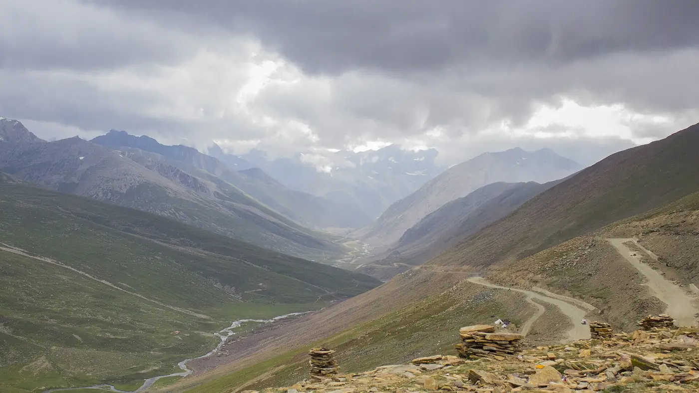
This is the stretch that decides how the day goes. From the top the road drops into Diamer district, through the village of Babusar and down the Thak valley to the Indus. In 40 to 50 km you lose close to 2,900 metres of height, far more than you gained on the way up from Naran.
The Diamer side is steeper, drier and more barren than the Kaghan side, with tight hairpins near the top and long, continuous gradients below. Grass gives way to rock and scree, and you leave a cold, windy saddle to arrive in Chilas, one of the hottest towns in the north in summer.
How to drive it:
- Use a low gear the whole way down and let the engine hold the car. Riding the brakes on this descent is how they overheat and fail, and brake failure is the most common cause of accidents on this road.
- Stop to let the brakes cool if you smell them, somewhere wide and safe rather than on a bend.
- Don't overtake on the hairpins, and expect trucks and loaded vans coming up in first gear.
- Take layers off in stages. Children who were in jackets at the top will be too hot by the time you reach the valley floor.
Fuel, cash and the car
Fill the tank in Naran. There is no petrol pump at the pass or on the upper road, and published route guides agree that the next dependable fuel is in Chilas. Don't leave Naran on half a tank hoping to top up on the way.
Carry cash. Tea stalls, small hotels and pumps on this route deal mainly in cash, and there is little else until Chilas. In January 2025 the Gilgit-Baltistan government also announced an entry fee for tourist vehicles, PKR 2,000 for a car, so keep enough to cover it if it is charged when you cross.
Check the car the night before. Brakes, tyres including the spare, and coolant matter more on this route than engine size. Ordinary cars cross every summer; what gets them into trouble is worn brake pads and a driver who has never done a long mountain descent.
Expect patchy signal on both sides of the pass, and tell someone your plan before you leave Naran.
Joining the Karakoram Highway at Chilas
The Babusar road comes down the Thak valley and meets the Karakoram Highway beside the Indus at Chilas. Gilgit is upstream, to the east. Chilas is the district headquarters of Diamer and the natural break in the day: fuel, a meal, cold drinks and a range of simple hotels if you would rather stop for the night.
From Chilas the Karakoram Highway runs north-east along the Indus. The distances on the tourism department's chart, counted from Chilas:
- Raikot Bridge, 50 km. The turn for Fairy Meadows. The road as far as here is older and narrower, and it passes Tatta Pani, a notorious slide zone. Drive through it steadily and don't stop under the slope.
- Jaglot, 85 km. A highway town and a sensible place for a break, with the Nanga Parbat viewpoint at Talechi on the way.
- Alam Bridge, 100 km. The turn for Skardu, which is 171 km further by this chart.
- Gilgit, 135 km. Karimabad in Hunza is another 105 km up the highway.
North of Raikot Bridge the highway was rebuilt, and the driving becomes noticeably easier. Our Chilas to Gilgit guide takes this stretch stop by stop.
A realistic timetable
For a clear summer day, with the pass open and no queues:
- 7:00 am: leave Naran with a full tank, as early as the road is open for the day.
- 9:00 to 9:30 am: Babusar Top, after a short stop at Lulusar Lake.
- 11:00 to 11:30 am: Chilas. Fuel and an early lunch out of the heat.
- About 1:00 pm: Raikot Bridge.
- 2:30 to 3:30 pm: Gilgit.
Push on to Hunza the same day only if you reach Gilgit by early afternoon and the driver is fresh.
The crossing is daylight-only. The Mansehra and Diamer administrations set the hours each season, and in recent years traffic has been stopped on the pass road in the evening. Opening dates are in our guide to whether Babusar Top is open or closed.
Is the road safe?
Pakistani families drive this route in large numbers every summer, and there are police checkposts along it, including one at the top. The risks are real but specific:
- Weather. Rain in July and August brings landslides and flash floods to the Diamer side, as in July 2025. Early in the season, snow and ice can close the road for days.
- Crime. On the Diamer side there have been armed robbery attempts on travellers, including one near Thak in July 2025 in which two passengers were injured. Travel in daylight, don't stop in isolated places, and follow what the police at the checkposts tell you.
- Security in Diamer. The district has seen serious incidents, including a bomb attack on a Frontier Works Organisation vehicle in Chilas in February 2026. Check local news before you set off.
The UK government advises against all travel on the Karakoram Highway from Mansehra up to the Babusar road junction; this route joins the highway there and heads north, away from that stretch, and neither the Babusar road nor Gilgit-Baltistan is on the UK list (checked September 2026). Overseas visitors should read their own government's advice, since travelling against it can void insurance.
One day or two, and is it worth it?
Do it in one day if you leave Naran early, the forecast is dry and everyone in the car is well. It is a long but manageable day, and far easier than the Karakoram Highway through Kohistan.
Split it at Chilas if you are heading for Fairy Meadows, if you start late, or if anyone struggles with long days in a car. Our guide to driving from Naran to Fairy Meadows covers that version of the day.
Take the Karakoram Highway instead if the pass is closed or has only just opened, if heavy rain is forecast for Diamer, or if the car is heavily loaded and the driver has no experience of long descents. Our comparison of Babusar Top and the KKH sets out which route suits which month and which car.
Our nine-day Gilgit, Hunza and Khunjerab tour starts in Gilgit, and from PKR 90,000 per person it covers the Karakoram Highway to the Chinese border with an experienced mountain driver.
Frequently asked questions
How far is Gilgit from Naran via Babusar?
Roughly 240 to 250 km: about 65 km from Naran to Babusar Top, 40 to 50 km down to Chilas, and 135 km on the Karakoram Highway to Gilgit.
How long does it take to drive from Naran to Gilgit?
Six to eight hours of driving, and seven to nine with stops for tea, fuel and lunch. Leaving Naran at 7 am puts most people in Gilgit by mid-afternoon.
Where is the last petrol pump before Babusar?
In Naran. There is no fuel at the pass or on the upper road, so fill up before you leave and plan to refuel next in Chilas.
Where does the Babusar road meet the Karakoram Highway?
At Chilas, where the road comes down the Thak valley to the Indus. Turn upstream for Raikot Bridge, Jaglot and Gilgit.
Can a normal car go from Naran to Gilgit over Babusar?
Yes, in season. The road is paved, and sedans cross every summer. The brakes are what matter: use a low gear on the long descent to Chilas and stop to let them cool if needed.