Babusar Pass, or Babusar Top, is the 4,173-metre saddle at the head of the Kaghan valley, where the N-15 crosses from Khyber Pakhtunkhwa into Gilgit-Baltistan. From Naran it is about 65 km and two to two and a half hours of steady climbing, past Batakundi, Lulusar Lake and the Gittidas meadows, to a windy top with tea stalls, signboards and, on a clear day, Nanga Parbat on the horizon. The road is open in summer only, in daylight, and most people either visit it as a half-day trip from Naran or cross it on the way to Chilas and Gilgit.
This guide covers the drive up, what you find at the top, how cold and how high it really is, and what the descent into Gilgit-Baltistan involves. Opening and closing dates have their own guide: is Babusar Top open or closed.
| At a glance | |
|---|---|
| Altitude | 4,173 m at the top |
| From Naran | About 65 km, 2 to 2.5 hours up |
| Down to Chilas | About 2 hours of steep descent to the Karakoram Highway |
| Season | Roughly late May or June to October or November |
| Hours | Daylight only; night travel has been banned in recent seasons |
| Temperature at the top | Around 11°C by day in high summer, near freezing at night |
| Jeep from Naran | PKR 12,000 return per jeep, the fare fixed by the Balakot administration (2026) |
| Fuel | Fill up in Naran |
What is Babusar Pass?
Babusar is the highest point of the N-15, the national highway that runs about 240 km from Mansehra through Balakot and Naran to Chilas on the Karakoram Highway. The pass marks the boundary between the two provinces, with Mansehra district of Khyber Pakhtunkhwa on one side and Diamer district of Gilgit-Baltistan on the other. It is the highest point in the Kaghan valley that an ordinary car can reach.
For travellers it does two jobs. It is the top of the valley and the most popular day out from Naran, and it is the summer shortcut to Gilgit-Baltistan. Going to Chilas this way avoids the whole Kohistan stretch of the Karakoram Highway and saves several hours, which is why the road is busy with through traffic as well as day-trippers.
The drive up from Naran, stop by stop
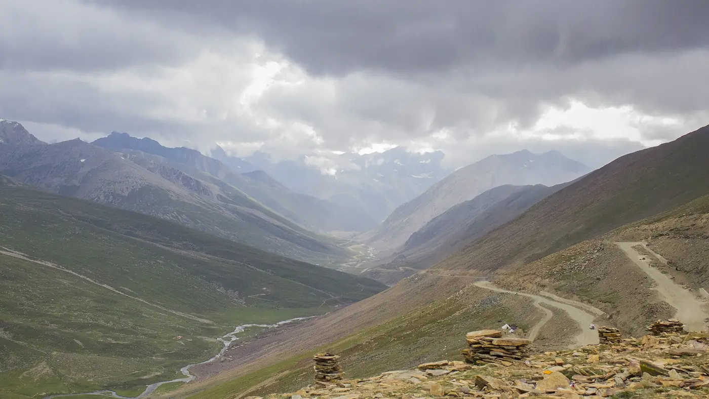
The road is paved all the way, narrow in places and patched where landslides have taken bites out of it. It climbs gently for the first hour and steeply for the last.
- Naran, 2,409 m. Fill the tank here. Beyond Batakundi you should not count on finding fuel until Chilas.
- Batakundi, about 15 km on, 2,624 m. The last proper village, with hotels and a jeep stand. The jeep track to the Lalazar meadows leaves from here.
- Burawai and Jalkhad, about 40 km from Naran. The valley opens out into wide grassy flats. At Jalkhad a rough jeep track climbs to Noori Top at about 3,960 m and on to Sharda in the Neelum valley, a separate adventure for another day.
- Besal, about 45 km, 3,260 m. A small summer settlement and the start of the trek to Dudipatsar Lake.
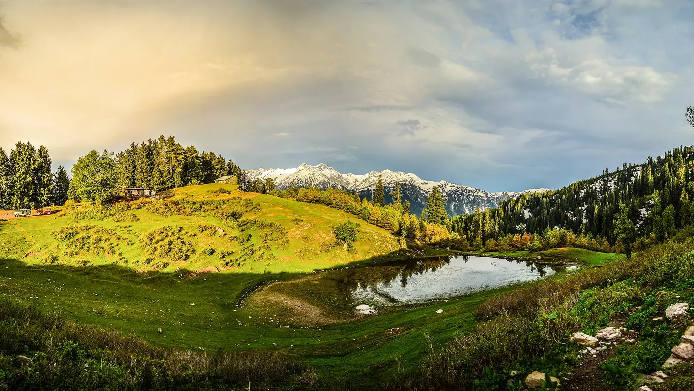
- Lulusar Lake, about 48 to 50 km, 3,410 m. A long, dark lake right beside the road, and the source of the Kunhar River. The best stop on the way up, and a good place to let everyone adjust to the height before the last climb.
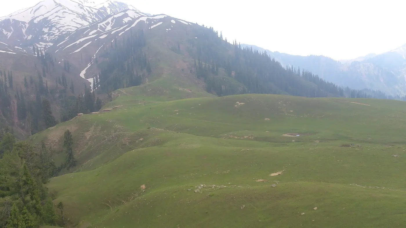
- Gittidas, 3,678 m. High, open meadows where herders bring their flocks for the summer grazing. Early in the season this stretch has the deepest banks of cleared snow.
- The last climb to the top. A series of tight hairpins brings you up onto the saddle.
Without long stops, Naran to the top takes about two hours; with a stop at Lulusar and a few photographs, allow two and a half to three. Leave Naran by 7 or 8 in the morning. The light is better, the queues at the top are shorter, and you have the day in hand if the weather turns.
What you find at the top
The top is a broad, bare saddle rather than a peak. There is a car park, usually full on summer weekends, signboards giving the height, where everyone takes the same photograph, and a row of small stalls in season selling tea, pakoras and snacks. People walk a little way along the ridge for photographs, and that short walk is where the height makes itself felt.
On a clear morning the view to the east takes in Nanga Parbat, at 8,126 metres the ninth-highest mountain on earth. Much of the time it is in cloud, and many visitors see nothing but the nearer ridges. That is one more reason to arrive early.
A few practical points:
- There is not much else. Don't expect a restaurant meal or proper toilets. Eat in Naran or Batakundi and treat the stalls as a tea stop.
- There is now a police post. Checkposts were set up at the top when the road reopened in 2025, and the police decide when traffic moves in each direction.
- Signal is patchy. Mobile towers were switched on at the top in 2025, but coverage on the way up comes and goes. Agree a plan with anyone not travelling with you.
- Holiday weekends are crowded. Eid and summer weekends bring long queues of cars on the last hairpins. A weekday visit is a different experience.
How cold is Babusar Top?
Colder than people packing in Islamabad expect. In high summer the daytime temperature at the top is around 11°C and nights are close to freezing, and a steady wind makes it feel colder still. Early in the season there is still snow beside the road, and in the first weeks after opening the road can ice over in the evening; in 2026 the authorities warned that it became unsafe after 6 pm.
Pack as you would for a much colder place than Naran:
- A warm jacket, a hat and gloves, even in July
- A dry layer for children, who tend to end up in the snow
- Sunglasses and sunscreen, because the sun at this height burns fast
- Water and snacks, since the stalls may be shut early or late in the season
The weather can change in an hour. If cloud comes down or it starts to rain or snow, start back down rather than waiting for it to clear.
Altitude: why it matters on this drive
Naran sits at about 2,400 metres, and the top is at 4,173. On the Babusar drive you gain more than 1,700 metres in around two hours, sitting in a car, with no time to adjust. Most healthy adults notice it as breathlessness on the walk up the slope, a mild headache or a slightly light head.
It usually passes as soon as you drive back down, and a few habits keep it mild:
- Walk slowly at the top, and skip any scramble up the slopes for a better photograph.
- Drink water on the way up.
- Keep the stop short. Thirty minutes to an hour at the top is plenty.
- Go down at once if anyone has a bad headache, nausea, dizziness or confusion.
- Ask a doctor first about taking anyone with a heart or lung condition, and keep a close eye on babies, small children and older parents. For some families, Lulusar Lake at 3,410 metres is a better turning point.
Driving it yourself, or taking a jeep
Your own car is fine in summer if it is in good order. Plenty of ordinary cars make the trip. What matters is the brakes, the tyres, and a driver who is comfortable on steep, narrow hairpins. Use a low gear on every descent, don't ride the brakes, and stop to let them cool if you smell them. Brake failure is the most common cause of accidents on this road.
A jeep or van from Naran saves the driving. In 2026 the Balakot assistant commissioner's office fixed the fares at PKR 12,000 return for a jeep from Naran to Babusar, and PKR 9,000 for a Suzuki Carry or yellow cab. Confirm the price and the waiting time at the top before you set off, since fares are revised each season.
Time it for daylight. Crossing hours are set each season by the Mansehra and Diamer administrations. In 2025 travel between Naran and Babusar Top was banned from 6 pm to 6 am, and in earlier seasons the window was narrower still. Plan to be back in Naran, or down in Chilas, well before dark.
Crossing into Gilgit-Baltistan
Beyond the top the road drops steeply into the Thak valley and down to Chilas on the Karakoram Highway, about two hours away. The Diamer side is steeper and drier than the Kaghan side, and it is where most of the serious trouble on this route happens.
- Brakes again. It is a long, continuous descent. Low gear, short stops, and no overtaking on the bends.
- Rain is the danger in July and August. On 21 and 22 July 2025 a cloudburst sent a flash flood down Thak Nala, killing tourists and stranding hundreds. If heavy rain is forecast for Diamer, go back the way you came or wait a day.
- Security. There have been armed robbery attempts on this stretch, one fatal in August 2023 and another near Thak in July 2025. Travel in daylight, don't stop in isolated places, and follow what the police at the checkposts tell you. Check current advice before you travel.
From Chilas it is about three hours on to Gilgit, and our Islamabad to Gilgit road guide explains where the Babusar route fits into the drive north. If you are heading for Nanga Parbat, the jeep track to Fairy Meadows starts at Raikot Bridge, an hour and a half or so beyond Chilas.
Is Babusar Pass worth it?
For most people staying in Naran, yes. The drive is the best part: the valley widening above Batakundi, Lulusar Lake, the high meadows at Gittidas and the hairpins at the end. The top itself is a busy car park with a view, and on a cloudy day it can feel like a long way to come for a cup of tea.
It suits families with healthy adults and older children, first-time mountain drivers who take it slowly, and anyone continuing to Gilgit-Baltistan. It is a poorer choice with a baby, with anyone unwell or likely to struggle at altitude, and on the first days of Eid, when the queues are worst. In those cases, turn round at Lulusar Lake and spend the time you save at the lake or at Lalazar.
If you want Babusar as one day within a longer trip, our trip planning page is the place to start.
Frequently asked questions
How high is Babusar Pass?
The top is at 4,173 metres, or 13,691 feet. Naran is about 1,700 metres lower, so you gain a lot of height in a short drive.
How long does it take from Naran to Babusar Top?
About two hours for the 65 km without long stops, and two and a half to three hours with a stop at Lulusar Lake. Coming back down takes a little less.
Can a normal car go to Babusar Top?
Yes, in summer. The road is paved all the way from Naran, though narrow in places. Get the brakes and tyres checked, fill up in Naran, and use a low gear on the way down.
Is Babusar Top open all year?
No. It is closed by snow from about November to late May or June, and open in daylight only during the summer season. Check the status on the day you plan to go.
Can you see Nanga Parbat from Babusar Top?
Yes, on a clear day, to the east. Cloud often hides it, especially later in the day, so an early start gives you the best chance.
Is Babusar Top safe for children and older people?
The road is manageable in season with a careful driver; the altitude is the concern. Keep the stop at the top short, watch for headaches or nausea, and consider turning back at Lulusar Lake with anyone likely to struggle.