Lulusar Lake is a long, narrow lake at 3,410 metres, right beside the Babusar road about 48 to 50 km above Naran, and it is the source of the Kunhar River that runs the length of the Kaghan Valley. You need no jeep and no walk: any car in good order reaches it in an hour and a half to two hours from Naran in season. Stop on the way up in the early morning, when the water is usually calm enough to hold the reflections, and give it half an hour to an hour.
Most people meet Lulusar as a stop on the way to Babusar Top or over the pass to Chilas. This guide covers how to fit it into that drive, when the light and weather are at their best, and the Gittidas meadows just above it.
| At a glance | |
|---|---|
| Altitude | 3,410 m |
| From Naran | About 48 to 50 km, 1.5 to 2 hours by car |
| Road | The paved N-15 towards Babusar; no jeep needed |
| Usually reachable | From late May or June, once the upper road is cleared, into October |
| Best time of day | Early morning, before the wind gets up |
| Nearby | Besal and the Dudipatsar trail just below; Gittidas and Babusar Top above |
| Protected area | Lulusar-Dudipatsar National Park, created in 2003 |
| Facilities | Seasonal tea stalls at most; fuel, food and rooms back in Naran |
What is Lulusar Lake?
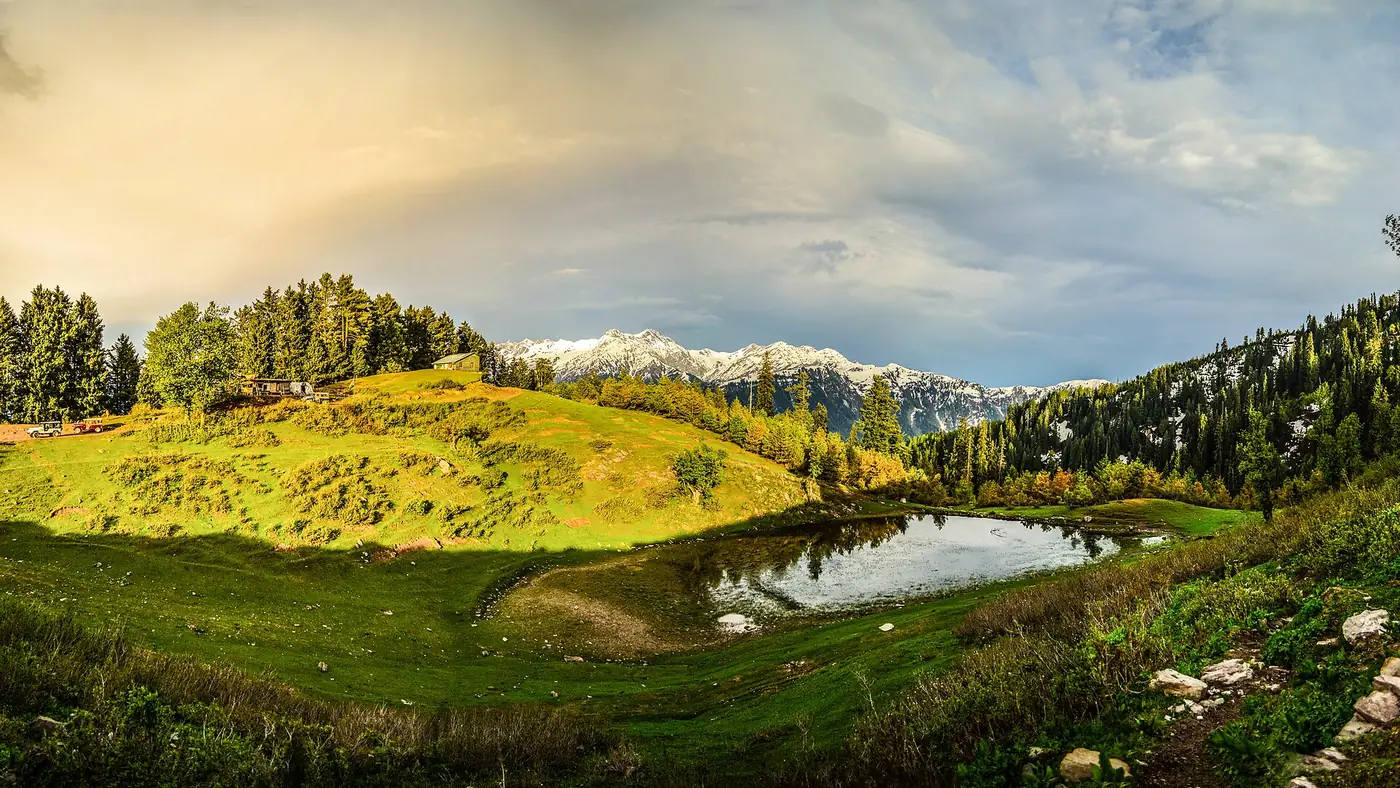
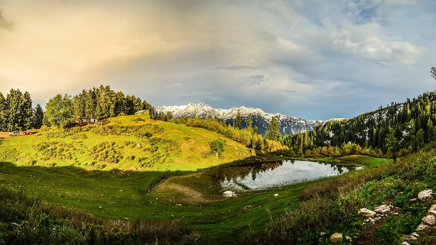
Lulusar is the largest lake in the national park that bears its name, and the only high lake in the valley you can reach in an ordinary car. It lies in a bare, high valley above the tree line, with the road running along its shore and grassy slopes rising on both sides to peaks that keep snow well into summer. The water is dark green or blue depending on the light.
It is the headwater of the Kunhar, the river you have followed all the way from Balakot. That is the fact most families remember, and it makes a good moment to stop: the river that roars past the hotels in Naran begins here as a quiet lake.
Lulusar gives its name to the Lulusar-Dudipatsar National Park, set up in 2003 to protect the upper valley. The park's wildlife includes snow leopard, black bear and marmots, and its wetlands are used by migrating waterfowl. From the road you are most likely to see marmots on the slopes and, in season, ducks on the water.
Getting there from Naran
Lulusar is on the Naran to Babusar road, the N-15, paved all the way. From Naran you pass Batakundi after about half an hour, then the flats at Jalkhad and the hamlet of Besal. The lake appears beside the road soon after Besal.
- Your own car is the easiest way. An ordinary sedan manages the road in season if the brakes and tyres are in good order.
- Fill up in Naran. There is no fuel on the upper road.
- Park well off the carriageway. The road is narrow in places, busy with traffic heading for the pass, and bends round the shore. Pull right off, and don't stop on a bend for a photograph.
- Without a car, the jeeps and vans that run from Naran to Babusar Top pass the lake. In 2026 the Balakot administration fixed the return fare to Babusar at PKR 12,000 for a jeep and PKR 9,000 for a Suzuki Carry or yellow cab; ask the driver to stop at Lulusar on the way up.
Our guide to the Babusar Pass describes the whole drive from Naran to the top.
When is the light best at Lulusar?
Early morning. On a still morning the lake holds a clean reflection of the slopes and snow above it, and that is the photograph people come for. As the day warms, wind comes up the valley, the surface ripples and the reflection goes. In summer, cloud also tends to build over the peaks from late morning.
That makes the order of the day simple. Leave Naran by about 7 am, stop at Lulusar on the way up, and carry on to Babusar Top while the sky is still clear. On the way back in the afternoon the lake is usually windier and greyer, though the colour of the water can still be striking when the sun comes through.
Through the season it changes:
- Late May and June: snow on the banks and slopes, and early in the season ice on parts of the lake. The road above Batakundi may still be closing for snow clearance; in 2026 all movement between Babusar and Lulusar was suspended from 31 May to 2 June.
- July and August: green slopes and the herders' flocks, but monsoon rain and low cloud on some days.
- September: often the clearest, calmest month, and far fewer cars.
- October: cold, quiet and brown, with the first snow on the tops. Check the road before you go.
Our guide to the best time to visit Naran covers the valley as a whole.
How long to stop, and what to do
Half an hour is enough for photographs and a cup of tea; an hour lets you walk a little way along the shore, away from the road and the parked cars. Beyond that there is not much to do. There is no boating to rely on and no proper restaurant, only tea stalls that appear in the busy months.
At 3,410 metres, Lulusar is high enough for some people to feel breathless on a short walk, especially the day after driving up from the plains. Walk slowly and drink water. It is also a sensible turning point: if anyone in the car is unwell, elderly or very young, you can see the lake and head back down without going on to 4,173 metres at the top of the pass.
Keep children well back from the water. The lake is cold enough to be dangerous, and the banks can be soft.
Gittidas, just above the lake
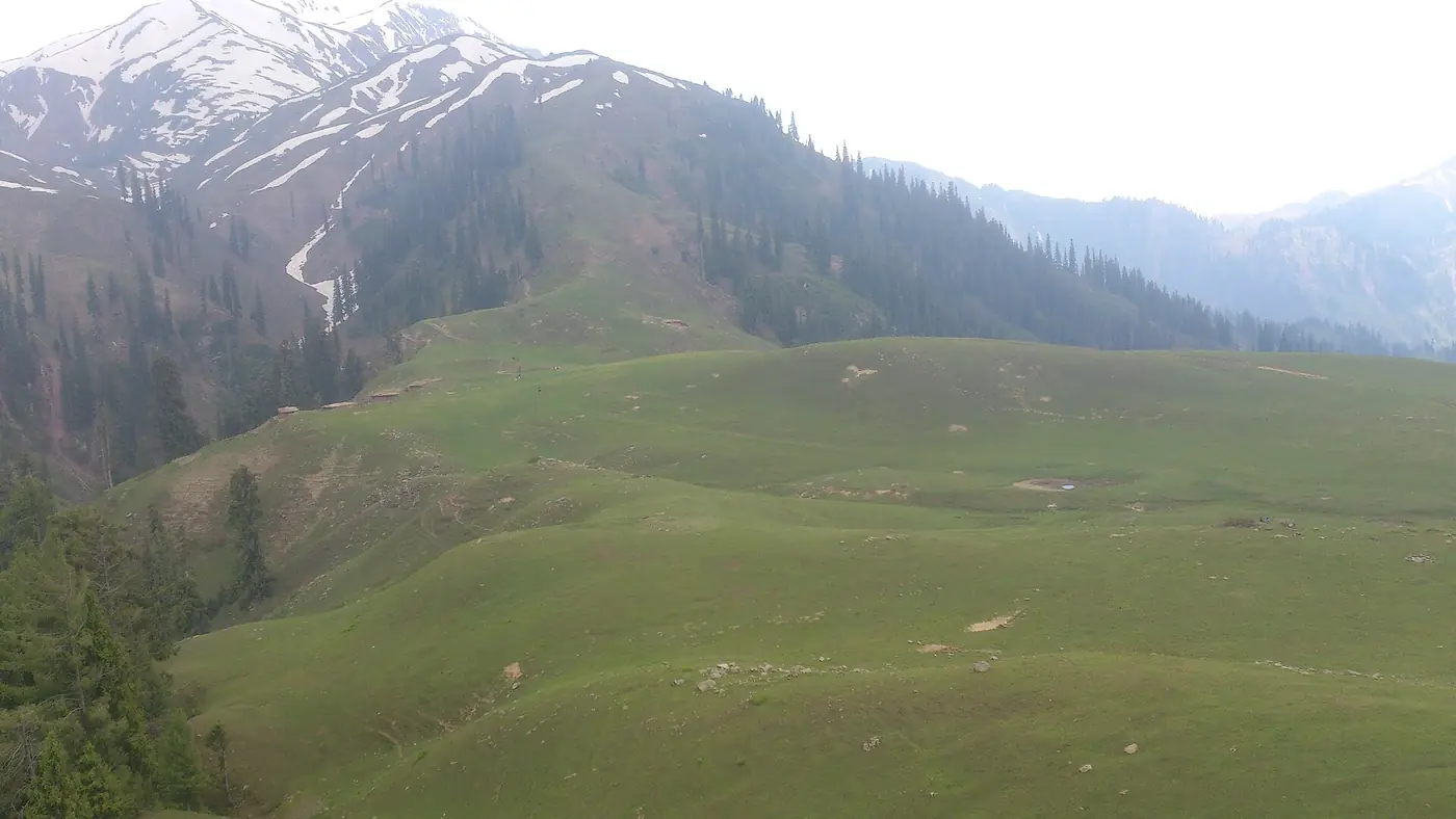
Past the head of the lake the road climbs onto the Gittidas meadows, a wide, high valley at around 3,600 metres, below the final hairpins to Babusar Top. In summer it is a grazing ground. An FAO study of the valley's pastures describes Gittidas as grazed by herders from Chilas, with several temporary settlements of fifty or more huts each, and found the herders in the area generally leaving in the third week of September.
For visitors it is worth a stop on a fine day, particularly if the top of the pass is crowded. The open grass and the flocks make a very different scene from the lake. A few courtesies:
- Ask before photographing people, especially women.
- Don't drive onto the grass or leave rubbish; this is someone's summer pasture.
- Keep dogs and children away from the herds.
From Gittidas the top of the pass is a short, steep climb.
Besal and Dudipatsar, just below
The hamlet of Besal, just below the lake, is where the trail to Dudipatsar Lake begins. It is a serious walk of a day or more, not a detour from the car. Our guide to the Dudipatsar Lake trek covers the stages and the season.
Looking after the lake
Lulusar is inside a national park, and under the Khyber Pakhtunkhwa Wildlife Act 2015 polluting water in a national park is prohibited. Even so, rubbish from the roadside ends up on the shore. Take everything back to Naran with you, don't wash cars or dishes in the lake, and keep music low; much of the pleasure of the place is its quiet.
Is Lulusar Lake worth the drive?
Yes, if you are driving towards Babusar anyway, which is how almost everyone sees it. It is the easiest high lake in the valley: no jeep, no walk and no fare, and on a still morning it is as memorable as Saif-ul-Malook with a fraction of the crowd.
On its own, it is a long drive for a short stop. If you are in Naran for only one day and the choice is between Lulusar and Saif-ul-Malook, most people will be happier at Saif-ul-Malook. If you have two days, do the lake in the morning on one and the Babusar drive, with Lulusar on the way, on the other. To fit it into a longer trip, start with our trip planning page.
Frequently asked questions
How far is Lulusar Lake from Naran?
About 48 to 50 km up the Babusar road, an hour and a half to two hours by car. It lies beyond Batakundi, Jalkhad and Besal, before the climb to Babusar Top.
Can a normal car go to Lulusar Lake?
Yes, in season. The road from Naran is paved all the way to the lake and on to Babusar Top. Fill the tank in Naran and check the brakes before you go.
What is the height of Lulusar Lake?
3,410 metres, or about 11,190 feet. That is roughly 1,000 metres higher than Naran.
Is Lulusar Lake the source of the Kunhar River?
Yes. The Kunhar flows out of Lulusar and runs south-west through Naran, Kaghan and Balakot to join the Jhelum.
When is Lulusar Lake open?
The road to it is usually cleared by late May or June and stays open into October. Early in the season there is snow on the banks and sometimes ice on the lake; after the first heavy snow in autumn the upper road closes.
What is the best time of day to visit Lulusar?
Early morning, when the water is calm and the peaks are clear. Stop on the way up to Babusar rather than on the way back.