
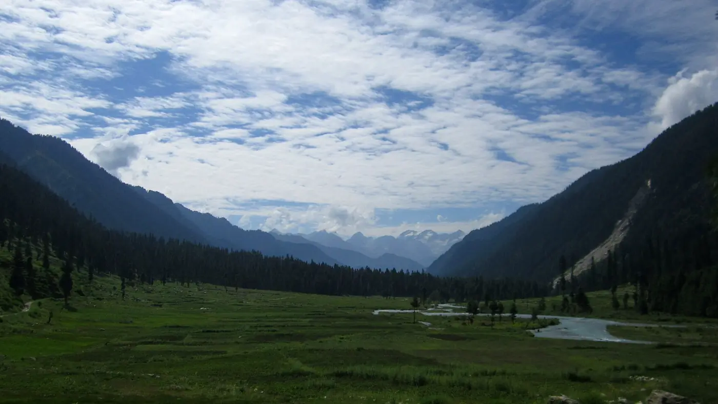
Kumrat Valley is the top of the Panjkora valley in Upper Dir, Khyber Pakhtunkhwa: a long deodar and pine forest along a fast, cold river, with meadows and high lakes above it. You drive to the village of Thal, about 375 km from Islamabad, and go on by jeep into the forest. The season runs roughly from May to October, and the valley suits people who are happy with camps, simple huts and a rough track rather than hotels and tarmac.
This guide explains how the valley is laid out, what there is to see at each point, where people stay, and who will enjoy it. Separate posts cover the best months to go and what a trip costs.
| At a glance | |
|---|---|
| Where | Upper Dir district, Khyber Pakhtunkhwa, at the head of the Panjkora valley |
| Gateway | Thal, the last village; cars stop here and jeeps go on |
| Altitude | About 2,400 m in the forest; Katora Lake about 3,500 m |
| From Islamabad | About 375 km to Thal, 8.5 to 10 hours |
| Inside the valley | Jeep track, about 18 km from Thal to Kala Chashma |
| Season | Roughly May to October; June to September is most reliable |
| Stays | Hotels in Thal, huts and tented camps in the forest, a few glamping sites |
| Signal and cash | Signal fades after Thal; take cash from Dir or Timergara |
Where is Kumrat Valley?
Kumrat lies in the north of Upper Dir district, in the part of the Panjkora valley known as Dir Kohistan. The Panjkora rises near the Shandur Pass and flows south through Kumrat, Thal and Sheringal, then on past Timergara to join the Swat River. A narrow gorge near Sheringal divides Dir proper from Dir Kohistan, and above it the language changes too: most people in Thal speak Gawri rather than Pashto.
The valley itself covers about 346 square kilometres. It is one of the most visited places in Malakand Division, yet it has no airport and no quick way in. Everyone arrives by road, through Chakdara and the N-45 to Dir, and then up the valley road to Thal.
How the valley is laid out
Kumrat is easiest to understand as one long line running north, with a couple of side valleys branching off it. From the south:
- The turn off the N-45, a few kilometres short of Dir town, at a gateway known as Bab-e-Kumrat.
- Sheringal, where the road enters the gorge of the upper Panjkora.
- Patrak, Barikot and Kalkot, the villages strung along the valley road.
- Thal, about 65 km from the turn-off. This is the last village and the end of the road for ordinary cars. It has a bazaar, hotels, jeep stands and the old wooden mosque.
- The Kumrat forest, which begins above Thal. The jeep track follows the river through deodar and pine, and the main camping area is about 12 to 14 km from Thal.
- Kumrat waterfall, near the camping area, a short walk from the track.
- Kala Chashma, about 18 km from Thal, where most jeeps turn round.
- Dojanga and the upper valley, beyond Kala Chashma, where the track continues towards the Dojanga meadows.
Two routes leave the main valley near Thal. To the south-east, a jeep road climbs from the Jandrai side towards the meadows of Jahaz Banda, with Katora Lake above them. To the east, the Badgoi Pass crosses the ridge to Utror and Kalam in Swat, a seasonal jeep route that opens later and closes earlier than the valley itself.
What to see in Kumrat
The forest and the river
The forest is the reason to come. Tall deodar, blue pine and fir stand on both banks, with oak lower down, and in several places the Panjkora splits into braided channels with gravel islands and grassy banks between them. This is where the camps are, and where most people spend their time: walking under the trees, sitting by the water, and watching the light on the ridges in the evening.
The river is fast and very cold all summer. Paddling at the edge is one thing; swimming is not safe, and children need watching near the water. The same forest is home to Asiatic black bears, red foxes, musk deer and markhor, though you are unlikely to see any of them near the busy camping areas.
Kumrat waterfall
The best-known waterfall in the valley comes down the hillside near the main camping area, about 13 km from Thal. It is a short walk from where the jeeps stop, and the standard jeep day from Thal takes it in along with Kala Chashma. Our Kumrat itinerary shows how to fit it into a day with Kala Chashma.
Kala Chashma
Kala Chashma, the "black spring", is named for the dark colour of its water. It sits near the end of the usual jeep run, about 18 km from Thal, and it is the natural place for a long picnic and a short walk upstream before the jeep takes you back down.
Thal and its wooden mosque
Thal is worth an hour of your time rather than just a jeep change. Its old Jamia Masjid, built mainly of deodar, is said to be about two hundred years old. If you want to go in, go outside prayer times, dress modestly and ask first. The bazaar is also the last place to buy snacks, batteries and anything else you forgot.
Jahaz Banda and Katora Lake
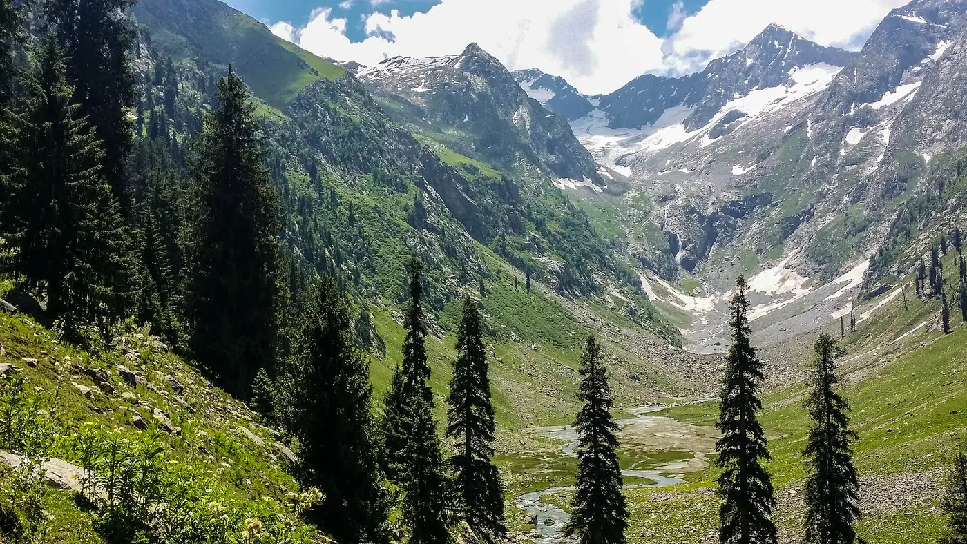
For walkers, the meadows of Jahaz Banda are the high point of a Kumrat trip, and Katora Lake, a glacial lake at about 3,500 metres whose name means "bowl", sits above them. Both need a jeep ride and a proper walk, and at least one night up in the meadows. They are a separate trip from the forest, not a detour from it, so plan an extra two days if you want them.
Dojanga and the upper valley
Beyond Kala Chashma the valley continues towards the meadows and camping ground of Dojanga, near the far end of the track. It suits a second full day in the valley rather than a rushed afternoon.
Where do you stay in Kumrat?
There are three kinds of place to sleep:
- Hotels and guesthouses in Thal. Proper rooms with beds, and the bazaar outside the door. The best choice for families on their first night.
- Huts and tented camps in the forest. Wooden huts and fixed tents along the river, run for the summer season, with meals cooked on site. This is the Kumrat most people come for.
- Glamping sites. A few places offer domes, pods and cabins with proper beds. They cost considerably more, so book ahead.
Don't count on mains power in the forest; many camps run on solar panels, enough for lights and some phone charging. Nights are cold even in July, so take proper warm clothes whatever you are told about the facilities. Take all your rubbish back to Thal, because litter is a growing problem around the camps.
Getting there and getting around
The drive from Islamabad takes the M-1 and the Swat Motorway to Chakdara, the N-45 through Timergara to the turn before Dir, and then the slow valley road through Sheringal and Kalkot to Thal. The road to Thal is partly paved and partly broken, and its reconstruction has been dragging on for years. An ordinary car can reach Thal in dry weather; beyond it you need a 4x4, and most people park and hire a jeep in the Thal bazaar.
One recent problem to check before you go: the bridge at Thal that links the bazaar to the Kumrat road gave way under a loaded truck in November 2025, and monsoon floods in 2024 and 2025 took out bridges around Thal and cut off Jahaz Banda for a time. Ask your hotel in Thal how vehicles are crossing before you fix your dates.
For timings, stops and road detail, see our Islamabad to Kumrat route guide.
What to know before you go
- Signal: expect usable mobile signal in Thal and little or none in the forest. Download offline maps before you leave Dir.
- Cash: there are no ATMs in the valley. Withdraw in Timergara or Dir, and carry enough for the jeep, the camp and a spare night.
- Fuel: fill up in Dir. Fuel further up the valley is limited and unreliable.
- Weather: summer days are mild, and forest nights can fall to 10 °C or lower. Rain can arrive quickly in July and August.
- ID: carry your CNIC. There are police checkposts on the Dir road.
- Security: some foreign governments, including the UK, currently advise their citizens against all travel to Upper and Lower Dir. Pakistani tourists visit in large numbers every summer, but check the local news and any official advice before you set off, and drive only in daylight.
Who Kumrat suits, and who it doesn't
Kumrat suits groups of friends, couples and families with older children who want a forest and a river rather than a view from a hotel balcony. If you are happy to sleep in a hut, eat what the camp cooks and spend a day doing very little by the water, it is one of the most satisfying trips in Khyber Pakhtunkhwa. Walkers get even more from it, with Jahaz Banda and Katora Lake above.
It suits people less well if they want paved roads, hot showers and restaurants. The drive is long and tiring, the last stretch is a jeep track, and at Eid the valley is crowded and the track jammed. Anyone who gets car-sick, and families with babies, should think hard about the ten-hour drive and the jeep ride on top.
If that sounds like the wrong trip, Swat's upper valley around Kalam gives you forest and river with far more hotels and no jeep needed to reach them; see our Swat Valley guide. If you would like someone else to arrange the jeeps, rooms and timings for Kumrat, tell us your dates and we will draft a day-by-day route.
Frequently asked questions
Where is Kumrat Valley located?
Kumrat Valley is in Upper Dir district, Khyber Pakhtunkhwa, at the head of the Panjkora valley. The last village is Thal, about 65 km beyond the turn off the N-45 near Dir town.
Can a car go to Kumrat Valley?
An ordinary car can usually reach Thal in dry weather. Beyond Thal the track through the forest needs a 4x4, so most visitors park in Thal and hire a jeep.
How many days are enough for Kumrat Valley?
Three days from Islamabad is the minimum: one to drive in, one in the valley and one to drive back. Add two days if you want to walk to Jahaz Banda or Katora Lake.
Is there mobile signal in Kumrat?
There is usually signal in Thal, but it fades quickly beyond the village and the forest camps have little or none. Tell family when to expect you back in range.
What is Kumrat Valley famous for?
It is known for its deodar forest along the Panjkora River, riverside camping, Kumrat waterfall and Kala Chashma, and the high meadows of Jahaz Banda with Katora Lake above them.
.jpg)