A Karakoram Highway road trip from Islamabad to the Khunjerab Pass covers about 870 km and roughly 20 to 24 hours of actual driving, climbing from the plains to the Chinese border at 4,693 metres. Done comfortably, it takes four days to reach the top and two or three to come back, so plan on nine or ten days for the round trip with time in Hunza. The best window is June to September, when the Khunjerab road is reliably open and the days are long.
This guide takes the highway section by section: how far and how long each part is, what the road is like in 2026, where to fill up, where to sleep, and how many days to give it.
| At a glance | |
|---|---|
| Distance | About 870 km, Islamabad to Khunjerab |
| Driving time | Roughly 20 to 24 hours one way, over four days |
| Highest point | Khunjerab Pass, 4,693 m |
| Best months | June to September; the top is open to visitors roughly May to November |
| Hardest section | Besham to Chilas, through Kohistan |
| Last fuel | Sost, about 75 km below the border |
| Good overnight towns | Besham, Chilas, Gilgit, Karimabad, Gulmit or Passu |
| Round trip | Nine or ten days with time in Hunza |
The KKH in six sections
The Pakistani part of the Karakoram Highway, the N-35, officially starts at Hasan Abdal and runs 806 km to the border. From Islamabad, you join its line on the Hazara Motorway and follow it all the way up.
| Section | Distance | Driving time | Character |
|---|---|---|---|
| Islamabad to Besham | About 250 km | 4 to 6 hours | Motorway to Thakot, then the first of the Indus gorge |
| Besham to Chilas | About 200 km | 5 to 8 hours | Kohistan: narrow, slow, slide-prone |
| Chilas to Gilgit | About 135 km | 2.5 to 3 hours | Wide, rebuilt road past Nanga Parbat |
| Gilgit to Karimabad | About 100 km | 2 to 3 hours | Good road up the Hunza river |
| Karimabad to Sost | About 95 km | About 2 hours | Attabad tunnels, Gulmit, Passu |
| Sost to Khunjerab | About 75 km | 1.5 to 2 hours | National park and the climb to the border |
Times are for a car in good conditions with short stops. The numbers are only half the story: the 200 km through Kohistan take longer than the 300 km of motorway and valley road before them, and almost all the uncertainty on the trip sits there.
Islamabad to Besham: the easy start
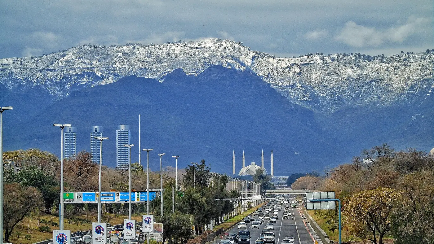
Take the M-1 towards Peshawar and turn north at the Burhan interchange onto the Hazara Motorway, which runs past Haripur, Abbottabad and Mansehra to Thakot. The old KKH through the Hazara towns still exists, but the motorway has made it redundant for through traffic. At Thakot the highway meets the Indus, and Besham, half an hour on, is the first proper stop.
Besham to Chilas: Kohistan
The 279 km from Thakot to Raikot Bridge have not been upgraded like the rest of the highway, and it shows. Through Pattan, Dasu and Shatial the road is cut into the side of the gorge high above the Indus, single-lane in places, broken in others, and busy with trucks. Work on the Dasu dam has added diversions and timed closures, and a new, higher alignment with tunnels and arch bridges around Dasu was still under construction in September 2026. This is a daylight road, and the one to start early.
Chilas to Gilgit: the road opens up
North of Chilas the highway improves sharply, because the 336 km from Raikot Bridge to Khunjerab were rebuilt and widened, a project finished in 2012. Watch for Nanga Parbat across the valley near Raikot, and stop at the viewpoint near Jaglot where the Himalaya, Karakoram and Hindu Kush meet. At Jaglot the Skardu road turns off east. The one notorious slide area on this stretch is Tatta Pani, between Chilas and Raikot.
Gilgit to Karimabad: into Hunza
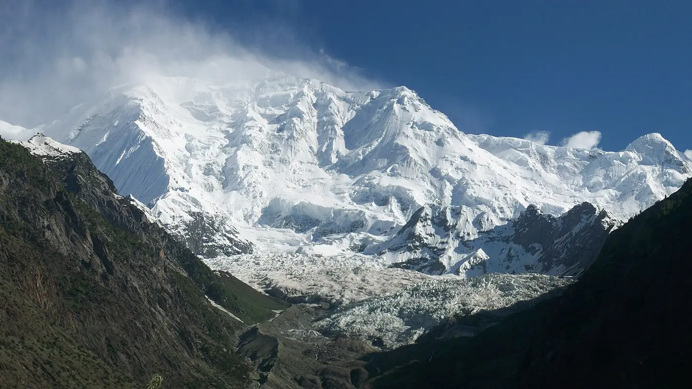
A wide, paved road up the Hunza river through the Nagar villages, with Rakaposhi rising almost straight above the road at Ghulmet. Aliabad is the market town on the highway; Karimabad, for the forts, is a short climb above it. Our Islamabad to Hunza road guide covers this stage and the overnight choices in more detail.
Karimabad to Sost: upper Hunza
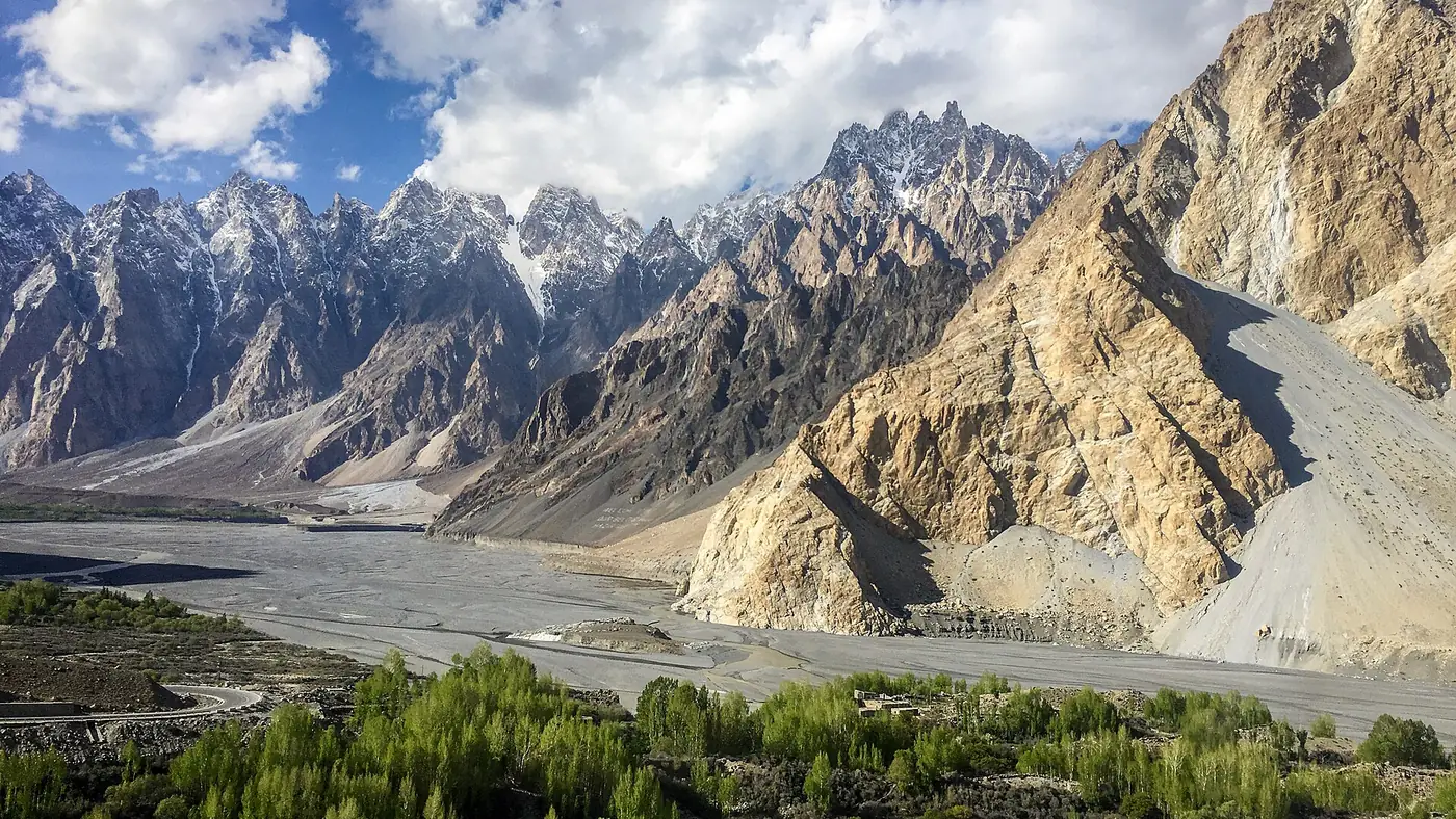
Beyond Karimabad the highway runs through the Attabad tunnels, a 24 km realignment with five tunnels that opened in 2015 to bypass the lake created by the 2010 landslide. Then come Gulmit, the Passu Cones, the Hussaini suspension bridge and Sost, the last town, with the customs and immigration post for the border.
Sost to Khunjerab: the top
The Dih checkpoint, about half an hour past Sost, is the entrance to Khunjerab National Park, where you register and pay the park fee in cash. The last 42 km climb in long switchbacks to the border. Our Khunjerab Pass guide covers the season, the checkpoint and the altitude.
How many days does the KKH need?
Four days up is the comfortable minimum, because nobody should drive Kohistan tired and nobody should arrive at 4,693 metres straight from the plains.
| Day | Drive | Night |
|---|---|---|
| 1 | Islamabad to Chilas, 10 to 13 hours with stops | Chilas |
| 2 | Chilas to Karimabad via Gilgit, 5 to 6 hours | Karimabad |
| 3 | Karimabad, with a short drive to Altit or Duiker | Karimabad |
| 4 | Karimabad to Gulmit or Passu via Attabad, 1 to 1.5 hours | Gulmit or Passu |
| 5 | Up to Khunjerab and back, about 5 hours of driving | Gulmit, Passu or Karimabad |
Coming back takes two long days (upper Hunza to Chilas, then Chilas to Islamabad) or three gentler ones with a night in Gilgit or Besham. Add a spare day for landslides or a snow closure at the top and the round trip comes to nine or ten days.
If the first day looks too long, stop in Besham after four to six hours and make Chilas the second night. It adds a day but halves the pressure. In summer, many people drive north on the KKH and come back over the Babusar Pass through Naran, which turns the trip into a loop and avoids Kohistan on the way home.
Where to fill up
Fuel is easy to find as far as Gilgit and harder beyond. The rule is to top up at every main town rather than waiting for the gauge.
- Motorway service areas before Mansehra: fill completely.
- Besham: top up before Kohistan.
- Dasu or Chilas: stations are few in between, and a closure can leave you idling for hours.
- Gilgit and Aliabad: the last choice of stations.
- Sost: the last fuel on the highway. There is none on the 75 km to the border, and the climb uses more than you expect.
Carry cash. Card machines are unreliable beyond the motorway, and the park fee at Dih is cash only. Never let the tank fall below half anywhere north of Thakot.
Where to sleep along the way
| Town | Why stop | What to expect |
|---|---|---|
| Besham | Short first day, or a late start from Islamabad | Roadside hotels, busy with through traffic |
| Chilas | Puts Kohistan behind you on day one | Low, very hot in summer; ask for air conditioning |
| Gilgit | The city stop: banks, pharmacies, choice of hotels | Busy, practical, a good base for Naltar |
| Karimabad or Aliabad | Central Hunza, for the forts and the views | Widest choice of hotels on the whole route |
| Gulmit or Passu | Upper Hunza, and the shortest drive to Khunjerab | Quieter guesthouses and small hotels |
| Sost | Only if you are crossing the border | Simple, and not a pleasant place to spend a night |
Book ahead for July, August and the Eid holidays, when Karimabad and Chilas fill up.
The road in 2026: what to expect
- Kohistan is the bottleneck. Construction at Dasu has brought timed openings: in May 2026 the Upper Kohistan administration allowed traffic at Samar Nullah only between 8 and 10 am, 3 and 6 pm, and at night. Check the schedule in Besham.
- Slides peak in July and August. In 2026 rain closed the highway near Chilas in June, flash floods cut it at several points in Diamer in July, and a nullah near Chilas flooded it in August.
- Sit-ins close it too. In April 2026 people affected by the Diamer-Bhasha dam blocked the road at Chilas and Thor for close to a week, and in June a protest at Pattan stopped traffic for more than 12 hours.
- Upper Hunza is in good shape, with occasional rockfall and flood damage where side streams cross the road.
- Snow, not slides, above Sost. The last stretch to the border is closed to visitors in winter and can shut for a day or two in May, October and November.
Before each day's drive, check with your hotel, the Tourist Police on 1422 inside Gilgit-Baltistan, and the official sources in our guide to checking Karakoram Highway road status. The National Highway Authority posts updates through the accounts linked from nha.gov.pk.
Your own car, or a car with a driver?
The whole highway is paved, and ordinary sedans make the trip every summer. What matters more than the car is its condition and the person driving it.
- Service the car before you leave. Brakes, tyres including the spare, coolant and battery. The climbs in Kohistan and the descent from Khunjerab are hard on both brakes and engines.
- Share the driving. Two drivers make the long first and last days far safer.
- Carry water, snacks and warm layers in the car, not the boot. A closure can hold you for hours, and the same trip can take you from the heat of Chilas to near freezing at the border.
- Download offline maps. Signal disappears for long stretches in Kohistan and above Dih.
- Keep your CNIC and the car's papers to hand for the checkposts.
If nobody in your group wants to drive Kohistan, a common answer is to fly to Gilgit and hire a car and driver there, which gives you the best part of the highway, from Gilgit to the border, without the hardest part.
Is the full KKH worth driving?
For anyone who likes long drives and has nine or ten days, yes. Few roads anywhere climb from the plains to 4,700 metres through scenery that changes this much, and having your own car in Hunza makes every side trip easy.
It suits groups of friends and couples who share the driving, and experienced drivers who have done Naran or Swat and want the bigger trip. It suits young children and elderly parents less well, because of the two long days each way and the altitude at the top.
If you have a week or less, or you would rather see the highway than drive it, fly to Gilgit and start from there. Our nine-day Gilgit, Hunza and Khunjerab tour does exactly that, with an experienced mountain driver, a night in Gulmit or Passu before the pass, and a spare day held for weather.
Frequently asked questions
How long is the Karakoram Highway in Pakistan?
The Pakistani section, the N-35, is 806 km from Hasan Abdal to the Khunjerab Pass. From Islamabad to the border is about 870 km by road.
How many days do you need for a KKH road trip?
Four days from Islamabad to Khunjerab at a comfortable pace, and two or three to come back. With time in Hunza and a spare day, nine or ten days is right for the round trip.
Where is the last petrol station on the Karakoram Highway?
Sost, about 75 km below the Khunjerab Pass. Fill the tank there before the climb, because there is no fuel between Sost and the border.
Which is the most dangerous part of the KKH?
The Kohistan section between Besham and Chilas, where the road is narrow, prone to landslides and affected by dam construction. Drive it in daylight and check for closures before you set off.
Can a normal car drive the Karakoram Highway?
Yes. The highway is paved all the way to the border, and sedans drive it every summer. Get the brakes and tyres checked first and use low gears on long descents.
When is the best time for a Karakoram Highway road trip?
June to September, when the road to Khunjerab is reliably open. September is often the best month, with settled weather and fewer slides than July and August.