The Passu glacier is the white glacier that comes down from Passu Sar, west of the Karakoram Highway, just south of Passu village in upper Hunza. You can see it from the road, and two short walks take you to viewpoints over the ice: an easy 30 to 45 minutes along a track from Passu village, or 20 to 30 minutes from the end of a jeep road above Borith Lake. Neither needs any experience, but going onto the ice itself does need a local guide.
This guide covers where to see the glacier from the highway, both walks step by step, what the glacier is doing to itself as it shrinks, and how to behave near the edge. For the other glaciers you can reach in the north, from Batura to Hopper, see our round-up of glaciers in Gilgit-Baltistan.
| At a glance | |
|---|---|
| Where | Just south of Passu, Gojal, upper Hunza |
| From Karimabad | About 1 to 1.5 hours by road |
| Source peak | Passu Sar, 7,478 m |
| Lower walk | From Passu village, about 2 km, 30 to 45 minutes |
| Upper walk | From above Borith Lake, 20 to 30 minutes to the first viewpoint |
| Best months for walking | June to September; viewpoints from April to October |
| Going onto the ice | Only with a local guide |
Where is the Passu glacier?
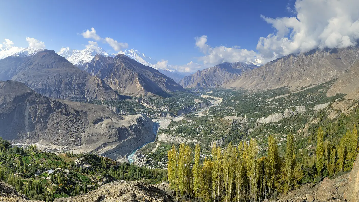
Passu sits on the Karakoram Highway in Gojal, the Wakhi-speaking upper half of Hunza, about an hour to an hour and a half north of Karimabad through the Attabad tunnels. The village lies between two glaciers. The Batura, one of the longest in the world outside the polar regions, reaches the highway a few kilometres to the north and is grey with rock debris. The Passu glacier, to the south of the village, is the clean one: bright white ice with far less rubble on it.
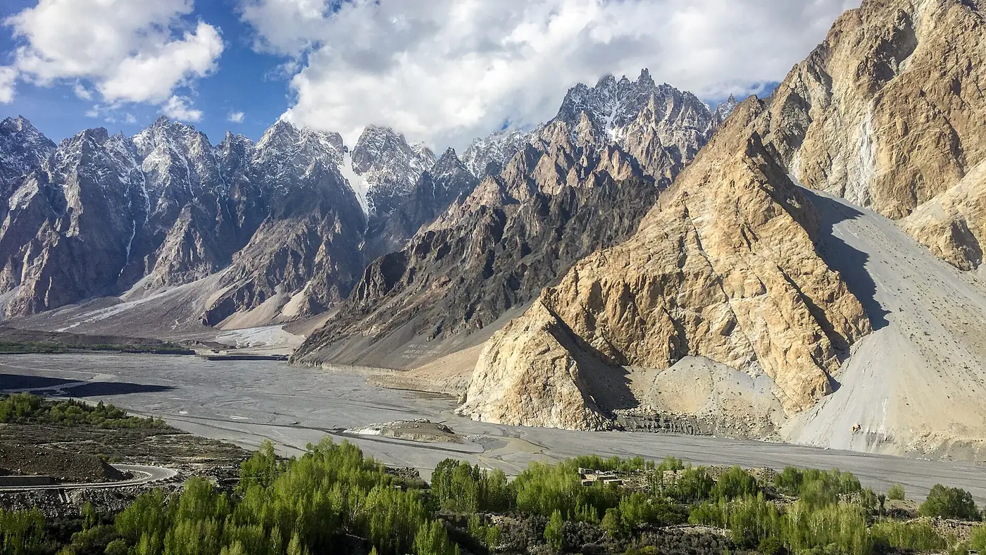
It flows down from Passu Sar, a 7,478-metre peak in the Batura Muztagh range, and ends in a steep, broken snout above the village. Its meltwater runs down to the Hunza river. The serrated peaks of the Passu Cones, across the river on the other side, are what most visitors photograph here; the glacier is on the opposite side of the road from them.
Seeing it from the road
You don't have to walk to see the Passu glacier. Driving north from Hussaini towards Passu, it appears on the left, a white tongue of ice filling the side valley below the peaks. The view is clearest in the morning, before cloud builds on the mountains.
There is no single official viewpoint on the highway. People pull over where the road widens around Hussaini and the southern edge of Passu. Park well off the tarmac, since this is a fast stretch used by trucks heading to and from the border, and don't stop on a bend or at the mouth of a stream channel.
On the way to or from Khunjerab Pass, the road view may be enough; with an hour or two to spare, one of the walks gets you much closer.
The walks to the ice
The lower walk from Passu village
This is the easier of the two and starts in the village itself.
- Start at the southern end of Passu, near the highway hotels and restaurants, and ask anyone for the path to the glacier. Locals are used to pointing visitors the right way.
- Follow the dirt track for about 2 km. It runs across the flat, stony bed of what used to be the glacier's lake, which has largely emptied as the ice retreated.
- Stop at the viewpoint below the snout, 30 to 45 minutes from the start. You look up at the front of the glacier from below, with the Passu Cones behind you.
It is gentle enough for most families. The ground is loose stone rather than a made path, so wear shoes with grip, and allow an hour and a half for the round trip with time to sit.
The upper walk from above Borith Lake
This route gives the better view, looking down on the ice rather than up at it.
- Turn off the highway at Hussaini and drive up the paved road to Borith Lake, about 2 km.
- Continue on the jeep track beyond the lake, about 4 km, to where it ends at a small café. The track is rough; local jeeps wait at the turn-off in Hussaini if you don't want to take your own car up.
- Walk 20 to 30 minutes from the café, first up a short slope and then along the edge of the valley, to the first viewpoint over the glacier.
- Go further only if you are sure-footed. The path continues to a second, closer viewpoint, and a steep, loose descent leads down towards the ice. Stay at the top unless you are with a guide.
You can also walk all the way from the highway through Hussaini and past the lake, which turns it into a half-day outing of two to four hours. Borith Lake is a quiet stop in its own right, and many people combine the two.
How the glacier has changed
The Passu glacier is shrinking, and it is one of the easiest places in Pakistan to see that with your own eyes. The flat, empty ground you cross on the lower walk was a lake at the foot of the ice not long ago. Studies of the glacier describe it retreating by several hundred metres in recent decades, with its snout breaking up as it thins.
That has consequences for Passu. The village has been hit by floods from the glacier's valley more than once, including in 2007 and 2008, when water released from the glacier damaged houses and a hotel. Glacier floods in Hunza are most likely in hot spells in summer, which is also the walking season.
It is why local advice matters more here than on an ordinary hill path.
Safety near the glacier edge
A few rules keep a Passu walk simple:
- Don't go onto the glacier without a local guide. Crevasses can be hidden under snow or a thin crust, and the surface is slippery and uneven. Guides can be found in Passu village; ask at your hotel.
- Keep back from the snout and any ice cliff. Ice and stones fall from the front of the glacier, most often on warm afternoons. Don't stand beneath it for a photograph.
- Watch the loose moraine. The ridges of gravel and boulders beside the ice slide easily underfoot, and the descent from the upper viewpoint is the steepest part of either walk.
- Cross meltwater streams early. They rise through the day in summer.
- Go back if there is a flood alert. In heatwaves the authorities issue glacier flood warnings for Hunza and Nagar; skip the walk and keep away from stream beds when one is out.
- Carry a warm layer and water. The air over the ice is cold even when the village is warm.
When to go
June to September is the season for the walks: the paths are clear of snow and the days are long. July and August are the months of highest meltwater and the most flood alerts, so check local news before you set out.
April, May and October are good for the road view and the lower walk, with fewer people and snow still on the peaks, though the jeep track above Borith Lake can be muddy or closed early in the spring.
November to March is winter in Gojal. The glacier is under snow and the tracks can be icy or blocked; enjoy it from the highway.
Is the Passu glacier worth the walk?
Yes, if you are staying in Gulmit or Passu or have a spare half-day in upper Hunza. The lower walk is one of the easiest ways in the north to stand close to a glacier, and it suits families and older walkers who are steady on loose ground. The upper walk is better for photographers and fit adults who want the view from above.
If you are coming up from Karimabad for a single day, with Attabad Lake, the Hussaini bridge and the Passu Cones all on the list, the road view and a short stop may be all the day allows. Our list of places to visit in Hunza helps you decide what to leave out, and our Gilgit and Hunza page puts Passu in the context of the wider valley. The nine-day Gilgit, Hunza and Khunjerab tour spends a night in Gulmit or Passu, which leaves time for the lower walk.
Frequently asked questions
How long is the walk to Passu glacier?
From Passu village, the lower walk to the viewpoint below the snout takes 30 to 45 minutes each way. From the end of the jeep road above Borith Lake, the first viewpoint is 20 to 30 minutes on foot.
Can you walk on the Passu glacier?
Only with a local guide. The surface is slippery and broken, crevasses can be hidden, and ice falls from the front, so day visitors should stay at the viewpoints.
Can you see the Passu glacier from the Karakoram Highway?
Yes. Driving north from Hussaini towards Passu, it appears on the left, west of the road, as a white tongue of ice below the peaks.
What is the difference between the Passu and Batura glaciers?
The Passu glacier, south of the village, is a clean white glacier. The Batura, to the north, is far longer and covered in grey rock debris, so from the road it looks more like a field of rubble than ice.
Is the Passu glacier walk suitable for children?
The lower walk from the village is flat and easy enough for most children, on loose, stony ground. Keep them close near the snout and don't let them climb onto the ice.