
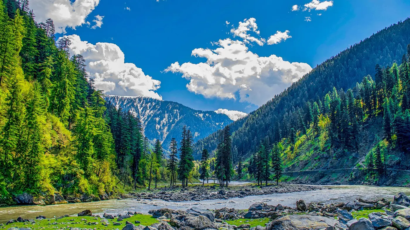

The Neelum Valley road condition changes as you climb. It is paved and generally good from Muzaffarabad to Keran, patchier from Keran to Sharda, rough and broken in places between Sharda and Kel, and an unpaved jeep track from Kel to Taobat. In dry summer weather a normal car can reach Kel if it is driven carefully. What decides your day is rain: it brings down slides and swells the streams that cross the road, most of all in July and August.
This guide takes the road one stretch at a time, then covers the side roads, the places that block most often, what to do after heavy rain, and what vehicle you really need.
| At a glance | |
|---|---|
| Muzaffarabad to Keran | About 90 km, paved, around 3 hours |
| Keran to Sharda | About 40 km, mostly paved with broken patches, about 2 hours |
| Sharda to Kel | About 20 km, rough in places, 1 to 1.5 hours |
| Kel to Taobat | About 40 km, unpaved jeep track, 3 hours or more |
| A normal car reaches | Kel, in dry weather |
| Worst months | July and August for slides; December to March for snow |
| Known trouble spot | Shaikh Bela, just before Kel |
Distances along the valley are quoted differently by almost every source, so treat these as rounded guides rather than milestones.
How is the Neelum Valley road right now?
In a normal summer the road is open end to end, and most closures are local and short. The pattern of the last few seasons shows what to expect:
- Rockfalls at Shaikh Bela. This slope, about 152 km from Muzaffarabad and just short of Kel, blocked the road in March 2024 badly enough that not even a motorcycle could pass, blocked it again in April 2024, and has come down since. Clearance by the highways department and the army usually takes hours rather than days.
- The August 2025 floods. Heavy rain on 14 and 15 August 2025 washed away two bridges over the Lawat nullah and a bridge at Kundal Shahi, and destroyed more than 2 km of the jeep road to Ratti Gali, stranding around 700 to 800 tourists at the lake's base camp. The main valley road reopened quickly; the Ratti Gali road took 12 days.
- Security. From Keran upwards, the river itself is the Line of Control in places. During the India–Pakistan confrontation of May 2025, police and army checkpoints turned tourists back towards Muzaffarabad for a time. The valley has been open to visitors since, but check the situation before you set out.
An upgrade of the upper road has been on paper for years. In December 2022 ECNEC approved the construction of the 109.2 km Athmuqam–Sharda–Kel–Taobat section, with Saudi funding and the National Highway Authority doing the work. By October 2025 the federal government was still committing only to feasibility studies for the two tunnels in the scheme. Until you see new tarmac yourself, assume the upper road is as described here.
Muzaffarabad to Athmuqam and Keran
This is the easy part. The road leaves Muzaffarabad and follows the Neelum upstream, past Nauseri, where the Neelum–Jhelum hydropower project diverts the river, then Kundal Shahi, where the side road to the Jagran valley turns off, and Athmuqam, the district headquarters. Keran is a short drive beyond Athmuqam.
The surface is tarmac almost all the way and in reasonable repair. What slows you down is the shape of the road rather than its surface: it is narrow, bends constantly, and is shared with buses, loaded pickups and army vehicles. Allow about three hours from Muzaffarabad to Keran without long stops.
Two things to watch:
- Stones on the road after rain. The slopes above are steep and were loosened by the 2005 earthquake. Researchers have mapped dozens of landslides along this corridor, and small falls onto the tarmac are common after a wet night.
- Fuel. Fill up in Muzaffarabad and top up in Athmuqam rather than counting on finding fuel higher up.
Keran to Dowarian and Sharda
Beyond Keran the road narrows and the repairs thin out. It is still mostly paved, but with broken patches, potholes, and places where a spring runs across the road. Cars manage it in dry weather at a slow, steady pace; the benefit of a higher vehicle starts to show here.
Some 15 km after Keran is Dowarian, the village where the jeep track to Ratti Gali Lake begins. The road then continues upriver to Sharda, around two hours from Keran in all. Sharda has a proper bazaar, and it is the last comfortable place to stop before the roughest paved stretch.
Sharda to Kel
This is the stretch that decides whether you enjoy the drive. It is only about 20 km, but the surface is broken in places, waterfalls and streams cross it, and after rain the unpaved patches turn to mud. Expect an hour to an hour and a half.
Shaikh Bela, the slide-prone slope described above, is on this stretch just before Kel. Pass it without stopping, and if stones are falling or the slope looks freshly scarred, wait well back until the highways crew or other drivers wave you through.
A common approach is to leave your own car in Sharda and take a local jeep for the last leg. It costs more, but it means the driver on the worst part of the road is someone who drives it every day.
Kel to Taobat
Past Kel the road becomes a jeep track, about 40 km to Taobat, the last village before the Line of Control closes the valley. It is unpaved, crosses streams, and runs close to the LoC for much of its length. Identity checks are routine, including at Halmat. The drive takes around three hours in good conditions and noticeably longer after rain.
Use a local jeep from Kel. A car is the wrong vehicle for this track, however good the weather. Snow usually closes it from late autumn to spring.
The side roads: Jagran, Ratti Gali and Arang Kel
- Kundal Shahi to Kutton. A side road climbs the Jagran valley to Kutton. The Jagran nullah floods fast: it tore away a bridge at Kundal Shahi in August 2025, and in May 2018 an overloaded footbridge there collapsed under a crowd of students taking photographs, killing six. Cross footbridges a few people at a time.
- Dowarian to Ratti Gali base camp. A 16 km jeep track, rough and narrow, closed by snow for roughly six months a year and cleared again each summer. Jeeps only. Our guide to getting from Islamabad to Ratti Gali Lake covers the timings.
- Kel to Arang Kel. There is no road. You go up by chairlift or on foot, as our Arang Kel guide explains.
Where slides and washouts happen
Anywhere on this road can block after heavy rain, but some places are known for it:
- Shaikh Bela, near Kel. The most persistent rockfall on the main road in recent years, in spring as well as the monsoon.
- The side streams. Nullahs such as Jagran, Lawat and Ratti Gali come down from high catchments. A cloudburst turns them into floods within minutes, carrying stones and trees onto the road and taking out bridges. A cloudburst in the Ratti Gali nullah in August 2022 killed five young tourists about six kilometres below the lake.
- Streams running over the road above Sharda. Harmless most mornings, fast and muddy after a storm.
The two risk seasons are spring, when snowmelt and rain loosen the slopes (both 2024 Shaikh Bela falls came in March and April), and the monsoon in July and August. The Azad Kashmir State Disaster Management Authority issues alerts when a weather system is coming, as it did in January and at the end of April 2026. Our Neelum Valley weather guide has the month-by-month picture.
What to do after heavy rain
- Check before you leave. Ask your hotel and drivers coming down the valley, who know within the hour if something has blocked. Look at the Pakistan Meteorological Department's forecasts at weather.gov.pk and any SDMA alert.
- Start early. Storms tend to build in the afternoon, and you want to be through the rough stretches before then.
- Don't cross a stream in spate. If water is running fast and brown over the road, wait. These surges often drop within an hour or two.
- Don't stop under a fresh scar. Keep moving past slopes with new debris, and don't park or picnic at the foot of one.
- At a blockage, wait well back. Don't walk across debris while rain is falling or stones are still moving.
- Keep a spare day. A single closure should cost you an afternoon, not the trip.
What vehicle do you need?
- A normal car: fine to Keran in any summer weather, and to Kel in dry weather if the driver is patient and the car has decent ground clearance. Many people make it in ordinary cars.
- A higher car or 4x4: noticeably more comfortable beyond Keran, and the better choice from Sharda to Kel after rain.
- A local jeep: essential from Kel to Taobat and from Dowarian to Ratti Gali, and sensible from Sharda to Kel if you are nervous.
- Public transport: buses run daily between Muzaffarabad and Kel, which tells you how passable the main road is in season.
Whatever you drive, check the brakes and tyres before you leave Islamabad, and don't do the whole drive from Islamabad to Kel in one day.
The road in winter
From December to March snow blocks the road beyond Sharda for days at a time, and the upper valley is avalanche country: in January 2020 avalanches in Neelum killed at least 74 people. Keran is usually reachable in winter, but the SDMA regularly advises against non-essential travel to the upper areas during snow alerts. A winter trip is not one for a first visit or for your own car.
Should you drive it yourself?
If you are comfortable on narrow mountain roads, yes as far as Keran, and probably Sharda. The drive is slow rather than frightening, and the river is beside you the whole way. From Sharda to Kel and beyond, the case for a local driver is strong, especially in July and August when the weather is least predictable.
If nobody in your group wants to drive, or you are travelling with elderly parents or small children, it is simpler to let someone else handle it. Our Neelum Valley Escape covers the road from Islamabad to Kel and Arang Kel over five days with an experienced mountain driver, which also means nobody is driving tired on the long run back.
Frequently asked questions
Is the Neelum Valley road open now?
In summer the main road from Muzaffarabad to Kel is normally open, with occasional closures of a few hours after slides, most often at Shaikh Bela near Kel. Ask your hotel the evening before and check for SDMA weather alerts.
Can a normal car go to Kel?
Yes, in dry summer weather, driven slowly. The road is paved to around Sharda; the last 20 km to Kel is rough in places and muddy after rain, so many people switch to a local jeep at Sharda.
How long does it take from Muzaffarabad to Kel?
Around six to seven hours of driving: about three to Keran, two more to Sharda and an hour or so to Kel. With stops, most people split it over two days.
Is the road to Taobat paved?
No. The 40 km beyond Kel is an unpaved jeep track with stream crossings and identity checks, and it takes around three hours or more by local jeep.
Is the Neelum road dangerous in the monsoon?
It is more hazardous in July and August, when heavy rain triggers slides and flash floods in the side streams. Travel early in the day, avoid the jeep tracks after heavy rain, and keep a spare day.
Can you drive to Arang Kel?
No. There is no road to Arang Kel. You drive to Kel, then take the chairlift and walk up, or walk the whole way.