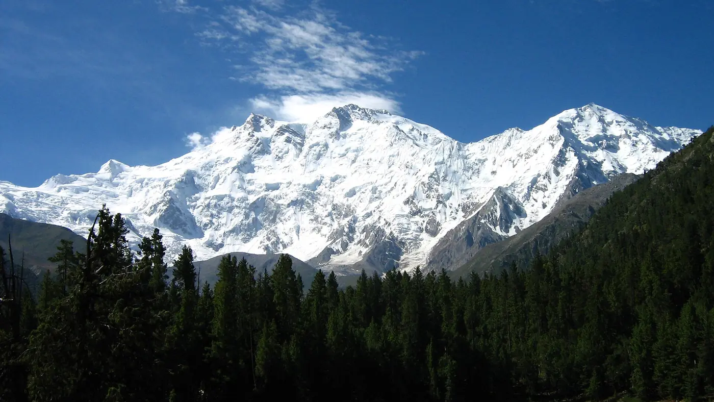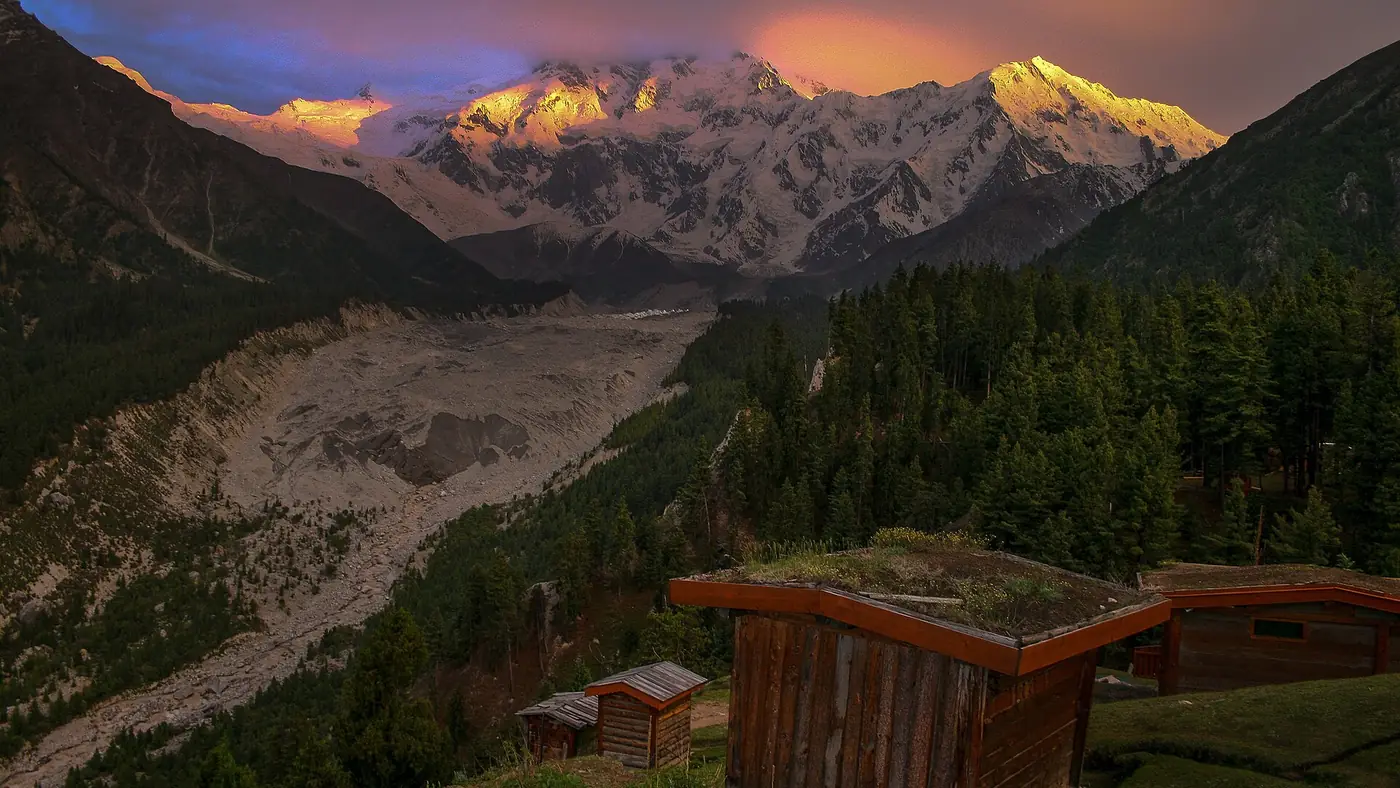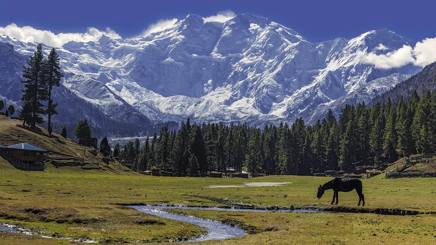
Nanga Parbat is the ninth-highest mountain in the world and the second-highest in Pakistan after K2, at 8,126 metres. It stands alone at the western end of the Himalaya, just south of the great bend of the Indus in Gilgit-Baltistan, and it has three huge faces: the Rupal to the south, the Diamir to the west and the Rakhiot to the north. Thirty-one people died trying to climb it before anyone reached the top, which is how it earned the name Killer Mountain.
For most Pakistani travellers it is also the easiest 8,000-metre peak to see. This guide covers the mountain itself, its history, and the places you can see it from without climbing anything.
| At a glance | |
|---|---|
| Height | 8,126 m |
| Rank | 9th highest in the world; 2nd in Pakistan after K2 |
| Location | Diamer and Astore districts, Gilgit-Baltistan |
| Range | The western end of the Himalaya |
| Faces | Rupal (south), Diamir (west), Rakhiot (north) |
| First ascent | Hermann Buhl, alone, on 3 July 1953 |
| First winter ascent | 26 February 2016 |
| Protected area | Nanga Parbat National Park, since 2021 |
| Easiest close view | Fairy Meadows, facing the Rakhiot face |
How high is Nanga Parbat?
Nanga Parbat's summit is at 8,126 metres. What makes it stand out is not only the height but how far it rises above everything around it. Its prominence, the height it stands above the lowest col linking it to a higher peak, is about 4,600 metres, among the highest of any mountain on earth.
The mountain is the western anchor of the Himalaya. The Indus wraps around its northern and western sides, and the Karakoram and the Hindu Kush begin across the river. That position is why, near Jaglot on the Karakoram Highway, there is a viewpoint where the three ranges meet.
On its north side the ground drops about 7,000 metres from the summit to the Indus in roughly 25 kilometres. Few places anywhere have that much relief in so short a distance, and it is what you are looking at from the KKH near Raikot Bridge.
What does the name mean?
Nanga Parbat comes from Sanskrit and means "naked mountain", a reference to the steep south face, which is too sheer to hold much snow. In Shina, the language of the surrounding valleys, the mountain is called Diamer or Deo Mir, usually translated as "mountain of God" or "heavenly mountain".
The three faces of Nanga Parbat
The Rupal face
The south face rises about 4,600 metres from its base in the Rupal valley, and it is often described as the highest mountain face in the world. It is the face you see from Tarashing, the last village in the Rupal valley, reached by road from Astore. Reinhold and Günther Messner made the first ascent of it in 1970.
The Diamir face
The west face looks down the Diamir valley towards the Indus near Chilas. The route climbed here in 1962 became the standard way up the mountain, and most commercial expeditions still use it. Its base camp, at around 4,100 metres, is two or three days' walk from the Karakoram Highway.
The Rakhiot face
The north side of the mountain, above the Raikot glacier, is the one most visitors see. Fairy Meadows sits at the foot of this side, looking straight up it. The German expeditions of the 1930s tried it from here, and it was by this route that the mountain was first climbed. What you see from the meadow is not quite the true summit, which is hidden behind the North Peak and the Silver Saddle.
Why is it called the Killer Mountain?
Nanga Parbat has one of the grimmest early histories of any major peak:
- 1895. The British climber Albert Mummery reached about 6,100 metres on the Diamir face. He then disappeared with two Gurkha companions while crossing towards the Rakhiot side, and was never found.
- 1932. A German expedition led by Willy Merkl explored the Rakhiot side and showed that a route along the ridge was possible.
- 1934. Merkl returned. Two climbers reached about 7,900 metres before a storm trapped the team high on the ridge. Merkl, two other Germans and six Sherpas died during the retreat.
- 1937. An avalanche buried Camp IV at night and killed sixteen men, seven Germans and nine Sherpas.
By the time the mountain was climbed, 31 people had died on it. The name has stuck ever since, and the mountain has gone on claiming climbers into the present decade.
Who first climbed Nanga Parbat?
On 3 July 1953 the Austrian climber Hermann Buhl, a member of a German–Austrian expedition, reached the summit alone. His companions had turned back, and he climbed the final 1,300 metres by himself, without supplementary oxygen, reaching the top at about 7 in the evening. He spent the night standing on a narrow ledge on the way down and staggered back into the high camp some 40 hours after leaving it.
No one else has made the first ascent of an 8,000-metre peak alone. The German name for the meadow below, Märchenwiese, meaning fairy-tale meadow, dates from these expeditions, and it is the origin of the name Fairy Meadows.
Climbing history since 1953
The mountain has kept its place in climbing history:
- 1962: second ascent, and the first by the Diamir face, which became the standard route.
- 1970: Reinhold and Günther Messner climbed the Rupal face and came down the Diamir side. Günther died in an avalanche on the descent; his remains were found in 2005.
- 1978: Reinhold Messner returned and made the first completely solo ascent of any 8,000-metre peak, on the Diamir face.
- 1984: Liliane Barrard of France became the first woman to reach the summit.
- 2005: Steve House and Vince Anderson climbed a new direct line on the Rupal face in light, fast style.
- 2012: Sandy Allan and Rick Allen completed the first ascent of the 10 km Mazeno Ridge.
- 2013: on the night of 22 June, gunmen attacked the Diamir base camp and killed eleven people, ten foreign climbers and a Pakistani guide.
- 2016: Ali Sadpara, Alex Txikon and Simone Moro made the first winter ascent on 26 February. Sadpara, from Skardu, became a national figure; he died on K2 in the winter of 2021.
- 2018: Élisabeth Revol and Tomasz Mackiewicz reached the summit in winter. Mackiewicz could not be saved, and Revol was rescued in a night-time operation by climbers flown in from the winter K2 expedition.
- 2025: the Czech climber Klára Kolouchová died in a fall on the mountain in July.
Expeditions still come every summer, mostly to the Diamir face, and the mountain remains a serious objective for the world's best climbers.
Where can you see Nanga Parbat?
You don't have to climb, or even trek far, to see it. The main places, from easiest to hardest:
- From the air. Flights from Islamabad to Skardu and Gilgit pass close by on clear mornings. Our Islamabad to Skardu flight guide explains which side to sit on.
- From the Karakoram Highway. Between Chilas and Jaglot the mountain appears above the Indus on a clear day, and there is a signed viewpoint near Thalichi. Mornings are usually clearest.
- From Babusar Top. On a clear morning, Nanga Parbat shows to the east of the pass. Our Babusar Pass guide covers the road.
- From Deosai. Sheosar Lake, at the western end of the plateau, has a view of the mountain on clear days; see our Deosai National Park guide.
- From Fairy Meadows. The classic view: the Rakhiot face across the meadow at about 3,300 metres, reached by jeep and a walk of two to four hours. Our Fairy Meadows destination page covers the trip.
- From Beyal and the viewpoint above it. A few hours' walk beyond the meadow, much closer to the ice; see our guide to Beyal camp.
- From the Rupal valley and Rama. On the Astore side, Tarashing looks up at the Rupal face, and Rama meadow sits below the massif on its eastern side.
Which view should you go for?
If you want to see Nanga Parbat properly once, go to Fairy Meadows. It is the only place where you can sleep facing the mountain after a short walk, and two nights there give you two mornings for a clear view.
If a jeep track and an uphill walk are not possible for your group, the KKH near Raikot and Babusar Top give real, if more distant, views from the car. The Rupal face from Tarashing suits people already travelling to Astore, and it shows the mountain's most dramatic side. Every view depends on the weather: cloud builds around the summit on most afternoons, so be out early.
Frequently asked questions
How tall is Nanga Parbat?
Nanga Parbat is 8,126 metres high, the ninth-highest mountain in the world and the second-highest in Pakistan after K2.
Why is Nanga Parbat called the Killer Mountain?
Because 31 people died on it before the first ascent in 1953, most of them on the German expeditions of 1934 and 1937. Climbers have continued to die on it since, most recently in 2025.
Who first climbed Nanga Parbat?
The Austrian climber Hermann Buhl, alone and without supplementary oxygen, on 3 July 1953, by the Rakhiot side above Fairy Meadows.
Where is Nanga Parbat located?
In Gilgit-Baltistan, on the border of the Diamer and Astore districts, just south of the bend of the Indus. It is the western end of the Himalaya.
What is the Rupal face?
The south face of Nanga Parbat, rising about 4,600 metres from its base. It is often called the highest mountain face in the world and can be seen from Tarashing in the Rupal valley.
Can you see Nanga Parbat from the Karakoram Highway?
Yes. On a clear day it appears above the Indus between Chilas and Jaglot, with a viewpoint near Thalichi. Early morning is the best time.