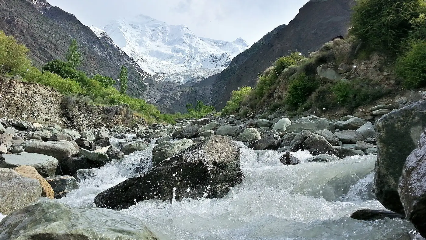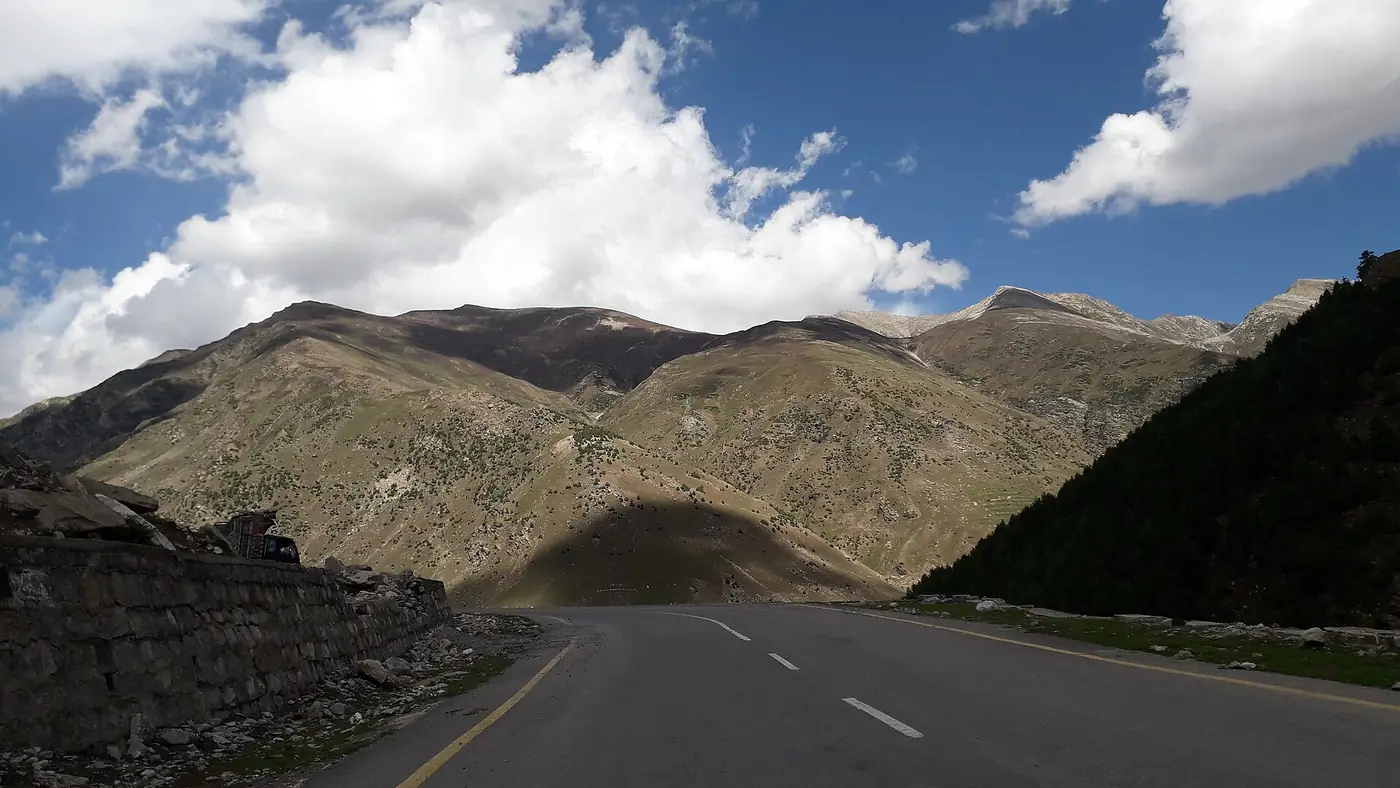
Driving on the Karakoram Highway is well within reach of a careful driver in a sound car, as long as you drive in daylight, in good weather, and at the road's pace rather than your own. The KKH is paved all the way to the Chinese border, but it is narrow and cut into the side of the gorge for long stretches, full of blind bends and heavy trucks, and exposed to rockfall. Most serious accidents are single vehicles leaving the road, usually through speed or tiredness.
This guide is about the driving itself: how to take the bends, how to share the road with trucks, what to do when rock starts coming down, why the day should end before dark, and how to plan fuel. For the route, distances and overnight stops, see our Karakoram Highway road trip guide.
| At a glance | |
|---|---|
| Road | N-35, paved from Hasan Abdal to Khunjerab |
| Hardest driving | Kohistan, between Besham and Chilas |
| Main hazards | Blind bends, trucks, rockfall, drops to the river |
| Drive | In daylight only, and not in heavy rain |
| Fuel | Top up at every town; Sost is the last fuel before the border |
| Emergency | Rescue 1122; Tourist Police 1422 inside Gilgit-Baltistan |
| Official advice | Hire a local, experienced driver if you are unsure |
What is the KKH like to drive?
It changes character along the way. The Hazara Motorway to Thakot is easy. Through Kohistan, as far as Chilas, the highway is cut into cliffs high above the Indus, single-lane in places and broken in others. North of Chilas it becomes a wide, rebuilt road all the way to the border.
The dangers are much the same all the way: a bend you cannot see round, a truck coming the other way in the middle of the road, a stone on the tarmac, a drop with no barrier. The gorge sections punish mistakes. In February 2026 three people died when a car travelling from Rawalpindi to Gilgit left the road in Lower Kohistan and fell towards the Indus. Early reports pointed to speed and loss of control, which is the pattern behind most crashes on this road.
After an accident in May 2025 in which four travellers died, the Gilgit-Baltistan tourism department's advice to visitors was blunt: hire a local, experienced driver, exercise caution at all times, and put safety ahead of speed or convenience.
Blind bends: how to take them
Much of the KKH follows the contours of the mountain, so many bends are blind: rock on one side, the drop on the other.
- Keep left and slow down before the bend, not in it. Assume there is a truck on your side of the road just round the corner, because sometimes there is.
- Use the horn. A short blast before a blind bend is normal here and expected. Listen for the reply.
- Never overtake on or near a bend, however slow the vehicle in front is. Wait for a straight where you can see the whole length of road you need.
- Watch the road surface. Gravel, water from a spring or a patch of fresh stones is more common on bends where the slope comes right down to the road.
- Don't stop on a bend for a photograph. Pull fully off the road at a wide point, and cross on foot with care.
Sharing the road with trucks
The KKH is Pakistan's road to China, and it carries heavy goods traffic to and from the border at Sost, as well as construction trucks for the Dasu and Diamer-Bhasha dams in Kohistan and Diamer. Buses and loaded trucks take up most of the road on narrow sections and climb very slowly.
- Be patient behind a truck on a climb. Stay far enough back to see past it. Overtake only on a clear straight with room to get back in, and never on the strength of a hand signal from the driver.
- Give way on narrow sections. Whoever has the easier place to pull in should do so. In practice that is usually the car, and it is always the car if the other vehicle is a loaded truck on a gradient.
- Watch for parked trucks. Trucks break down and stop where they are, often on bends, sometimes without lights or warning triangles.
- Expect dust and diesel smoke behind trucks in dry weather. Drop back until you can see.
Rockfall and landslides: what to do
Rockfall is the hazard that sets the KKH apart. It is worst in and after rain, in the spring thaw and in the July and August melt, but small stones can come down on a dry, still day.
- Read the road. Fresh stones or soil on the tarmac mean the slope above is active. Slow down and keep going steadily through the stretch rather than stopping in it.
- Don't stop under cliffs, in gullies or where a stream crosses the road. The tourism department's current advice is to steer clear of landslide-prone areas, streams and riverbanks altogether. If you need a break, choose an open stretch with a gentle slope above.
- If rock is falling ahead, stop well back and wait. Don't try to time a dash through. Slides usually come in bursts, and machinery arrives to clear the road.
- Never walk across moving debris, and never with children. Passengers crossing a blockage on foot is common, but not while the slope is still moving or rain is still falling.
- Heavy rain is a reason not to drive. When the Pakistan Meteorological Department issues a heavy-rain or glacial flood alert for Gilgit-Baltistan, postpone the day.
Our guide to Karakoram Highway road status covers where the road closes most often and how to check before you set off.
Why you should not drive at night
Plan every day to finish by sunset. Unlit trucks, broken edges and rockfall are all harder to see in the dark, help is further away, and a tired driver is far more likely to make the mistake the gorge does not forgive. The Gilgit-Baltistan tourism department advises against travel after dark, and so do we.
In practice that means an early start. From Islamabad to Chilas, for example, the long day works only if you are through Kohistan well before dark; if you are running late, stop in Besham rather than pushing on.
Fuel, brakes and the car
Fuel. Stations are frequent as far as Besham and much sparser after it, and a closure can leave you idling for hours. Fill up at every main town (Besham, Dasu or Chilas, Gilgit, Aliabad and Sost) and don't let the tank fall below half anywhere north of Thakot. Sost is the last fuel before the border, and there is none on the 75 km climb to Khunjerab and back. Carry cash, since card machines are unreliable beyond the motorway.
Brakes and gears. On long descents, especially coming down from Khunjerab and on the steep stretches in Kohistan, use a low gear and let the engine hold the car. If you smell hot brakes, stop somewhere safe and let them cool; don't pour water on them.
Heat and altitude. In June and July, Kohistan and Chilas are very hot and long climbs push engine temperatures up; watch the gauge, and switch the air conditioning off on a climb if it rises. Near Khunjerab the car will feel weaker in the thin air.
Is it safe? Security and checkposts
Pakistani families drive the KKH every day, and the police and army checkposts along it are routine: carry your CNIC and the car's registration papers, and foreign nationals should carry passport and visa copies to register. Follow what you are told at each post.
The Kohistan section has a security history that you should know about. In March 2024 a suicide bomber attacked a bus carrying Chinese engineers to the Dasu dam near Besham, killing six. In December 2023 gunmen fired on a passenger bus near Chilas, killing ten, and in February 2026 a roadside bomb hit a Frontier Works Organisation vehicle near Chilas, killing its driver. Check local news and ask the police at Besham or Chilas about the day's situation before you set out.
For overseas visitors: the UK government's travel advice, updated in September 2026, advises against all travel on the KKH between Mansehra and Chilas, through Battagram, Besham and Dasu. Other governments may say something similar, and travelling against that advice can void your travel insurance. Flying to Gilgit or Skardu avoids this stretch.
Should you drive it yourself?
Drive yourself if you have real experience of mountain roads, such as Naran, Swat or Murree in winter, if you can share the driving, and if you are happy to keep to daylight and a slow pace. The KKH rewards patience more than skill.
Hire a driver if nobody in the group has driven mountain roads, if you would be driving tired after a week of work, or if you are travelling with small children or older parents and want to look after them rather than the road. A local driver also knows which stretch was blocked yesterday. Our guide to hiring a driver for a Gilgit-Baltistan trip covers the rates, and our travel guide has more on roads, altitude and what to carry across the north.
A middle way is to fly to Gilgit and drive only the best part of the highway, from Gilgit to Khunjerab, with an experienced driver. That is how our Gilgit, Hunza and Khunjerab tour works.
Frequently asked questions
Is it safe to drive on the Karakoram Highway?
For a careful driver in daylight and good weather, yes. The risks are blind bends, trucks, rockfall and steep drops, plus a security history in Kohistan, so check road and security conditions before each day's drive.
Which part of the KKH is the most dangerous to drive?
Kohistan, between Besham and Chilas. The road is narrow and cut into the cliffs, it carries construction traffic, and it closes most often for landslides.
Can I drive on the Karakoram Highway at night?
It is best avoided. Rockfall, unlit trucks and broken edges are hard to see in the dark, and the Gilgit-Baltistan tourism department advises against night travel.
Where can I get fuel on the Karakoram Highway?
In every main town: Besham, Dasu, Chilas, Gilgit, Aliabad and Sost. Sost is the last fuel before Khunjerab, so fill the tank there.
Should I hire a local driver for the KKH?
If you have not driven mountain roads before, yes. The Gilgit-Baltistan tourism department itself recommends a local, experienced driver for visitors.