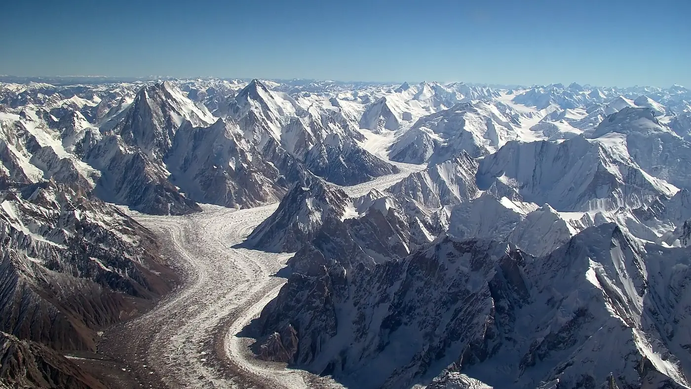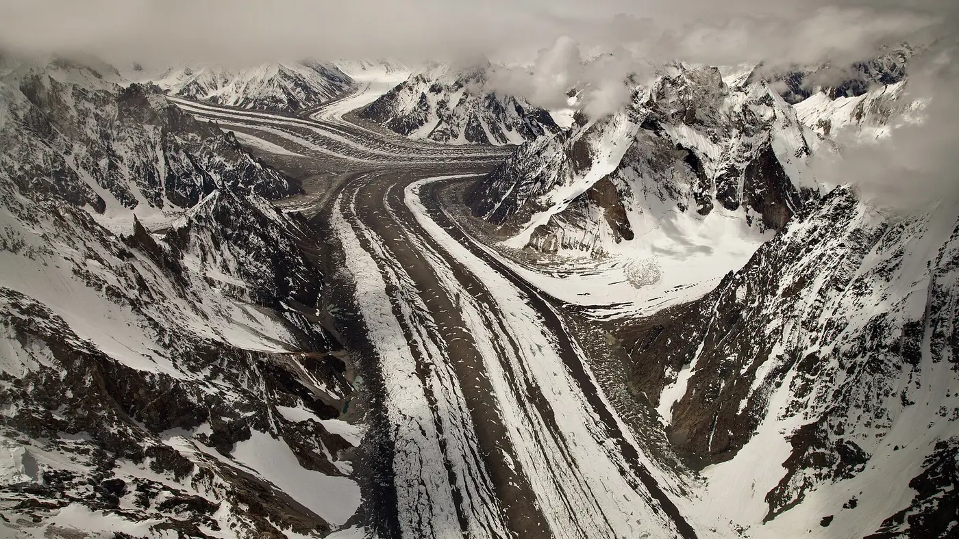
The Baltoro glacier is about 62 km long, one of the longest glaciers outside the polar regions. It flows west from the Conway Saddle, at about 6,200 metres near the China border, to its snout near Paiju at about 3,400 metres, in the Central Karakoram of Baltistan. Trekkers walk up it on the way to K2: three or four days on the ice from Paiju to Concordia, past the Trango Towers, Masherbrum and Gasherbrum IV, sleeping at camps such as Urdukas and Goro.
This guide covers the glacier itself: its size and how it behaves, the peaks along each stretch, and what each camp on the ice is like. The full day-by-day trek is in our K2 base camp trek guide.
| At a glance | |
|---|---|
| Length | About 62 km; some sources give 63 km |
| Altitude | About 3,400 m at the snout to 6,200 m at the Conway Saddle |
| Drainage basin | About 1,500 km² |
| Ice thickness | About 850 m at Concordia, by a 1954 gravity survey |
| Feeds | The Braldu river, then the Shigar and the Indus |
| Nearest village | Askole, two days' walk below the snout |
| Main camps | Paiju, Khoburtse, Urdukas, Goro, Concordia |
| Season to walk it | July and August; June and September possible |
Where is the Baltoro glacier?
The Baltoro lies in the Shigar valley system of Baltistan, inside the Central Karakoram National Park, north-east of Skardu. It fills a long, straight trough between two walls of mountains: the Baltoro Muztagh to the north, which holds K2 and the Gasherbrums, and the Masherbrum mountains to the south.
At its lower end, the glacier melts into the Braldu river near the Paiju campsite, two days' walk above Askole. At its upper end, it splits at Concordia. The Godwin-Austen glacier comes down from K2 to the north, and the Upper Baltoro climbs south-east towards Baltoro Kangri and the Conway Saddle, the pass that separates it from the Siachen glacier.
How big is it, and is it melting?
The Baltoro is about 62 km long from the Conway Saddle to the snout. Including its side glaciers, its drainage basin covers about 1,500 square kilometres. The ice is thick: a gravity survey in 1954 put it at about 850 metres at Concordia.
For most of its length you walk on rock, not ice. About 38 per cent of the glacier's surface is covered in debris, rising to 70 to 90 per cent below 5,000 metres, which is the stretch trekkers use. It is rock that falls from the valley walls and rides down on the ice.
The glacier moves fastest just below Concordia, at up to about 58 cm a day, or roughly 200 metres a year, and about twice as fast in summer as the yearly average. That movement is why the paths across the moraine shift from one season to the next.
It has not shrunk the way glaciers in the Alps have. Glaciologists who compared records going back to the early 1900s found the snout moving back and forth by a couple of hundred metres, with little net change, and the surface at Concordia changing by a few tens of metres at most since 1909. That stability is part of a wider pattern in the Karakoram, where many glaciers have held their size while those in the Himalaya retreat.
Which glaciers flow into the Baltoro?
The Baltoro is fed by a series of side glaciers:
- Trango and Dunge, on either side of the Trango Towers
- Yermanendu, from Masherbrum on the south side
- Muztagh, Younghusband, Mundu and Biarchedi, the other large side glaciers
- Godwin-Austen, from K2, meeting it at Concordia
- Abruzzi and the Gasherbrum glaciers, from the Gasherbrum peaks
- Vigne, from Chogolisa, which leads to the Gondogoro La
Which peaks line the Baltoro?
The big peaks stay hidden behind nearer ridges, and each stretch of the glacier brings a new one into view.
The snout and Paiju
From Paiju you look up at Paiju Peak, 6,610 metres, directly above camp, and ahead to the snout of the glacier and the first granite spires of the Trango and Cathedral groups.
Paiju to Urdukas
On the north side of the glacier, the Trango group rises between the Trango and Dunge glaciers: Great Trango, at 6,286 metres, and the slender Trango or Nameless Tower, at 6,239. The east face of Great Trango has one of the tallest near-vertical drops of any cliff on earth. Nearby stand Uli Biaho Tower, at 6,109 metres, and the walls of the Cathedral and Lobsang groups.
Urdukas to Goro
Past Urdukas the glacier widens and the scale changes. Across to the south, Masherbrum, at 7,821 metres, towers above the Yermanendu glacier. It was the first Karakoram peak surveyed from Kashmir in 1856, which is why it was labelled K1. Ahead, at the head of the valley, Gasherbrum IV, at 7,925 metres, grows larger every hour. Higher up, Muztagh Tower, at 7,276 metres, stands to the north, made famous by a photograph Vittorio Sella took from the upper Baltoro in 1909.
Goro to Concordia
The last day brings Broad Peak into view, then Mitre Peak, Crystal Peak and Marble Peak around the approach to the junction. K2 stays hidden until you reach Concordia itself. Our guide to Concordia goes through that view peak by peak.
The camps on the Baltoro
Groups use the same handful of camps every season. Altitudes vary between sources and with the shifting ice, so treat these as approximate.
| Camp | Altitude | What it is like |
|---|---|---|
| Paiju | About 3,400 to 3,450 m | Off the ice beside the snout; toilets, water and the usual rest day |
| Khoburtse | About 3,600 to 3,800 m | A camp on the moraine; some groups break the stage here |
| Urdukas | About 4,000 to 4,100 m | A grassy ledge above the south side of the glacier, facing the Trango group |
| Goro II | About 4,300 to 4,380 m | On the ice; cold, stony and exposed, facing Masherbrum |
| Concordia | About 4,600 to 4,700 m | The junction with the Godwin-Austen glacier, under K2 |
Paiju is the last proper campsite off the ice, and the rest day there is as much about the porters preparing food for the glacier as about acclimatising. Urdukas is the last green ground: a terrace of grass and boulders above the ice, and the camp most trekkers like best. From Goro onwards, whether at Goro II or the lower Goro I that some groups use, you sleep on the glacier itself, with stones under the tent and ice under the stones, and nights well below freezing even in midsummer.
What is walking on the Baltoro like?
Harder than the distance suggests. The stages are mostly 6 to 12 km, but the moraine turns every kilometre into small climbs and drops over loose rock.
- Slow going. Expect 2 km an hour or less on rough moraine, and sore ankles and knees by the end of the day.
- Meltwater streams. They run across and along the glacier and rise through the afternoon. Cross them early, and follow your guide's line.
- Hidden ice. The rubble hides hollows and, higher up, crevasses. The route shifts every year as the glacier moves, so nobody should wander off it.
- Glare and cold together. Hot sun off the ice by day, frost at night.
Our guide to glaciers in Gilgit-Baltistan covers staying safe near the ice more generally.
A short history of the Baltoro
The first outsider to survey the glacier was the British surveyor Henry Godwin-Austen, in 1861. He climbed about 1,000 metres above Urdukas and fixed the height and position of K2 for the first time, and the glacier that flows down from K2 now carries his name.
Martin Conway's expedition of 1892 mapped the upper glacier and gave many of its features the names still used, including Hidden Peak for Gasherbrum I. In 1909 the Duke of the Abruzzi led an Italian expedition to K2, and Vittorio Sella's photographs from that trip showed the Baltoro to the world.
Can you see the Baltoro without the full K2 trek?
Not easily. The snout is two days' walk above Askole, and the whole route from Askole lies in the Karakoram's restricted trekking zone, so even a short walk to Paiju needs the trekking permit and park fees. Some operators in Skardu sell helicopter and light-aircraft flights over the glacier in good weather, which is the only way to see it without walking.
Walk it if you are a fit, experienced trekker with at least two weeks to spare.
Look elsewhere if you want a glacier on a normal holiday. The Passu, Batura and Hopper glaciers in Hunza and Nagar are an easy drive or a short walk from the road, and the Shigar and Askole valleys give a taste of the Baltoro's approach. Our Skardu destination page shows what else is within reach.
The Central Karakoram National Park is managed by the Gilgit-Baltistan Forest, Wildlife and Environment Department. If you would like help planning a trek on the Baltoro, including the season and enough spare days, send us your dates through our trip planning page.
Frequently asked questions
How long is the Baltoro glacier?
About 62 km from the Conway Saddle to its snout near Paiju, with some sources giving 63 km. It is one of the longest glaciers outside the polar regions.
Where does the Baltoro glacier start and end?
It starts at the Conway Saddle, at about 6,200 metres near the China border, and ends near Paiju at about 3,400 metres, where its meltwater becomes the Braldu river.
How many days does it take to walk the Baltoro glacier?
Three or four days on the ice from Paiju to Concordia, after two days' walk from Askole to Paiju.
Is the Baltoro glacier retreating?
Not in the way most glaciers are. Records covering most of the last century show its snout moving back and forth by a few hundred metres with little net change.
Which mountains can you see from the Baltoro glacier?
The Trango Towers, Paiju Peak, Masherbrum, Muztagh Tower and Gasherbrum IV along the way, then K2, Broad Peak and Chogolisa from Concordia at the top.