The places to visit in Chilas are mostly beside the road you arrived on. The best are the rock carvings: figures, stupas and inscriptions cut into boulders along the Indus, at Chilas I opposite the Thalpan bridge, at Chilas II near the police checkpoint, and across the river at Thalpan. Add a look at the old fort, a drive into the Thak valley on the Babusar road and an evening above the river, and Chilas makes a good overnight stop rather than just a bed.
This guide covers what is worth seeing, how to fit it around the heat, and a plan for one evening and one morning.
| At a glance | |
|---|---|
| Where | Diamer district, where the Babusar road meets the Karakoram Highway |
| Altitude | About 1,265 m |
| Main sights | Rock carvings at Chilas I, Chilas II and Thalpan |
| Time needed | An evening and an early morning |
| Summer heat | July afternoons average around 35°C |
| To Raikot Bridge | About 50 km, 1 to 1.5 hours |
| To Gilgit | About 135 km, 3 to 3.5 hours |
| To Babusar Top | About 50 km up the Thak valley |
Why stop in Chilas at all?
Chilas is the headquarters of Diamer district and the town where the two roads north meet: the Babusar road down from Naran and the Karakoram Highway up from Besham. Almost everyone driving to Gilgit-Baltistan passes through, and many sleep here because it breaks the drive from Islamabad at a sensible point.
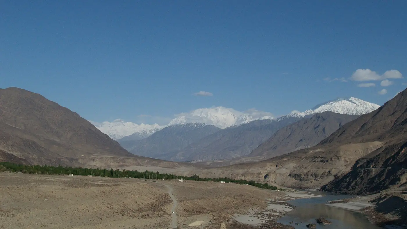
It is not a resort. The town sits low on the Indus among bare brown mountains, and in summer it is one of the hottest places in the north. What it has is history: this stretch of the river lay on the old routes between Central Asia and the plains, and for thousands of years travellers left their marks on the rocks beside it.
The rock carvings of Chilas
Diamer holds one of the largest collections of rock art anywhere. The Gilgit-Baltistan tourism department counts more than 50,000 carvings and 5,000 inscriptions in the Chilas and Thalpan area. The oldest are hunting scenes and animals, ibex above all; later come stupas, Buddha figures and Bodhisattvas from the Buddhist centuries, with inscriptions in several ancient scripts.
The main sites are beside the highway or a short walk from it, with few signs or facilities, and a couple of hours covers the best of them.
Chilas I, opposite the Thalpan bridge
The best-known site is on the town side of the Indus, above the highway and directly opposite the bridge that crosses to Thalpan, about 4 km east of Chilas and ten minutes' drive from the hotels. Look for the large stupa with banners streaming from it, and the panel with two Bodhisattvas side by side: Avalokiteshvara on the left and Maitreya on the right.
Thalpan, across the river
Cross the bridge to Thalpan for more boulders covered in carvings. Among them are scenes from the Jataka stories of the Buddha's earlier lives, and figures in Central Asian dress honouring stupas, thought to date from around the 7th century. The tourism department lists the Thalpan petroglyphs among the district's main sights.
Chilas II, near the police checkpoint
Chilas II is signed from near the police checkpoint on the highway, down a jeep track of less than a kilometre. A huge rock here is covered with hunting and battle scenes, ibex and stupas. On a knoll facing the river are some of the oldest inscriptions in the area, from around the 1st century AD.
How to see them well
- Go early or late. Before about 9 am, or in the last hour of daylight, the rock is cooler and the low sun shows the carved lines far better.
- Carry water and wear shoes with grip. The ground is loose and the boulders are steep in places.
- Look, don't touch. Don't chalk, wet or trace the carvings to make them stand out in photos. Panels at Chilas I have been defaced with paint more than once, as recently as 2022.
- Don't leave it for another trip. The Diamer-Bhasha dam is being built on the Indus about 40 km downstream of Chilas, and when its reservoir fills it will cover many of the carvings along the river.
Chilas Fort
The large fort in the town dates from the British period. In 1893 a tribal force nearly overran the post here, and the British then built a stronger fort to guard their supply route over the Babusar Pass. It is still in use as a police post, so you can look at it from outside but not wander in. Ask before you photograph it, and accept a no politely.
The Thak valley and the Babusar road
From Chilas the Babusar road leaves the Indus and climbs south up the Thak valley towards Babusar Top, about 50 km away and nearly 3,000 metres higher. Thak has a long place in local history: Syed Noor Shah, known as Ghazi Baba, a preacher from the Kaghan valley, brought Islam to the area and built the first mosque in Thak, which still stands.
If you came up the Karakoram Highway and are not crossing the pass, a short drive up the valley in the early morning is a cool change from the town. The road over the top is closed in winter, usually until late May or June, and the valley floods: on 21 July 2025 a cloudburst sent a flash flood down Thak Nala onto the Babusar road, killing tourists, and more than 200 people were rescued and brought down to Chilas. Don't go up in heavy rain. Our Babusar Pass guide covers the drive over the top.
Along the Indus
The river is half the reason to stop:
- An evening on a hotel terrace. Several hotels along the highway look straight down on the Indus, and once the sun is off the valley their lawns are the pleasantest place in town. Our guide to hotels in Chilas covers where to stay.
- The Thalpan bridge. Walk out onto it for the closest view of the river, fast and grey with silt, with carvings on both banks.
- Stay out of the water. The Indus here is cold, fast and much stronger than it looks. Keep children well back from the edge.
- The drive east. The highway follows the river for about 50 km, past slide-prone stretches around Tatta Pani, to Raikot Bridge, where the Fairy Meadows jeeps leave. A short way beyond it is the roadside Nanga Parbat viewpoint.
An overnight plan for Chilas
For travellers arriving from Naran or Besham and going on the next morning:
- Arrive by late afternoon, well before dark, and rest indoors until the sun leaves the valley.
- Early evening: Chilas I. Ten minutes' drive east, then walk out onto the Thalpan bridge as the light goes.
- Dinner above the river. Fill the tank and withdraw cash tonight: if you are heading for Fairy Meadows, there is no ATM at Raikot Bridge or on the meadow.
- Dawn: Chilas II or Thalpan, or a short drive up the Thak valley if you are not crossing Babusar.
- Leave by 8 or 9 am. That puts you at Raikot Bridge by mid-morning for the Fairy Meadows jeep, or in Gilgit by lunchtime.
Is Chilas safe to stop in?
Pakistani families stop in Chilas in large numbers every summer. Diamer has also had security incidents in recent years. In December 2023 gunmen attacked a passenger bus near Chilas, killing ten people. On 12 February 2026 a bomb hit a Frontier Works Organisation vehicle in Chilas, killing one person, and in April 2026 militants ambushed a police team in the Thor valley nearby, killing three policemen.
Travel in daylight, check local news and ask at police checkposts before setting out, and follow police instructions. The UK government's travel advice advises against all travel on the Karakoram Highway between Mansehra and Chilas, the Besham and Dasu stretch. Overseas visitors should read their own government's advice, since going against it can void travel insurance, and expect to register at police checkposts.
Who should stop, and who should drive on
Chilas suits you if you are heading for Fairy Meadows, since it leaves the shortest drive to Raikot Bridge, or if the carvings interest you and you can give them an evening and a dawn. It is also the natural stop if you came over Babusar late in the day.
It suits you less in July and August with small children or older parents, when the heat is hard to escape and power cuts can leave the air conditioning off. On the Babusar route, sleeping in Naran and passing Chilas in the cool of the morning is often easier. If you would like us to work out where the nights should fall on your route north, send us your dates through our trip planner.
Frequently asked questions
What is Chilas famous for?
Its rock carvings: tens of thousands of figures and inscriptions on boulders along the Indus, from prehistoric hunting scenes to Buddhist stupas and Bodhisattvas.
Where are the Chilas rock carvings?
The main site, Chilas I, is beside the highway about 4 km east of town, opposite the bridge to Thalpan. More carvings lie across the bridge at Thalpan, and Chilas II is signed from near the police checkpoint on the highway.
How far is Chilas from Fairy Meadows?
About 50 km, or 1 to 1.5 hours, to Raikot Bridge, then 1.5 to 2 hours by jeep to Tato and a walk of two to four hours to the meadow. Leaving Chilas by 8 or 9 am lets you reach the meadow in daylight.
Is Chilas worth an overnight stop?
Yes, if you use the evening and early morning for the carvings and the river. For a whole summer day, no: the afternoons are too hot.
Is Chilas safe for tourists?
Many Pakistani travellers stop there every summer, but Diamer has had security incidents, including attacks in 2023 and 2026. Travel in daylight, check local news and police advice before setting out, and foreign visitors should read their government's travel advice.