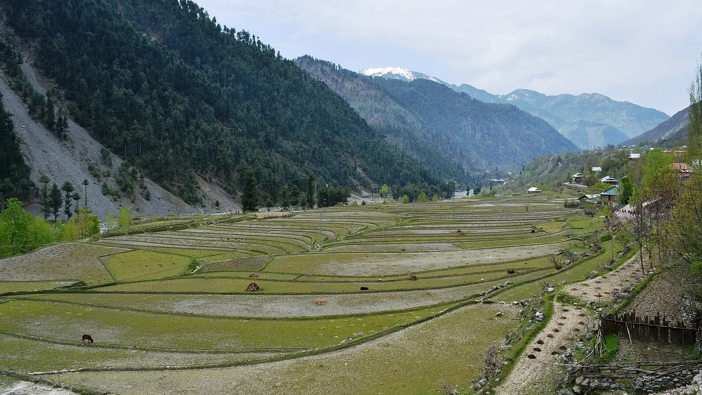
The Jhelum Valley in Azad Kashmir runs east from Muzaffarabad along the Jhelum river towards the Line of Control, through Garhi Dupatta, Chinari and on to Chakothi. It is one road, largely paved, that most visitors drive as a day trip or as the first stage of a longer journey to Leepa Valley, with the river beside you for most of the way.
This guide takes the road stage by stage, covers what each stop offers, and adds the side trip to Chikar and Zalzal Lake for anyone with a full day rather than a few hours.
| At a glance | |
|---|---|
| Route | Muzaffarabad to Chakothi, along the Jhelum river |
| Distance, Muzaffarabad to Chakothi | Roughly 55 to 60 km |
| Road | Paved along the main river road |
| Drive time, one way | Around 2 hours without stops |
| Main stops | Garhi Dupatta, Chinari, Chakothi |
| Side trip | Chikar and Zalzal Lake, off the main road |
| Access at Chakothi | A border area near the Line of Control; controlled and subject to change |
The route in outline
From Muzaffarabad the road follows the Jhelum upstream, broadly south-east and then east, with the river visible for much of the drive. It passes Garhi Dupatta, then Chinari, and continues to Chakothi, close to the Line of Control. A side road partway along climbs off the valley floor towards Chikar and, beyond it, Zalzal Lake. The same road, via a turn at Naili, is also the way in to Leepa Valley, covered separately in our guide to reaching Leepa Valley from Islamabad.
Garhi Dupatta: the first stop
Garhi Dupatta is around 20 km from Muzaffarabad and the first proper settlement on the road, with basic services, shops and educational institutions. It is not a destination in itself so much as a marker that you are properly into the valley, and a reasonable place to stop for tea or fuel before the road narrows further on.
Chinari: a riverside town
Chinari sits on the left bank of the Jhelum, roughly 50 km from Muzaffarabad, ringed by hills and with a working bazaar, a hospital and other basic facilities. It is a good midpoint stop on the drive, with views along the river valley from the town itself, and a sensible place to break the journey if you are also heading on to Chakothi or turning off for Chikar.
Chikar and Zalzal Lake: the side trip
A side road leaves the main valley road, near Dhanni Baqallan, and climbs to Chikar, a hill town at around 1,828 metres, roughly 46 km from Muzaffarabad by this route. Chikar sits above the main valley with views over the surrounding hills, and it is also the access point for Zalzal Lake, the landslide lake formed in the 2005 earthquake. This detour adds real time to the day rather than a quick stop, so it needs its own half-day rather than being squeezed in on the way to Chakothi. Our separate guide to Zalzal Lake covers the lake itself, how it formed and what a visit involves.
Chakothi: the end of the road
Chakothi, close to the Line of Control, is roughly 55 to 60 km from Muzaffarabad and the practical end point of the Jhelum Valley road for visitors. It sits near the Kaman bridge, the crossing point historically used for the Muzaffarabad–Srinagar bus service and for periods of cross-LoC trade, both of which have been suspended for years amid wider India–Pakistan tensions. Chakothi itself is a controlled border area: expect checkpoints, and be ready to show identification and follow what soldiers on duty tell you about where you can go and what you can photograph. Treat any specific claim about what is currently open at Chakothi, including this one, as something to confirm locally rather than rely on.
A day out from Muzaffarabad
A straightforward plan for a single day:
- Leave Muzaffarabad by mid-morning and drive to Garhi Dupatta, a short first stretch.
- Continue to Chinari, stopping for a proper break beside the river.
- On to Chakothi, allowing time at the checkpoints and for the views back down the valley.
- Return the same way, or turn back earlier if you plan to add Chikar and Zalzal Lake, which needs its own time rather than being tacked onto the end of the day.
Doing the whole round trip to Chakothi and back, without the Chikar detour, is realistic in a single day from Muzaffarabad, at around two hours' driving each way plus stops. Adding Zalzal Lake turns it into a longer day or a better reason to spend a night in the valley.
Practical notes
- Fuel up in Muzaffarabad. Formal fuel stations thin out beyond the town.
- Carry your CNIC. You will need it at checkpoints, particularly approaching Chakothi.
- Don't expect reliable signal much beyond Chinari, and less again near Chakothi.
- Check conditions before you go, since access along this road, especially near Chakothi, can change at short notice given its position on the Line of Control.
For a longer Azad Kashmir trip that includes this drive, our Kashmir destination guide and trip planning page can help put it together with the rest of the region.
Frequently asked questions
How far is Chakothi from Muzaffarabad?
Roughly 55 to 60 km by road, following the Jhelum river valley, which takes around two hours to drive without stops.
Is the Jhelum Valley road from Muzaffarabad paved?
Yes, the main road along the valley as far as Chakothi is paved. A side road to Chikar and Zalzal Lake is a separate, smaller route off the main valley.
Can visitors go all the way to Chakothi?
Chakothi is a controlled border area near the Line of Control, with checkpoints and identification checks. What is accessible can change, so confirm locally in Muzaffarabad rather than assuming.
What is there to see between Muzaffarabad and Chakothi?
Garhi Dupatta and Chinari are the main towns on the way, both beside the Jhelum river, along with the side trip to Chikar and Zalzal Lake off the main road.
Is a day trip enough for the Jhelum Valley?
For the drive to Chakothi and back, yes. If you want to add Chikar and Zalzal Lake, it is a fuller day or better split across two, especially if you are also continuing on towards Leepa Valley.