
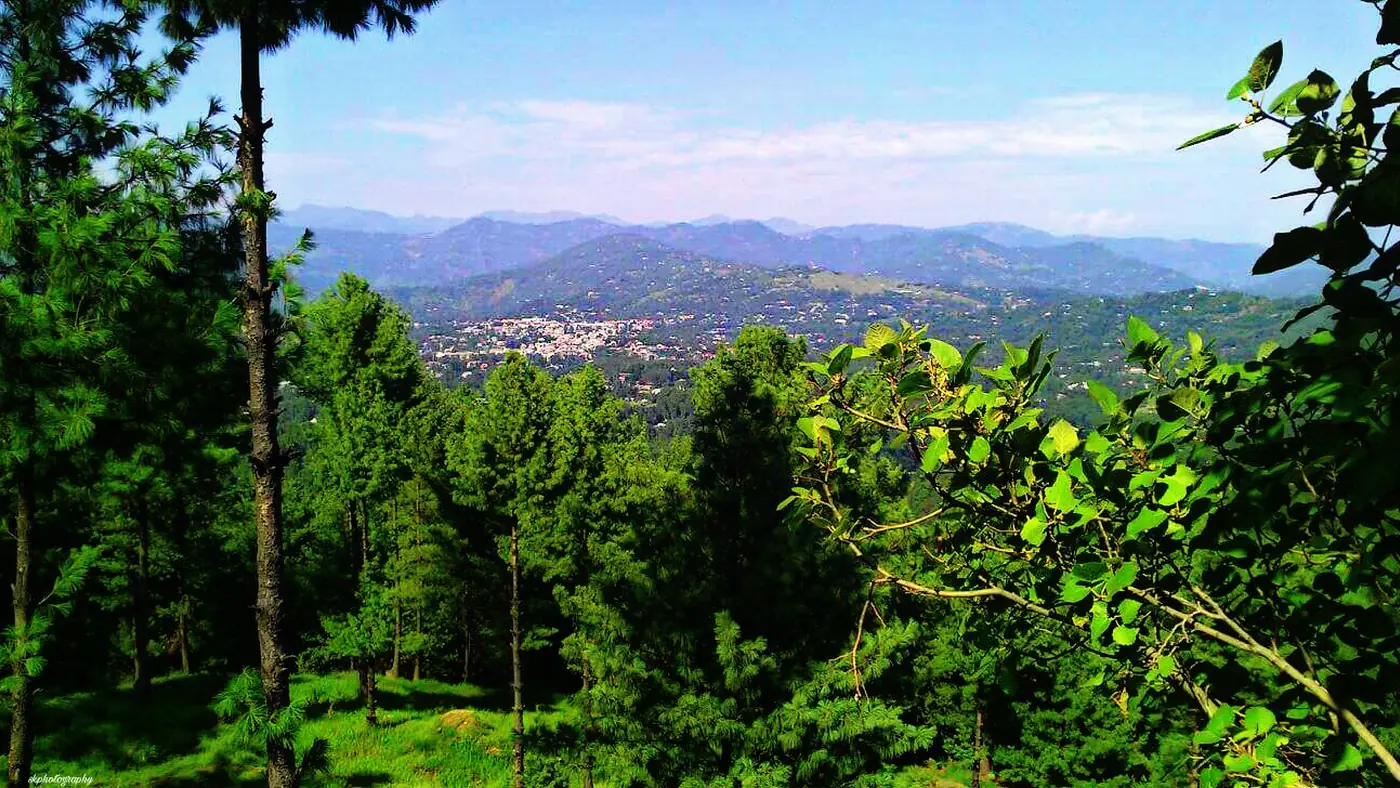

Islamabad to Rawalakot is about 110 km by the usual route, via Kahuta and the bridge over the Jhelum at Azad Pattan, and takes three to three and a half hours in normal traffic. The alternative runs through Murree, Kohala and Dhirkot: about 160 km and four and a half to five and a half hours. For most trips the Azad Pattan road is the one to take; the Kohala road makes sense when you are combining Rawalakot with Murree, Muzaffarabad or the Neelum valley, or when the Azad Pattan road is blocked.
This guide takes each route stage by stage, compares the roads, the scenery and the risks in the monsoon and in winter, and covers the vans and coaches from Rawalpindi.
| At a glance | Via Azad Pattan | Via Kohala |
|---|---|---|
| Distance | About 110 km | About 160 km |
| Usual drive time | 3 to 3.5 hours | 4.5 to 5.5 hours |
| The road | Kahuta road, Azad Pattan bridge, then the climb through Goain Nala | Murree Expressway, Kohala bridge, Dhirkot and Arja |
| Best for | Most trips, and winter | Linking with Murree, Muzaffarabad or Neelum |
| Main risk | Landslides in the monsoon | Murree traffic, snow near Murree, monsoon landslides |
Which route should you take?
Take the Azad Pattan road unless you have a reason not to. It is shorter by about 50 km and by well over an hour, it avoids Murree entirely, and it is the main road between the twin cities and Rawalakot.
Take the Kohala road if you are coming from Murree or Muzaffarabad, if you want to make a loop and return a different way, or if the Azad Pattan road is closed. It is also the connection to the rest of Azad Kashmir: from Kohala the road north goes to Muzaffarabad and on up the Neelum valley.
There are smaller back roads into Poonch as well, used mostly by people who live along them. For a first trip, these two routes are the ones to plan around.
The Azad Pattan route, stage by stage
- Islamabad to Kahuta, about 45 km. Leave the Islamabad Expressway for the Kahuta road and follow it east through the Pothohar country to Kahuta, the last sizeable town before the river. Fill up before you leave the twin cities or in Kahuta.
- Kahuta to Azad Pattan, about 30 km. The road winds down through the hills to the Jhelum. This stretch is prone to landslides: in July 2025 a large slide at Thanda Pani closed it completely after heavy rain and stranded hundreds of travellers for hours.
- The bridge at Azad Pattan. At about 500 metres, this is the lowest point of the drive and the border between Punjab and Azad Kashmir. Expect a police check at the picket here, especially since security was tightened in 2026; keep your CNIC to hand. Foreign nationals face restrictions near the Line of Control and should check the current rules with the AJK authorities before going.
- Azad Pattan to Rawalakot, about 35 km. The road climbs out of the river valley through Goain Nala, gaining more than a thousand metres to Rawalakot at around 1,600 metres. Since it was built it has cut the journey time considerably, but it is a mountain road: steep, bendy, with drops to one side. Allow an hour to an hour and a half.
Count on about two hours from Islamabad to the bridge and a little over an hour for the climb. Traffic on the Islamabad Expressway or the Kahuta road, a slow truck on the climb or a landslide being cleared will add to that.
The road along the river near Azad Pattan has seen serious accidents, including a passenger van from Hajira that went into the Jhelum in December 2025. Drive it in daylight, don't overtake on bends, and don't drive it tired.
The Kohala route, stage by stage
- Islamabad to Kohala, about 90 km. Take the Murree Expressway into the hills, past the toll plaza at Phulgran, then on beyond Murree and down to the Jhelum at Kohala. On a clear weekday this takes around two hours; on a summer weekend or after snow, Murree traffic can add a great deal more. Our Islamabad to Nathia Gali guide covers the expressway, the toll and when to avoid it.
- Across Kohala bridge into Azad Kashmir. Here the road to Muzaffarabad carries on north along the river; you turn off towards Dhirkot.
- Kohala to Dhirkot, about 25 km. The road climbs steeply from the river to the hill town of Dhirkot, at close to 1,700 metres.
- Dhirkot to Arja, about 20 km. Arja is a busy junction: the road north goes to Bagh, and yours turns south.
- Arja to Rawalakot, about 28 km. The last stretch runs south through the hills to Rawalakot.
From Kohala the drive is around 70 km of hill road, narrower than the Azad Pattan road and busier with local traffic, especially around Arja. Allow two to two and a half hours for it, and more after rain.
How do the two roads compare?
Road quality
Both routes are paved all the way, and a normal car in good condition manages either in dry weather. The Azad Pattan road is the main road for Poonch, and the climb through Goain Nala is its one long ascent. The Kohala road climbs over the Murree hills, drops to the river at Kohala and climbs again to Dhirkot, and has more narrow stretches where two vehicles pass slowly.
Scenery
On the Azad Pattan road the highlight is the Jhelum itself, deep in its valley at the bridge, and the long climb afterwards with the hills of Poonch opening out ahead. On the Kohala road you get the pine forests of the Murree hills, the river at Kohala, and the forested ridges around Dhirkot. Neither is dull, and if you have time, going in by one and out by the other gives you both.
In the monsoon
July and August are the wettest months, and landslides are the main risk on both routes. The Kahuta to Azad Pattan stretch is known for them, as the July 2025 closure showed, and the hill roads on the Kohala route are just as exposed after heavy rain. Leave early, check the road on the morning you drive, and keep a spare day at the end of the trip.
In winter
Snow is a bigger factor on the Kohala road, because it crosses the hills near Murree, where heavy snow and heavy winter traffic go together. The Azad Pattan road stays low until the final climb, so in winter it is usually the better choice. Both can close for a time after a heavy fall around Rawalakot, and anyone driving up between December and February needs warm clothes in the car, not in the boot.
After dark
Neither road is lit. Plan to arrive in Rawalakot before sunset, which means leaving Islamabad by early afternoon at the latest in winter, and earlier on the Kohala road.
Making a loop
A good way to use both roads on a two- or three-day trip:
- Day one: Islamabad to Rawalakot via Azad Pattan, arriving by early afternoon.
- Day two: Banjosa Lake and Devi Gali, or Toli Pir if the weather is clear, back in Rawalakot for the night.
- Day three: north to Arja, across to Dhirkot and down to Kohala, then back to Islamabad on the Murree Expressway. Leave early to reach Murree before the afternoon traffic.
If you are heading on to Muzaffarabad or the Neelum valley instead, turn north at Kohala. Our Kashmir page covers the Neelum side of Azad Kashmir.
For what to see once you arrive, our guide to the places to visit in Rawalakot gives the distance and time for each stop.
By public transport
Coaches and vans for Rawalakot run from the Pir Wadhai general bus stand in Rawalpindi. Ask which way the vehicle goes; the Azad Pattan road is the shorter journey. Fares change, so check at the counter rather than relying on a figure online, and ask for a front seat if anyone in your group gets car sick on hill roads.
Public transport across Azad Kashmir was suspended for days at a time during the 2026 strikes, so confirm services are running before you go to the bus stand. In Rawalakot, taxis and local vans cover Banjosa and the other places nearby.
From Lahore, the simplest plan is the motorway to Islamabad and then the Azad Pattan road, which puts Rawalakot within a long day's drive.
Our advice on timing the drive
The drive is short enough for a weekend, and that is where people go wrong: they leave Islamabad late on a Friday, hit traffic, and do the climb in the dark. Leave in the morning, and give the drive half a day rather than the three hours it takes on paper.
For the best months to go and what the weather is like on the road, see our guide to the best time to visit Rawalakot. If you would like us to plan the route around your dates, tell us what you have in mind.
Frequently asked questions
How far is Rawalakot from Islamabad?
About 110 km via Kahuta and Azad Pattan, or about 160 km via Murree, Kohala and Dhirkot. The Azad Pattan road is the usual route.
How long does it take to drive from Islamabad to Rawalakot?
Three to three and a half hours via Azad Pattan in normal traffic, and four and a half to five and a half hours via Kohala. Landslides in the monsoon and traffic around Murree can add hours.
Which is the best route from Islamabad to Rawalakot?
The Azad Pattan road for most trips: it is shorter, avoids Murree and is the main road to Poonch. Use the Kohala road when combining the trip with Murree, Muzaffarabad or the Neelum valley.
Is the road to Rawalakot safe for a normal car?
Yes, in dry weather, if the brakes and tyres are in good order. Both routes are paved but steep and bendy in places, so drive in daylight and take care in rain and snow.
Is there public transport from Rawalpindi to Rawalakot?
Yes. Coaches and vans run from the Pir Wadhai bus stand in Rawalpindi. Services were suspended at times during the 2026 strikes, so check they are running before you travel.
Can you fly to Rawalakot?
No. Rawalakot has an old airstrip, but there are no scheduled passenger flights, so the only way in is by road.