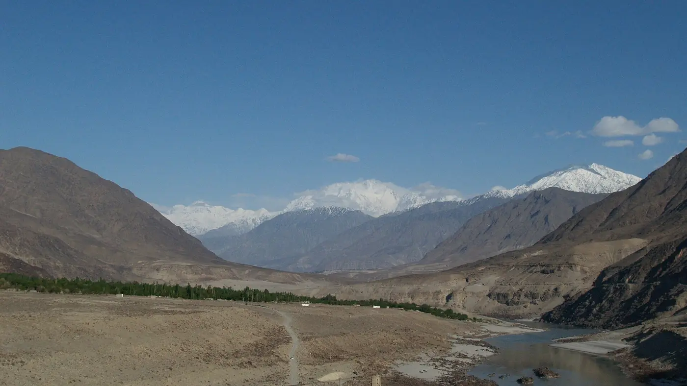
Chilas weather is hot and dry in summer and cold and dry in winter, with July afternoons regularly passing 34°C even though the town sits in the mountains of Gilgit-Baltistan. The reason is altitude: Chilas is only about 1,176 metres above sea level, low enough to sit in a bare, rocky stretch of the Indus valley that traps heat, while towns further into the mountains such as Gilgit and Skardu sit far higher and stay noticeably cooler.
Almost everyone driving to Gilgit-Baltistan on the Karakoram Highway passes through or sleeps in Chilas, so its climate matters for planning the drive. This guide covers why it gets so hot, what to expect month by month, and the best time of day and year to be on the road through it.
| At a glance | |
|---|---|
| Altitude | About 1,176 m |
| Climate type | Cold semi-arid: hot dry summers, cold dry winters |
| Hottest month | July, average high around 35°C |
| Coldest month | January, average low around 1°C |
| Annual rainfall | About 254 mm, spread thinly through the year |
| Best driving hours in summer | Early morning or evening |
| Road in winter | Kept open by the highway authority, but cold and can ice |
Why Chilas gets so hot
Chilas sits low in the Indus gorge, hemmed in by bare mountains that reflect and hold the heat rather than a green, open valley that would cool the air. At just over 1,100 metres it is far lower than Gilgit or Skardu, both well above 1,400 metres, and the difference in altitude alone accounts for several degrees. Add rock and sand on both sides of the road with almost no vegetation to shade it, and a still summer afternoon in the gorge can feel closer to a plains city than a mountain town.
Chilas weather by month
These figures are long-term averages, so any single day can run hotter or colder.
| Month | Typical high | Typical low | Notes |
|---|---|---|---|
| January | Around 8°C | Around 1°C | Coldest month, occasional light snow |
| February | Cool | Near freezing at night | Still cold |
| March | Mild, warming | Cool nights | Spring begins |
| April | Warm | Mild | Wettest month, around 46 mm of rain |
| May | Hot | Mild | Heat builds quickly |
| June | Around 34°C | Around 20°C | Hot, driest month of the year |
| July | Around 35°C | Around 22°C | Hottest month |
| August | Around 34°C | Around 21°C | Very hot, occasional storms |
| September | Cooling | Mild | More comfortable travelling weather |
| October | Mild | Cool | Pleasant for a stopover |
| November | Cool | Cold nights | Winter sets in |
| December | Around 13°C | Around 2°C | Cold, occasional snow |
Best time to drive through Chilas
In summer, drive in the early morning or evening. The midday hours from roughly 11 am to 4 pm in June, July and August are the hottest part of the day in the gorge, and a car without working air conditioning gets genuinely uncomfortable, especially for children and older passengers. Leaving Chilas by 7 or 8 am, or arriving after the sun has dropped behind the ridge, makes the same stretch of road far more bearable.
Spring and autumn are the easiest seasons to pass through. April, May, late September and October avoid the worst of the summer heat and the winter cold, with generally settled, dry weather for driving.
Winter is cold rather than dangerous for the road itself. The Karakoram Highway through Chilas is kept open through winter by the Frontier Works Organisation, unlike higher passes such as Babusar, which close under snow. That said, night-time temperatures fall below freezing, ice can form on the road in shaded stretches, and heavy snowfall further along the highway, particularly the Besham to Dasu section, occasionally causes short closures. Check the Karakoram Highway road status before a winter drive, and don't assume the whole route is clear just because Chilas itself is.
If you are breaking the journey overnight, our guide to hotels in Chilas covers what to check before you book, and our places to visit in Chilas guide has an evening-and-morning plan that works around the heat.
Rain and the monsoon
Chilas gets little rain overall, only about 254 mm a year, and June, in the heart of summer, is usually its driest month. What rain does fall tends to come as short, heavy storms in July and August, the monsoon months, and these can trigger landslides on the more exposed Kohistan stretch of the highway between Besham and Chilas rather than in the town itself. If you are driving that stretch in peak monsoon, build in a spare day and check conditions before you set out.
Does the heat actually affect your trip?
For most travellers, yes, but only for the hour or two spent in the car or walking around Chilas itself, not for the rest of a Gilgit-Baltistan trip. Once you climb north towards Gilgit or east towards Skardu, the altitude rises and the temperature drops noticeably within an hour or two of leaving town. The practical response is simple: don't linger in Chilas at midday in summer, keep water in the car, and use the cooler hours either side of the heat for driving and sightseeing. Our guide to the seasons across Pakistan sets Chilas in the context of the wider Gilgit-Baltistan calendar.
Frequently asked questions
Why is Chilas so much hotter than Gilgit or Skardu?
Chilas sits at only about 1,176 metres, far lower than Gilgit or Skardu, in a bare rocky stretch of the Indus valley that holds heat. The lower altitude and lack of vegetation both push summer temperatures well above those further into the mountains.
What is the hottest month in Chilas?
July, with average highs around 35°C. June and August are close behind, and all three months are best driven through in the early morning or evening.
Is the road through Chilas open in winter?
Yes. The Karakoram Highway through Chilas is kept clear through winter, unlike higher passes that close under snow. Nights are cold and ice can form, and heavy snowfall elsewhere on the highway occasionally causes short delays.
Does it rain much in Chilas?
Very little overall, about 254 mm a year, but July and August can bring short, heavy storms that trigger landslides on the more exposed Kohistan stretch of the highway rather than in the town itself.
When is the most comfortable time to pass through Chilas?
Spring and autumn, roughly April, May, late September and October, avoid both the summer heat and the winter cold and are the easiest months for a stopover.
Is the Karakoram Highway route safe for overseas visitors?
Pakistani travellers use it all year, but as of September 2026 the UK government advises against all travel on the Karakoram Highway between Mansehra and Chilas, through Besham and Dasu. In summer the road over the Babusar Pass avoids that stretch. If you hold a foreign passport, check your own government's advice before you go, because travelling against it can void your insurance. Everyone should check local news and road conditions before setting out.