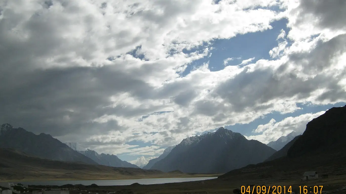
Broghil Valley is the far northern tip of Chitral: a national park of high pastures, peat bogs and some 30 lakes on the border with Afghanistan's Wakhan corridor. It lies about 250 km from Chitral town, two long days by jeep up the Yarkhun valley from Mastuj, and the road is open only from about June to early October. People go for the Wakhi villages, the yaks and the walk to Karambar Lake, at 4,272 metres.
This guide covers the route, what you find at the top, when to go, the paperwork, and the security picture, which in 2026 is part of the decision.
| At a glance | |
|---|---|
| Where | The far north of Upper Chitral, on the Wakhan border |
| National park | Established 2010, about 1,348 km² |
| Altitude | From about 3,200 m in the park to 4,272 m at Karambar Lake |
| From Chitral town | About 250 km; two long days by jeep |
| Route | Chitral, Booni and Mastuj, then up the Yarkhun valley |
| Season | Roughly June to early October; snowbound about five months a year |
| Vehicle | A local 4x4 jeep with driver beyond Mastuj |
| Time to allow | Four to five days from Chitral; a week or more with Karambar Lake |
| Documents | CNIC, registered at checkposts; foreign nationals need permission |
Where is Broghil Valley?
Broghil is where Chitral runs out. The Yarkhun valley climbs north from Mastuj, and at its head it opens into a wide, high basin of grass, streams and small lakes. To the north, over the Broghil Pass, is the Wakhan corridor, the thin strip of Afghanistan that separates Pakistan from Tajikistan. To the east, over the watershed, is the Ishkoman valley in Gilgit-Baltistan.
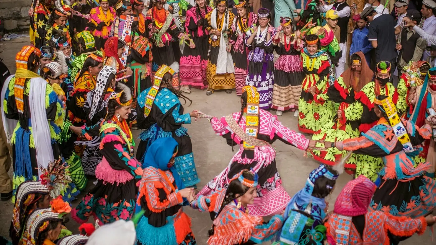
The people are Wakhi, the same community and language you meet in Gojal, upper Hunza, with smaller Kyrgyz and Sarikoli families who have largely merged with them. They live in low houses of stone and mud and keep yaks on the summer pastures. What Broghil lacks, compared with Gojal, is almost any tourist infrastructure.
The area became Broghil Valley National Park in 2010. It covers about 1,348 km² and ranges from about 3,200 metres to over 5,600. Snow leopard, Himalayan brown bear, golden eagle and bearded vulture live here, though you are far more likely to see marmots and yaks. People still live inside the park, and in March 2026 residents objected to a zoning plan that placed settlements in its core zone.
How do you get to Broghil?
There is only one practical road in, and it is slow.
- Chitral to Mastuj, about four hours. The road follows the river up through Booni and is exposed to floods: on 4 August 2026 flash floods cut it near Kuragh, and a landslide at Parwak held more than 150 vehicles for about 16 hours. Hindukush Express announced a daily coach between Chitral and Mastuj in June 2026.
- Mastuj up the Yarkhun valley. Beyond Mastuj the road becomes a rough jeep track through villages such as Yarkhun Lasht, Kishmanja and Garil. Rockfall, stream crossings and washed-out sections are normal. Near Kishmanja an alternative 32 km track with two suspension bridges, built by the Aga Khan Rural Support Programme, avoids a stretch where the old track kept being buried by debris.
- A night in the Yarkhun valley. Most people split the drive, sleeping in a village guesthouse partway up.
- On to Lashkargaz. The last stage reaches the Broghil villages, with Lashkargaz, the base for Karambar Lake, at the end of the road. Mastuj to Lashkargaz is 12 to 14 hours of driving in all.
Don't expect this to improve soon. In July 2026 residents marched to Booni demanding a proper Mastuj–Broghil road, and when work still had not started by late August, campaigners announced a sit-in near the border from 15 September.
Can you drive your own car?
Not beyond Mastuj. The Yarkhun track needs a local 4x4 and a driver who knows where the river has moved this year. Hire a jeep in Chitral or Mastuj, and agree the price for the whole trip before leaving, including waiting days and the driver's food and lodging.
What is there to see in Broghil?
Broghil is a place to stay a few days and walk, not a list of sights.
- The Wakhi villages. Visitors are usually offered salt tea and flatbread. Stay a night or two with a family in Lashkargaz rather than passing through.
- The lakes and wetlands. The park holds around 30 freshwater lakes and large areas of peatland, including a chain of small lakes just before Lashkargaz. In summer the basin turns green.
- Karambar Lake. At 4,272 metres on the watershed with Gilgit-Baltistan, and almost 4 km long, it is the big objective. It is about 24 km from Lashkargaz, 9 to 11 hours each way on foot or by pony, and there is nothing at the lake, so you camp or turn round. It can still be frozen in June.
- The Chiantar glacier, at the head of the valley, which feeds the Yarkhun river, the river that becomes the Chitral river downstream.
- The Broghil Festival, a few days of yak polo, horse races, buzkashi and Wakhi music. Its date moves between July and early September, so confirm it before planning around it.
The border itself is not a sight. Keep to the villages and valley paths, and don't head up towards the Broghil Pass.
When can you visit Broghil?
Broghil is cut off by snow for about five months a year. The practical season is June to September, with early October possible in a good year.
- June: the track is opening and meltwater streams run high. Karambar Lake may still be iced over.
- July and August: the most reliable months and the greenest pastures, with the best chance of the lake free of ice. They are also flood months in Upper Chitral, so keep two spare days.
- September: clearer and quieter, a good choice if the road is open, with cold nights.
- October: a gamble, as early snow can close the track.
Our guide to the best time to visit Chitral covers the rest of the district.
Do you need a permit for Broghil?
Pakistani visitors have generally needed only their CNIC, registering at checkposts on the way up the Yarkhun valley. Rules near the border can change without notice, so before leaving Chitral, ask the Deputy Commissioner's office for Upper Chitral in Booni, or your hotel in Mastuj, what is required that month.
Foreign nationals need permission from the district administration, and reports suggest some have been turned back in the Yarkhun valley even with papers. Confirm in writing before you commit.
Is Broghil safe?
Crime is not the issue. The risks are the border, the track and the altitude.
- The border. Broghil lies directly on the Afghan border. Fighting between Pakistan and Afghanistan in 2026 hit other parts of the frontier, including Arandu in Lower Chitral in March, and tension rose again in late September. Check the news before you set off.
- Foreign government advice. The UK's Pakistan travel advice advises against all travel within 10 miles of the Afghan border, which covers Broghil, and on the N-45 into Chitral. Overseas visitors should read their own government's advice, which can affect travel insurance.
- Remoteness. Help is a day or more away. Carry a first-aid kit and any medicines you need.
- Altitude. You sleep above 3,000 metres and may walk to over 4,200. Go up gradually, drink water, and descend if anyone develops a bad headache, vomiting or confusion.
Our guide to whether Chitral is safe covers the district as a whole and the road in.
What to take
- Warm layers, a down jacket, hat and gloves, even in July
- A good sleeping bag if you plan to camp
- All the cash you need, taken from Chitral
- Sun protection, water purification and snacks
- A power bank; assume little or no mobile signal for much of the trip
- Two or three spare days for floods, rockfall or a closed checkpost
Is Broghil worth it?
For the right traveller, yes. It is one of the least visited corners of Pakistan, with a living Wakhi culture and high, open country unlike the rest of Chitral. The price is four long jeep days, basic lodging and a border setting to keep an eye on.
It suits fit adults with a week or more and some experience of altitude. It does not suit young children, older parents, anyone with a heart or lung condition, or a short holiday. If Wakhi culture is the draw, the villages around Gulmit in upper Hunza offer it on a paved highway. For Upper Chitral with less commitment, Mastuj and Shandur are closer; our list of places to visit in Chitral compares them, and our trip planning page explains how we fit a remote valley into a longer trip.
Frequently asked questions
Where is Broghil Valley?
In the far north of Upper Chitral, at the head of the Yarkhun valley, on the border with Afghanistan's Wakhan corridor. It is about 250 km from Chitral town.
How do I get to Broghil from Chitral?
Drive to Mastuj in about four hours, then take a local jeep up the Yarkhun valley. Mastuj to Lashkargaz takes 12 to 14 hours of driving, usually split over two days.
Can a normal car go to Broghil?
No. A car can reach Mastuj, but beyond it the track is rough, washed out in places and crosses streams, so hire a local 4x4 jeep and driver.
What is the best time to visit Broghil Valley?
July and August are the most reliable months, with the track open and Karambar Lake usually free of ice. The wider season runs from June to about early October.
Do Pakistanis need a permit for Broghil?
Pakistani visitors have generally needed only a CNIC and registration at checkposts. Rules near the border change, so confirm with the Upper Chitral district administration in Booni before you go.
How far is Karambar Lake from Broghil?
About 24 km from Lashkargaz, the last village. It takes 9 to 11 hours each way on foot or by pony, and there are no facilities at the lake.