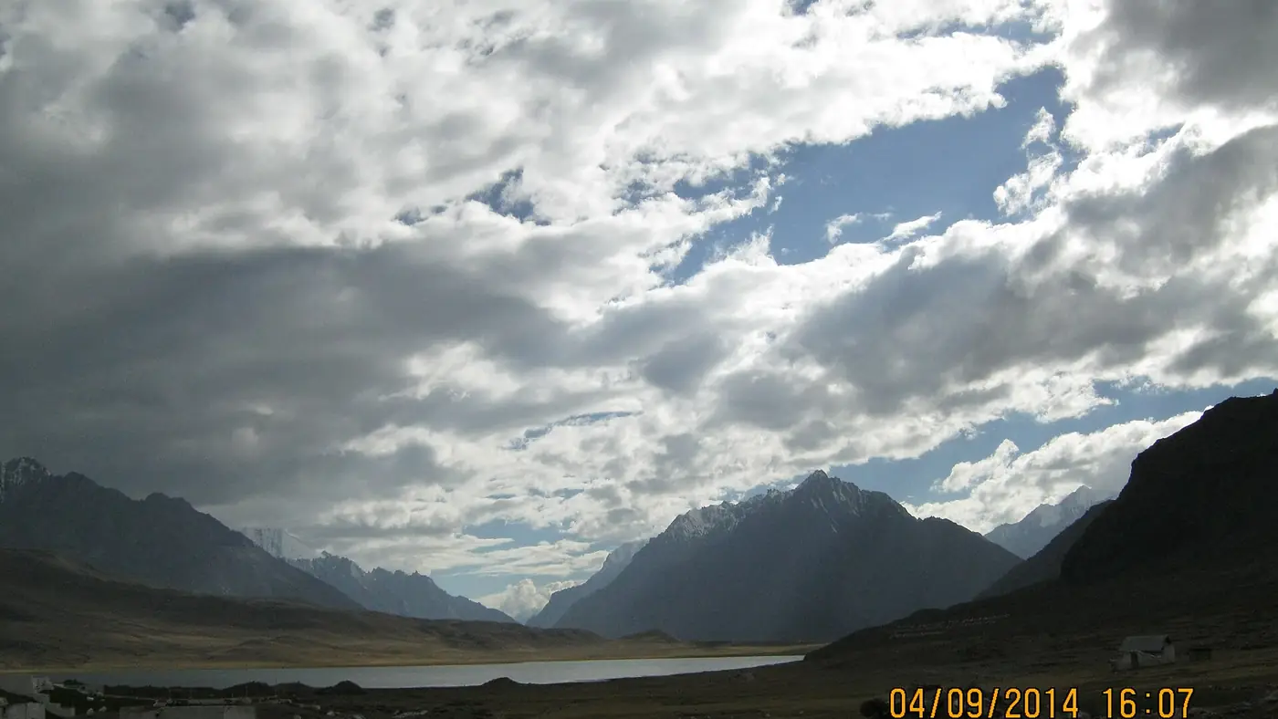
Shandur Pass is the high, open plateau at about 3,700 metres between Upper Chitral and the Ghizer valley of Gilgit-Baltistan, with Shandur Lake and the famous polo ground on its top. Outside the three days of the polo festival it is almost empty: grass, water, wind and snow peaks, and no hotels. The road is usually passable from late spring until the first heavy snow of autumn, but June to September is the dependable window. From Chitral town it is 153 km through Booni, Mastuj and the Laspur valley, a drive of six to eight hours.
This guide is about Shandur on an ordinary day: what is up there, when you can get there, the road from the Chitral side, camping, and how to cope with the height and the cold. For the festival itself, see our Shandur Polo Festival guide.
| At a glance | |
|---|---|
| Altitude | About 3,700 m on the plateau |
| Between | The Laspur valley in Upper Chitral and Ghizer in Gilgit-Baltistan |
| Dependable season | June to September; snowbound in winter |
| From Chitral town | 153 km via Booni, Mastuj and Laspur; 6 to 8 hours |
| From Mastuj | About 3 hours |
| From Gilgit | About 216 km via Gupis and Phander |
| On the top | Shandur Lake, the polo ground and summer grazing; no hotels |
| Nearest beds | Sor Laspur and Mastuj in Chitral; Phander on the Gilgit side |
| Vehicle | Jeep or 4x4 |
What is on the plateau?
The top of the pass is not a narrow col but a broad, rolling grassland several kilometres across, ringed by snow peaks. Shandur Lake, about 1.4 square kilometres, lies between the crest of the pass and the polo ground, and drains east into the Ghizer river, the upper Gilgit river.
The polo ground, described as the highest in the world, is a long, narrow field walled with low stone walls. Outside festival week it stands empty, and in summer livestock graze the grassland around it.
The lake lies within Shandur National Park, on the Gilgit-Baltistan side, set up in 1993. Snow leopards, brown bears and wolves are recorded in the park, but you will almost certainly not see them. What you will see is open country, clear water, and very few people.
When is Shandur open?
Snow covers the plateau from late autumn to late spring, and the road opens when the snow melts and the NHA clears the drifts and avalanche debris. That does not happen on both sides at once: in February 2025 the Gilgit-Baltistan side had been cleared up to the foot of the pass while the Chitral side was still blocked, and people in Laspur and Mastuj complained about the delay.
For planning:
- June is when the road becomes dependable, with snow still on the high ground. The polo festival has recently moved into June: 20 to 22 June in 2025 and 11 to 13 June in 2026.
- July and August are the warmest months at the top, and also the flood months on the roads below.
- September is the best month to see Shandur on an ordinary day: settled weather, clear air and quiet roads.
- May and October are possible in some years, but snow can close the road without warning, and the nights are bitterly cold.
The road from Chitral through Laspur
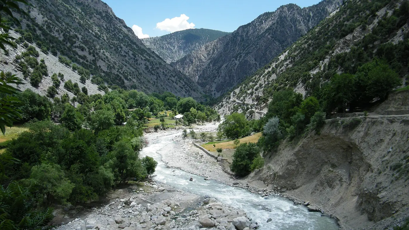
From Chitral town the road runs up the Chitral river through Booni to Mastuj, about four hours in normal conditions. At Mastuj it turns south into the Laspur valley, through Harchin and Sor Laspur, the last village on the Chitral side, and climbs onto the plateau. Allow about three hours from Mastuj to the top, more where the road is being worked on.
The whole 153 km is being rebuilt as national highway N-140. In July 2026 the last section, up to Shandur, was the least advanced of the four, at about 30 per cent, and in September 2026 Laspur residents were asking for compensation for fields, fruit trees and water channels damaged by the construction. Expect a rough, dusty, steep road with diversions, and use a jeep or 4x4 with a driver who knows it. Our guide to Chitral road conditions covers the flood damage at Kuragh and Parwak on the way to Mastuj.
From the Gilgit side, the road comes up the Ghizer valley through Gupis, Phander, Teru and Barsat; our guide to the drive from Gilgit to Shandur covers it.
Visiting outside the festival
On an ordinary summer day, Shandur is one of the emptiest places you can drive to in Pakistan. A typical visit from the Chitral side runs like this:
- Sleep in Mastuj or Sor Laspur the night before, which also helps with the altitude.
- Leave early, by 7 am, to reach the top in the clear morning light and leave time for the drive back.
- Spend two or three hours on the plateau, walking the lake shore and the edge of the polo ground.
- Drive back down to Mastuj for the night, or carry on over the pass to Phander if you are crossing to Gilgit.
There is nothing to buy on the top outside festival week, so carry food, water and fuel for the whole day, and don't count on mobile signal. Keep vehicles on the tracks rather than driving across the grass, give the herds a wide berth, and take all your rubbish back down.
Camping on the plateau
There are no hotels at Shandur, so you either camp or sleep lower down. People crossing between Chitral and Gilgit often camp on the plateau in summer.
- Bring a proper tent and a sleeping bag rated well below freezing. Nights at 3,700 metres are cold even in July, and the wind carries across the open ground.
- Pitch somewhere sheltered, and away from the lake shore, the polo ground and the herders' camps.
- Carry all your food, water treatment and a stove. There are no trees on the plateau and nothing to buy.
- Leave nothing behind, including food scraps.
If you would rather have a bed, the Khyber Pakhtunkhwa tourism authority's camping pods at Sor Laspur, reopened for the 2025 season, are the nearest on the Chitral side. Mastuj has glamping tents and chalets beside the old fort, and simpler hotels in the village. On the Gilgit side, Phander is the usual night stop.
Altitude and cold
Chitral town is at about 1,500 metres and Shandur at about 3,700, so driving up from Chitral in one day means climbing more than 2,000 metres. Most healthy adults will feel it as breathlessness or a headache. Sleeping lower, in Mastuj at about 2,360 metres, before and after your visit makes the day much easier.
At the top, move slowly, drink water, and if anyone develops a bad headache, nausea or confusion, go down. Be cautious with small children, older parents and anyone with a heart or lung condition. Even on a sunny day in July, bring a warm jacket, hat and gloves, sunglasses and sunscreen: the sun is strong and the wind is cold. Our travel guide has more on altitude in the north.
Is it safe to travel to Shandur?
Shandur, the Laspur valley and the Ghizer side are not on the UK government's list of places to avoid. The concern is how you get to Chitral. The UK advises against all travel on the N-45 through Dir to the edge of Chitral city, the usual road from Islamabad, and in August 2026 there was a deadly bombing at the Kabal police station in Swat and a two-day gun battle with militants in Upper Dir.
Pakistani visitors still use that road. If you do, check local news and police advice first and travel in daylight. Overseas visitors should know their government's advice may say not to go, which can affect insurance, and that foreign tourists need a Khyber Pakhtunkhwa no-objection certificate for Chitral. Coming from the Gilgit side avoids Dir. Carry your ID, because there are checkposts along the route.
Who should go?
Shandur on an ordinary day suits travellers with a jeep, a few spare days and a liking for wide, empty country, especially those crossing between Chitral and Gilgit. September, with a night in Mastuj either side, is the ideal way to see it.
It is a poor choice for young children, older parents or anyone who dislikes long days on rough roads, and a long way to go for a single afternoon from Chitral town. For them, Mastuj or the Kalash valleys make a better trip. Our trip planning page explains how we build spare days into routes like this.
Frequently asked questions
How high is Shandur Pass?
About 3,700 metres on the plateau, where the lake and the polo ground are. It lies between Upper Chitral and the Ghizer valley of Gilgit-Baltistan.
When is Shandur Pass open?
Usually from late spring until the first heavy snow in October or November, but June to September is the only dependable window. It is snowbound in winter.
How far is Shandur from Chitral?
About 153 km by road through Booni, Mastuj and the Laspur valley, which takes six to eight hours while the road is being rebuilt. From Mastuj, allow about three hours.
Are there hotels at Shandur?
No. You can camp on the plateau in summer, stay in the tourism department's pods at Sor Laspur, or sleep in Mastuj on the Chitral side or Phander on the Gilgit side.
Can a normal car go to Shandur?
Not sensibly. The road beyond Mastuj is rough, steep and under construction, so use a jeep or 4x4 with a local driver.
Is Shandur worth visiting outside the polo festival?
Yes, if you enjoy empty high country. In September you may have the lake and the polo ground almost to yourself, but there are no facilities, so go prepared.