The Makran Coastal Highway (N-10) runs for about 650 km along Balochistan's Arabian Sea coast between Karachi and Gwadar. It leaves the Karachi–Quetta road at Zero Point near Uthal, crosses Hingol National Park past Kund Malir, the Princess of Hope and Buzi Pass, then runs through Ormara and Pasni to Gwadar. The road is paved all the way; the driving alone takes nine to ten hours, and most people spread it over two days. Go between October and March, drive only in daylight, and check the security news before you set out, because Balochistan's roads have seen repeated attacks since 2025.
This guide goes stop by stop from Karachi to Gwadar: what is worth pulling over for, where to refuel and eat, what happens at the checkposts, and when to travel.
| At a glance | |
|---|---|
| Road | N-10, the Makran Coastal Highway, opened in December 2004 |
| Karachi to Gwadar | About 650 km |
| Driving time | 9 to 10 hours without long stops; better over two days |
| Halfway point | Ormara, about 360 km from Karachi |
| Reliable fuel | Hub, Zero Point, Ormara, Pasni, Gwadar |
| Best months | October to March |
| Night travel | Buses and coaches barred at night since March 2025; keep to daylight |
| Documents | Original CNIC for every adult; foreign nationals need separate permission |
| Foreign government advice | The UK advises against all travel to Balochistan |
The route in brief
From Karachi you leave by Hub on N-25, the old RCD Highway, and follow it north-west to Zero Point, where the coastal highway turns west. From there it is N-10 all the way, across open coastal plain, through the clay hills of Hingol, over Buzi Pass and along the shore to Gwadar.
Distances are approximate, measured from central Karachi.
| Place | Distance from Karachi | What it is |
|---|---|---|
| Hub | about 30 km | First town in Balochistan; fuel, shops |
| Zero Point | about 105–110 km | Start of N-10; fuel, food, toilets |
| Chandragup turn | about 200 km | Mud volcano off a dirt track |
| Aghor, Hingol bridge | about 225 km | River crossing; road to Hinglaj |
| Kund Malir | about 240 km | Beach, huts, simple restaurants |
| Sphinx and Princess of Hope | about 265 km | Roadside rock formations |
| Buzi Pass | a few km further | Viewpoint over the coast |
| Ormara | about 360 km | Halfway town; fuel, food, rooms |
| Pasni turn | about 525 km | Fishing town, a few km off the road |
| Gwadar | about 650 km | End of the road trip |
Stop by stop from Karachi
Hub, Winder and Zero Point
The first hour and a half, through Karachi's western traffic and onto a busy N-25, is the slowest part. Dhabas at Winder make a good breakfast stop.
Zero Point is the junction where N-10 begins. Whatever your fuel gauge says, fill up here, buy water, and use the toilets. The next stretch, about 250 km to Ormara, has no fuel you should plan around. Our guide to driving from Karachi to Kund Malir covers this first leg in detail.
Hingol National Park: Chandragup, Aghor and Hinglaj
West of Zero Point the road crosses a long, empty plain and then enters Hingol National Park, some 6,100 km² of desert, river and coast. Three stops sit close together:
- Chandragup mud volcano. A grey cone of bubbling mud about a kilometre off the highway on a dirt track, sacred to Hindu pilgrims as Baba Chandrakup. Check the track before taking a low car down it.
- The Hingol River at Aghor. The highway crosses the river on a long bridge. Pull over only where it is safe; the view up the valley is one of the best on the road.
- Hinglaj Mata temple. A cave shrine about 15 km up the valley from Aghor, and the scene of the largest Hindu pilgrimage in Pakistan. It adds an hour or more, so it fits an overnight trip better than a through drive.
Kund Malir
Soon after Aghor the road drops to the sea at Kund Malir, a long sandy beach with a few huts and simple restaurants. It is the natural lunch or overnight stop on the first day. Our Kund Malir beach guide covers the beach, the huts and the sea.
The Sphinx, the Princess of Hope and Buzi Pass
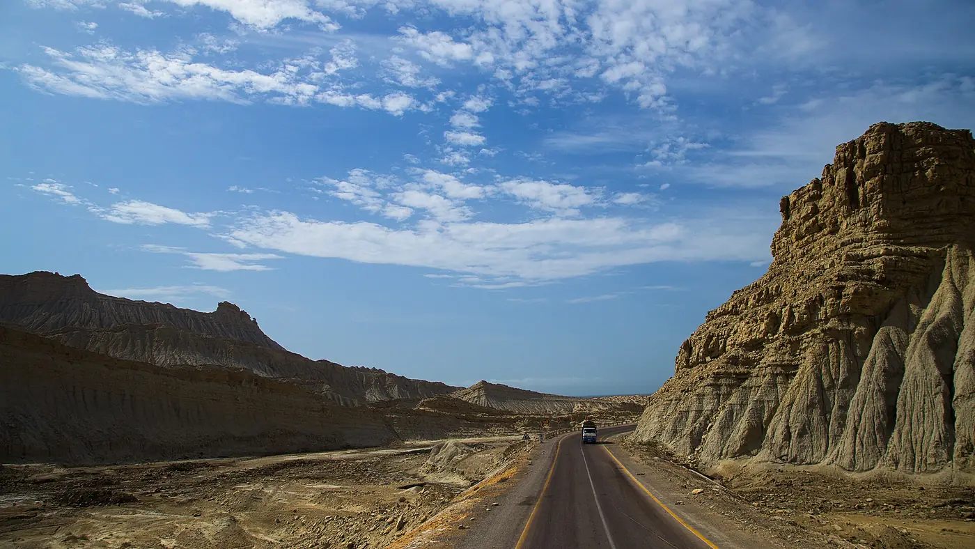
About 25 km past Kund Malir the road climbs into the hills and the eroded clay formations begin. The Sphinx, a crouching figure that looks like a lion with a human head, and the Princess of Hope, a tall pinnacle shaped like a standing woman, are both visible from the road. The Princess is said to have got her name from Angelina Jolie's visit in 2004 as a UN envoy.
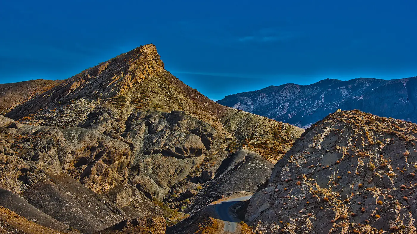
Then comes Buzi Pass, where the highway tops out at about 320 metres and looks down on the coast, the plain and the pale, fluted hills. Early morning and late afternoon light are far better than midday here. Don't climb on the formations; they are compacted clay and break easily.
Ormara
Ormara is a fishing town on a sandy neck of land with a rocky headland behind it, roughly halfway to Gwadar. It is also home to the Jinnah Naval Base, so expect a visible naval presence and don't photograph military installations. You can refuel, eat and, if you are splitting the trip, spend the night in one of a handful of simple hotels.
Kalmat, Pasni and on to Gwadar
Beyond Ormara the road runs inland of the coast for long stretches, past the Kalmat area and its lagoon, through scrub and low hills. Pasni sits a few kilometres south of the highway: a working fishing town with a large fish harbour, and the base for boat trips to Astola Island, Pakistan's largest offshore island.
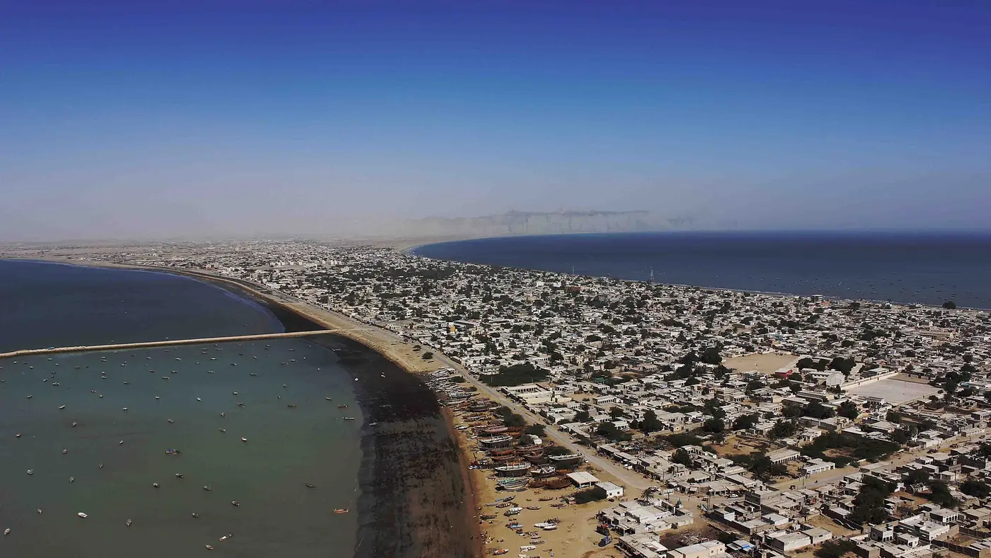
The last leg brings you to Gwadar, where the town sits on a narrow isthmus below the hammer-shaped headland of Koh-e-Batil. The road continues west towards Jiwani and the Iranian border, but for most travellers Gwadar is the end of the trip.
Fuel, food and cash
The road has long gaps between towns, so plan stops rather than hoping for them.
| Stop | Fuel | Food | Notes |
|---|---|---|---|
| Hub | Yes | Yes | Top up if you left Karachi low |
| Winder | Yes | Dhabas | Breakfast |
| Zero Point | Yes, last reliable for about 250 km | Yes | Buy water here |
| Kund Malir | No | Simple restaurants | Huts for the night |
| Ormara | Yes | Yes | Halfway town |
| Pasni | Yes | Yes | A short detour off the highway |
| Gwadar | Yes | Yes | Hotels and restaurants |
Iranian petrol sold in cans by the roadside is not something to plan around. Carry cash, because card machines and ATMs are rare once you leave Hub, and more drinking water than you think you need.
Checkposts and documents
There are security checkposts along N-25 and all the way along the coastal highway, run by several different security forces. You will be stopped at some of them and asked where you are going and where you are coming from.
- Carry every adult's original CNIC and keep them where you can reach them.
- Keep the car's registration papers with you, and a letter from the owner if the car isn't yours.
- Answer plainly and follow instructions. Don't photograph checkposts or the people staffing them.
- Foreign nationals need a No Objection Certificate from the Balochistan government and are normally escorted. The rules change; confirm them well before travelling, not at the barrier.
When to drive the coastal highway
The season
October to March is the time to go. Days are warm, nights are cool, and the sea is calm enough to enjoy at Kund Malir, Ormara and Gwadar. From about May to September the heat is severe, there is almost no shade on the road, and the monsoon swell makes the sea dangerous. Whatever the month, check the Pakistan Meteorological Department for cyclone or rough-sea warnings before you go.
Two dates are worth knowing. The Hinglaj yatra each April brings hundreds of thousands of pilgrims and their buses to the road around Aghor. And Eid and long weekends fill the stretch from Karachi to Kund Malir with day-trippers, while the road beyond is much quieter.
The time of day
The one rule we would never bend: be off the highway before dark. In March 2025, after gunmen stopped a Karachi-bound bus near Kalmat and killed passengers, the Gwadar administration barred public transport from the coastal highway at night, and coaches were given morning departure windows so they arrive in daylight. The ban is aimed at buses, but the reasoning applies to everyone. Help is far away, signal is poor, and the worst attacks on travellers on this road have happened after dark.
In practice that means leaving Karachi around 6 am. In December the sun sets around 6 pm on this coast, so a single-day drive to Gwadar leaves almost no margin for a puncture, a closure or a long lunch. Our guide to Karachi to Gwadar by road sets out how to split the drive at Ormara.
Is the Makran Coastal Highway safe?
Pakistani families and groups do still drive this road, especially the eastern section to Kund Malir, and coaches run daily to Gwadar. But the security situation in Balochistan has worsened since 2025, and it would be wrong to play that down.
These are the incidents most relevant to the route:
- April 2019, Buzi Top near Ormara. Gunmen stopped buses at night, checked passengers' identity cards and killed 14 people.
- March 2025, Kalmat. Passengers were taken off a Karachi-bound bus at night and killed after their identity cards were checked. The night-time ban on public transport followed.
- January and February 2026. A wave of coordinated attacks across Balochistan included Gwadar and Pasni; in Gwadar, militants tried to abduct passengers from buses on the highways.
- July 2026, Bela–Winder, Lasbela. Militants blocked a highway route and ambushed a military convoy, killing 11 soldiers. N-25 through Winder is the road you take from Karachi to Zero Point.
The pattern is attacks at night, buses stopped at makeshift roadblocks, and passengers from outside Balochistan singled out by their identity cards. Travel in daylight, in your own vehicle or a proper coach, and read the news the evening before and the morning you leave. Mobile internet has been suspended across the province for days at a time after attacks, so download offline maps and tell someone your plan.
For overseas visitors, the UK's Foreign Office travel advice for Pakistan advises against all travel to Balochistan, and many other governments say much the same. Travelling against that advice can void your travel insurance. Our guide to whether Kund Malir is safe explains when we would postpone a trip on this coast.
Driving it well
The road is good tarmac, but it is not a motorway. The long straights tempt you to speed, and camels, goats and broken-down trucks appear with little warning. The hills around Aghor, Kund Malir and Buzi have blind bends where nobody should overtake, and coaches and fuel pickups travel fast, so give them room. A sedan in good order is fine; check the tyres, spare, coolant and brakes before you leave.
Who the road trip suits
The Makran Coastal Highway is one of the great drives in Pakistan: desert, clay mountains and empty beaches for hundreds of kilometres, with very little traffic once you pass Kund Malir. It suits confident drivers, groups of friends and families with older children who are comfortable with basic food and rooms and willing to change plans at short notice.
It suits people less well if they would spend the drive anxious about security, if anyone in the group needs to be near a hospital, or if the only days they can travel fall in the summer heat. If that is you, a winter day trip to Kund Malir and the Princess of Hope, covered in our Hingol National Park guide, gives you the best of the scenery without the long run west. For help thinking through a trip in Pakistan around timing and safety, start with our trip planning page.
Frequently asked questions
How long is the Makran Coastal Highway?
About 650 km from Karachi to Gwadar, including the stretch of N-25 from Karachi to Zero Point where N-10 begins.
How long does it take to drive from Karachi to Gwadar?
Nine to ten hours of driving with short stops. Most people split it over two days with a night at Ormara or Kund Malir, so that all the driving happens in daylight.
Where can I get fuel on the coastal highway?
Fill up at Zero Point, the last reliable fuel for about 250 km, then at Ormara, Pasni and Gwadar. Roadside sellers of Iranian petrol are not something to rely on.
Can you drive the Makran Coastal Highway at night?
You shouldn't. Buses and coaches have been barred from the highway at night since March 2025 after attacks on passengers, and private cars should keep to daylight too.
What is the best time to drive the coastal highway?
October to March, when the days are warm and the sea is calm. Avoid the summer months, when the heat is severe and the monsoon swell makes the beaches dangerous.