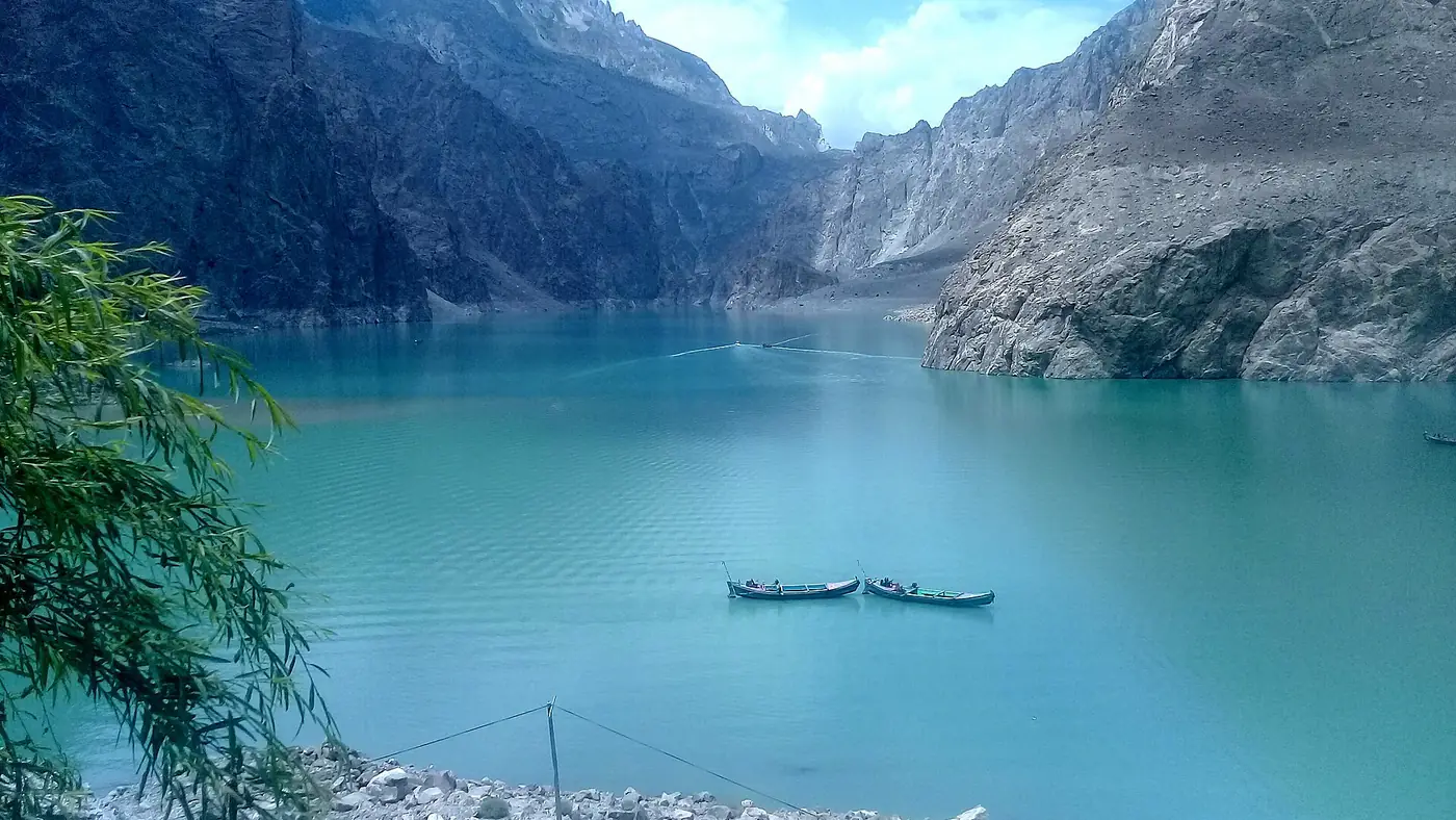
Attabad Lake formed on 4 January 2010, when a huge landslide above Attabad village fell into the Hunza river and blocked it completely. The blockage killed about 20 people in the slide itself, then backed the river up into a lake that eventually stretched roughly 21 km and reached over 100 metres deep, flooding villages and burying a long stretch of the Karakoram Highway for years.
This is the story behind the blue lake that visitors now stop to photograph on the drive north from Karimabad: what happened on the day, what it did to the valley, and how the highway finally got through again.
| At a glance | |
|---|---|
| Date of the landslide | 4 January 2010 |
| Cause | Mountainside collapse above Attabad village |
| Deaths in the slide | About 20 |
| Lake length at its peak | About 21 km |
| Lake depth at its peak | Over 100 m |
| Highway blocked | About five and a half years |
| Tunnels opened | September 2015 |
| Villages affected | Attabad, Shishkat, Gulmit and others upstream |
What happened on 4 January 2010
On the evening of 4 January 2010, a huge section of the mountainside above Attabad village, in upper Hunza, gave way and slid into the Hunza river valley below. The slide buried part of Attabad village itself, killing about 20 people, and dumped enough rock and earth into the river gorge to block it completely.
With nowhere to go, the river began backing up behind the new natural dam. Within days, water was rising over land that had been fields, orchards and houses only weeks before.
How the lake grew
Because the river had nowhere else to flow, the water level behind the landslide dam kept climbing through the following months. By the time the lake reached its full extent in June 2010, it stretched roughly 21 km up the valley and was more than 100 metres deep at its deepest point, submerging land as far as Gulmit and Shishkat.
The rising water swallowed the lower part of Shishkat and cut into Gulmit, and it drowned around 19 km of the Karakoram Highway, the single road link between Hunza and the Chinese border. Around 6,000 people upstream of the new lake were displaced from their homes, and a further estimated 25,000 people found themselves cut off on the far side, unable to drive south towards Gilgit and beyond.
Life on a cut highway
For years afterwards, there was no road around the lake. People and goods crossed by boat, a slow and often dangerous way to move a highway's worth of traffic, especially in winter and whenever the water was rough. Villages that had depended on trade along the Karakoram Highway to China, and on the tourist traffic heading to Hunza and beyond, lost that connection overnight.
The Pakistani and Chinese governments eventually agreed to build a new stretch of road around the lake rather than wait for the water to recede, cutting a series of tunnels through the mountainside above the shoreline. Construction took years, through difficult rock and a harsh climate.
The tunnels and the highway's return
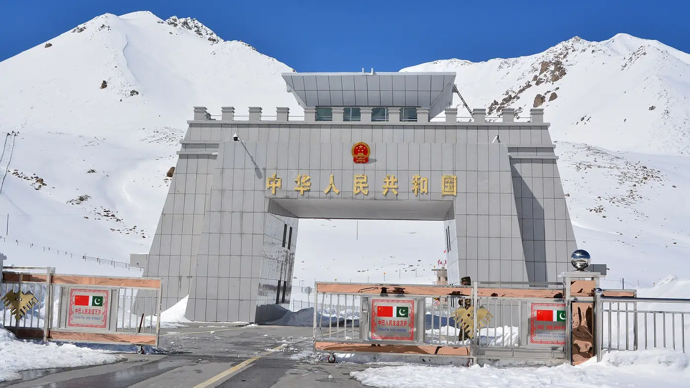
The new bypass opened in September 2015, made up of five tunnels totalling around 7 km, cut into the hillside above the water so that the road no longer depends on the lake staying at any particular level. It restored the direct road link between Hunza, Sost and the Khunjerab border with China, and it is the road every visitor now drives along the lake's edge.
Roughly five and a half years passed between the landslide and the tunnels opening, years in which an entire section of the Karakoram Highway simply did not exist in a form that ordinary vehicles could use.
What the lake looks like today
What was once a disaster site is now one of the most photographed stretches of road in Gilgit-Baltistan: a long turquoise lake with the highway running along and above it through the tunnels, backed by bare brown mountains. Boats now carry sightseers rather than displaced commuters, and hotels and cafés line the southern landing.
Our Attabad Lake guide covers how to get there today, the best viewpoints and how the water's colour changes through the year, and our Attabad Lake boating guide covers the boat trips themselves.
Why this history matters for visitors
Knowing the story changes how the lake reads. The straight-edged shoreline and the drowned tops of trees still visible in places are the remains of fields and orchards, not natural lake features. The tunnels you drive through were built because there was no other way to reopen the highway once the water rose. And the villages named on road signs along this stretch, Shishkat and Gulmit among them, are communities that were partly rebuilt on higher ground after 2010.
It is also a reminder of the terrain the whole northern road network sits in. Landslides remain a real hazard on mountain roads throughout Gilgit-Baltistan, which is why road updates matter more here than on a motorway; our travel guide has more on driving conditions across the region.
Frequently asked questions
When did Attabad Lake form?
On 4 January 2010, when a landslide above Attabad village blocked the Hunza river. The lake reached its full size of roughly 21 km long and over 100 metres deep by June 2010.
How many people died in the Attabad landslide?
About 20 people were killed in the landslide itself. Thousands more were displaced from flooded villages, and tens of thousands were cut off by the loss of the highway.
How long was the Karakoram Highway blocked by Attabad Lake?
About five and a half years. A bypass of five tunnels around the lake opened in September 2015, restoring the direct road link to Sost and the Chinese border.
Which villages were affected by Attabad Lake?
Attabad village itself took the direct impact of the slide. The rising lake went on to submerge the lower part of Shishkat and cut into Gulmit further up the valley.
Can you still see signs of the flooded villages at Attabad Lake?
In places, yes: parts of the old road and building remains are visible near the shoreline depending on the water level. Most visitors now see the lake as a scenic stop rather than a disaster site, which is covered in our main Attabad Lake guide.