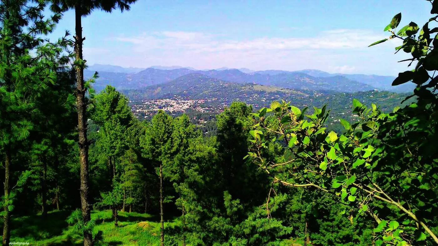
Toli Pir is a broad hilltop of meadows and pine forest above Rawalakot, at around 2,743 metres, the highest ground in this part of Poonch district. It is about 30 km from Rawalakot by road, and depending on how the last stretch is driving that day, the trip up takes an hour to two hours each way. Most visitors come for a single morning or afternoon: the drive, an hour or two on the meadows, and back down before the cloud builds.
This guide covers the road, what is actually up there, the protected area around it, and when to go.
| At a glance | |
|---|---|
| Altitude | About 2,743 m (close to 9,000 ft) |
| From Rawalakot | About 30 km, 1 to 2 hours each way |
| Best months | May to October |
| Winter | Snow usually from late autumn into spring; the road can close |
| Facilities | A tourist rest house on the way; little at the top itself |
| Protected as | Tolipir National Park |
Where is Toli Pir, and what is it?
Toli Pir sits north-east of Rawalakot, the district headquarters of Poonch, in Azad Kashmir. It is described locally as the point where three separate mountain ridges meet, which is what makes it the highest and most open viewpoint for a long way around. On a clear day the ground drops away on several sides at once, with the hills of Poonch running out towards Abbaspur, Bagh and the Poonch River valley.
On the highest point are the remains of an old Sufi shrine, with little documented history beyond that it has stood there a long time and is still known locally as a place of pilgrimage as well as a viewpoint. There is no visitor centre or interpretation here: it is open meadow, forest edge and a wide sky.
The hill and the forest around it are protected as Tolipir National Park. Officially the park's boundary reaches down through pine and mixed forest on the slopes, home to birdlife and smaller mammals typical of these Himalayan foothills. Don't expect to see the park's wildlife from the road; the value of the drive is the forest itself and the open ground at the top, not close wildlife encounters.
Getting there
The road climbs out of Rawalakot and gains height steadily over about 30 km. In good summer conditions a normal car manages it, but the last stretch is steep, and travel writers and recent visitors describe drive times anywhere from about an hour to two hours depending on the state of the road and how cautiously you take the climb. Treat two hours each way as the safer planning figure and be pleasantly surprised if it is quicker.
A few things to plan around:
- Ask in Rawalakot before you set off, especially outside the height of summer. Local advice on the day is more reliable than anything written down, because the surface and any recent rain or snow change how manageable the climb is.
- There is a tourist rest house along the way, in a scenic spot short of the top, but don't count on food being available at the summit itself. Carry water and snacks.
- A 4x4 is the safer choice if you are going outside the peak summer weeks, or if there has been recent rain. In dry midsummer conditions, a well-maintained normal car usually gets up without trouble.
- Go in the morning. In the monsoon months especially, cloud tends to build over the hills through the afternoon, closing down the views you came up for.
What there is to do at the top
There is not much infrastructure at Toli Pir, and that is largely the point. What draws people:
- The views. On a clear day you can see a long way across the ridges of Poonch, in a way that is not possible from anywhere lower down near Rawalakot.
- The meadows. Open grass and pine forest edge, good for a walk and a picnic, cooler and greener than the town below.
- The shrine remains. A quiet stop at the top of the hill, treated by some visitors as a place of pilgrimage as well as a viewpoint.
- The cool air. Because it sits about 1,000 metres higher than Rawalakot, expect it to be noticeably colder here even in June, and windier still on the open top.
Allow half a day for the round trip from Rawalakot: an hour or two up, an hour or two at the top, and the same back down. Our guide to the places to visit in Rawalakot sets Toli Pir alongside Banjosa Lake and Devi Gali, with the distance and time each one needs.
When is Toli Pir open?
May to October is the dependable season. The road is at its most reliable, the meadows are green, and the views are at their clearest away from the monsoon cloud.
July and August bring the monsoon: the hills are at their greenest, but afternoon cloud and rain are common, and the same rain that makes the roads to Rawalakot risky in these months can affect the Toli Pir road too.
From late autumn into spring, snow usually settles on the top and can close the upper road entirely. There is no fixed date for this; it depends on the winter. If you are travelling between November and April, ask locally before assuming the road is open, and don't plan a trip around reaching the top in this window.
What to carry
- A warm layer regardless of the month; the wind on the open top adds to the cold.
- Water and snacks, since food at the summit cannot be relied on.
- Sunscreen and sunglasses for the exposed meadows.
- Cash, in case of any charge at the rest house or on the road.
- A full tank from Rawalakot; there is no fuel on the way up.
Is Toli Pir worth the trip?
For a clear day with a few hours to spare, yes. It is the best viewpoint near Rawalakot, and the meadows and shrine give the drive a destination rather than just a view from a car window. It suits travellers who are comfortable with a slow, winding climb and don't mind basic facilities at the top.
It is not worth pushing for in poor weather or outside the May to October window: cloud erases the views that are the whole reason to go, and outside the summer months the road itself is often the obstacle. If your time in Rawalakot is short, Banjosa Lake is the easier, lower-effort outing; add Toli Pir only if you have a second day and the sky is clear.
Frequently asked questions
How high is Toli Pir?
About 2,743 metres, close to 9,000 feet, making it the highest point near Rawalakot.
How far is Toli Pir from Rawalakot?
About 30 km by road. Depending on conditions, allow one to two hours each way for the drive.
Can a normal car reach Toli Pir?
In good summer conditions, usually yes, though the last stretch is steep. Outside midsummer, or after rain, a 4x4 is the safer choice, and it is worth checking locally before you set off.
Is Toli Pir open in winter?
Not reliably. Snow usually settles on the top from late autumn into spring and can close the upper road. May to October is the season to plan around.
Are there facilities at Toli Pir?
There is a tourist rest house on the way up, in a scenic spot short of the summit, but little at the top itself. Carry your own water, snacks and warm clothing.
What is at the top of Toli Pir?
Open meadows, pine forest edge, wide views across the ridges of Poonch, and the remains of an old Sufi shrine on the highest point.