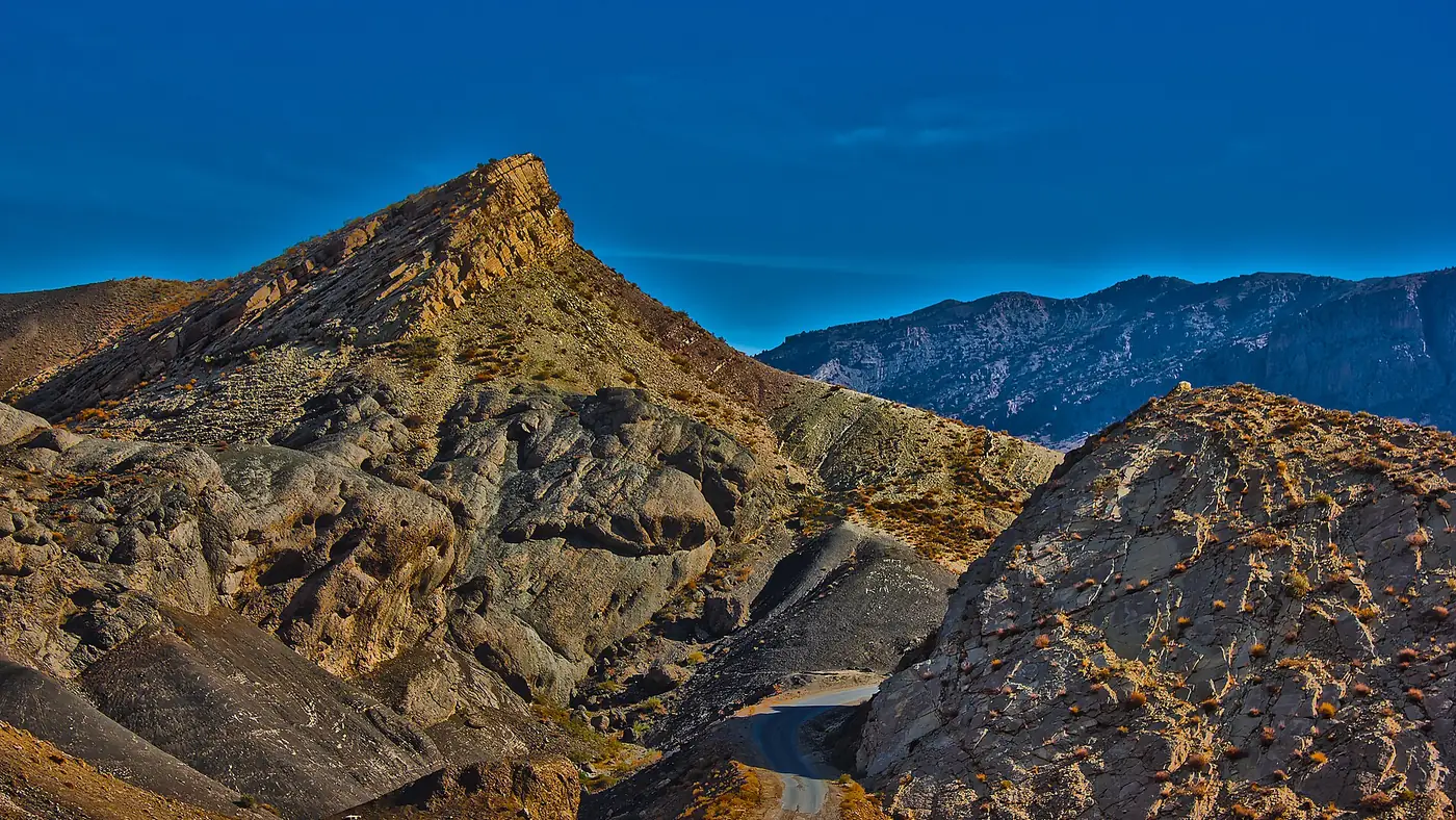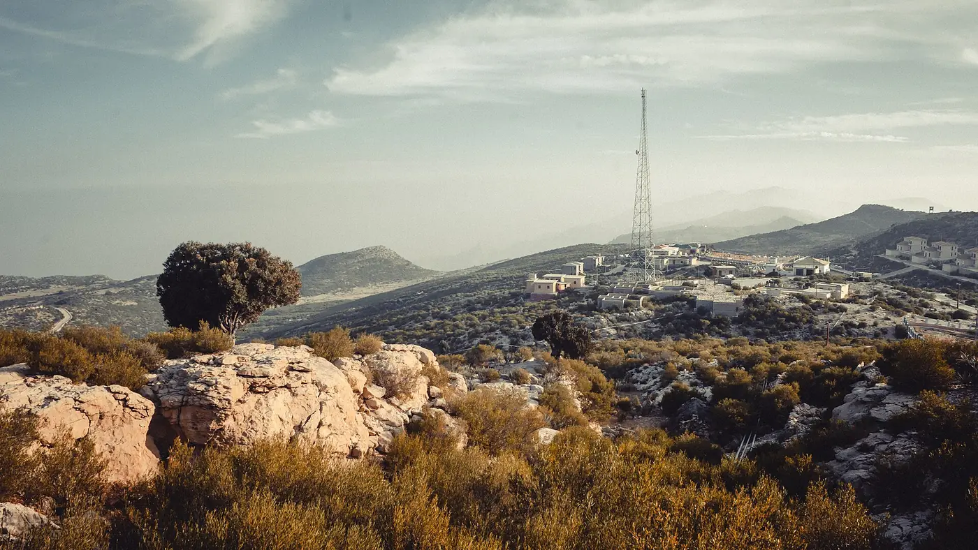
Gorakh Hill Station is Sindh's only hill station: a high plateau at about 1,734 metres (5,688 ft) in the Kirthar mountains of Dadu district, on the border with Balochistan. It is far cooler than the plains below, with frosty winter nights and occasional snow, and people go for the air, the views over two provinces and a night under the stars. Getting there is the hard part: about 350 km by road from Karachi to Wahi Pandhi, then a 50 km jeep track that takes three hours or so. Facilities at the top are basic.
This is the planning overview: where Gorakh is, what you will find at the top, the viewpoints, the seasons, and the honest safety picture. Separate guides cover the route from Karachi and the weather month by month.
| At a glance | |
|---|---|
| Altitude | About 1,734 m (5,688 ft) |
| Location | Kirthar range, Dadu district, about 94 km northwest of Dadu city |
| From Karachi | About 400 km in all; a full day's travel |
| Last stage | About 50 km of steep track from Wahi Pandhi; 4x4 only, 2.5 to 3.5 hours |
| Best months | October to November and February to March |
| Summer | Low 30s °C by day on top, while the plains are well over 40 °C |
| Winter | Nights around or below freezing; snow in some years |
| Facilities | Rest houses, huts, tents, basic food; unreliable power, water and signal |
Where is Gorakh Hill, and how high is it?
Gorakh sits on the crest of the Kirthar range, the long wall of mountains that divides Sindh from Balochistan. The hill station is a plateau of about 2,500 acres, around 94 km northwest of Dadu city, and it is named after the saint Gorakhnath.
You will see two heights quoted. Some official pages repeat a figure of 7,684 ft (2,342 m), but most sources, including recent reports in Dawn and The Nation, give the plateau as about 1,734 metres, or 5,688 ft, and that is the figure to plan around. Either way, it is high enough to be 10 °C or more cooler than Dadu and the Indus plains on the same day.
The altitude itself causes no problems for healthy visitors. At 1,700 metres you may notice the thinner air on a steep walk, but it is nowhere near the heights where altitude sickness is a real concern.
How you get there, in brief
Every trip has two parts. First the drive: from Karachi up the M-9 and the Indus Highway (N-55) to Sehwan, then on to Johi and Wahi Pandhi, the town at the foot of the mountains. It is roughly 350 km and takes six to seven hours with stops.
Then the climb. From Wahi Pandhi a narrow, steep and partly unmade road climbs about 50 km to the plateau. Only 4x4 vehicles can manage it, and most visitors leave their cars in Wahi Pandhi and hire a local jeep with a driver who knows the road. The climb takes around two and a half to three and a half hours.
That makes Gorakh a two-day trip at the very least, and far better as three days. Our Karachi to Gorakh Hill guide covers the route, road conditions, fuel and timings in detail.
What is at the top?
Less than the name "hill station" suggests. Gorakh has been a government development project for decades. The Gorakh Hills Development Authority looks after the site, and it has rest houses and huts, but the plans for a proper resort town have never been completed. In mid-2025 politicians in Karachi were still urging the Sindh government to fix the single-lane road and provide reliable electricity, water and mobile coverage.
What you can expect:
- Rest houses and huts. A limited number of government rest houses and huts. They fill up at weekends and holidays, so arrange a room before you make the climb.
- Private rooms and tents. Some basic rooms and tents are offered around Zero Point, at prices well above what similar rooms cost in the plains.
- Food. A small restaurant, and food sellers on busy days, again expensive. Many groups bring their own food and cook.
- Water. Scarce. Bring drinking water for your whole stay, and don't count on running water for washing.
- Electricity. Unreliable. Bring power banks and torches.
- Mobile signal. Weak or absent in most places. Tell someone at home when you expect to be back in coverage.
Camping is common, particularly in the cooler months, and many organised group trips from Karachi and Hyderabad sleep in tents. If you camp, bring proper warm bedding: winter nights go below freezing, and even in spring and autumn they are cold.
The viewpoints
The plateau sits right on the edge of the range, with steep drops on both sides, which is what gives Gorakh its views.
- Benazir Point. The best-known viewpoint, reached by a walk of about 2 km from the main area. From here you look out over the ridges of the Kirthar.
- Zero Point. A path runs along the cliff edge near the border between Sindh and Balochistan. It is spectacular, and it is where people get too close to unguarded drops for photographs.
- Sunrise and sunset. Gorakh's signature experience is watching the sun rise over the mountains of Sindh and set behind the hills of Balochistan. Be at a viewpoint before first light and again in the hour before sunset.
- The night sky. Far from any city, on a clear night the stars are extraordinary, one of the best reasons to stay overnight rather than make a day trip.
When to go
Gorakh has a season for almost every kind of visitor, but not every month suits every trip.
- May to August is when most people from Sindh go, to escape the heat. It is hot on top by day, in the low 30s °C, but a relief from Dadu and Sehwan, where the heat regularly passes 40 °C, and the nights are comfortable. July and August bring most of the year's rain, which makes the jeep track slippery.
- October to November and February to March are the best months for camping and walking: warm days, cool nights and clear air.
- December and January are cold, with frosty nights and, in some years, snow. Gorakh had snowfall in January 2023, when the temperature fell to -8 °C, and again in January 2026. Snow cannot be predicted, so don't plan a trip around it.
Our Gorakh Hill weather guide gives temperatures for every month and the best window for camping.
Is Gorakh Hill safe?
The main dangers are the road and the cliffs. The jeep track has broken parapets and tight hairpin bends, and there have been fatal accidents on it: in September 2021 four tourists died when their vehicle's brakes failed and it overturned into a deep ditch. There is no ambulance or fire service anywhere close, so the nearest proper medical care is in Wahi Pandhi or Dadu, hours away.
Go with an experienced local driver in a well-maintained jeep, don't drive the track in the dark, and don't overload the vehicle.
On security, Pakistani families and groups visit Gorakh regularly, particularly in summer and on long weekends. The Kirthar belt had a serious kidnapping problem in the 1980s and 1990s, and although that is long past, it is sensible to check current conditions with local police or your hotel in Dadu or Sehwan before setting off. Overseas visitors should know that the UK government advises against all but essential travel to all areas of Sindh north of and including Nawabshah; Sehwan, Dadu district and Gorakh all lie north of Nawabshah. Check your own government's travel advice, since travelling against it can void insurance.
What to bring
- Warm layers for the night in every month, and a proper jacket, hat and gloves from November to February
- All your drinking water, and more than you expect to need
- Food for the stay, or at least for the drive and the first evening
- Power banks, torches and spare batteries
- Cash, since there are no ATMs on the mountain and card payments are unlikely
- Any regular medicines and a basic first-aid kit
- Sunscreen and sunglasses; the sun is strong even when the air is cool
Who Gorakh suits, and who it doesn't
Gorakh suits groups of friends, students and families with older children who are happy with basic rooms or a tent, want a real change of air from Karachi or Hyderabad, and can give it at least two nights. The sunrise over Sindh and the stars at night are worth the effort.
It doesn't suit anyone expecting a Murree-style hill town with shops and hotels, families with very young children, or people who get travel sick on steep mountain roads. The drive is long, the climb is rough, and the comforts are few. If you want a cool break with more facilities, the hill stations of the north are a flight or a long drive away, and our trip planning page can help you weigh up the options.
Frequently asked questions
How high is Gorakh Hill Station?
About 1,734 metres, or 5,688 ft, above sea level. Some official pages print a higher figure of 7,684 ft, but most sources use 5,688 ft.
How far is Gorakh Hill from Karachi?
About 400 km in all: roughly 350 km by road to Wahi Pandhi, then about 50 km up the jeep track. Allow a full day each way.
Can a car reach Gorakh Hill?
Not a normal car. The last 50 km from Wahi Pandhi is steep, narrow and rough, and needs a 4x4. Most visitors park in Wahi Pandhi and hire a local jeep.
Does it snow at Gorakh Hill?
Occasionally, in winter, most often in January. Snow fell in January 2023 and January 2026, but many winters pass without any.
Are there hotels at Gorakh Hill?
There are government rest houses and huts, some basic private rooms and tents, but no proper hotels. Book a room before you set off, especially for weekends and holidays.
Is there mobile signal at Gorakh Hill?
Coverage is weak or absent in most places on the plateau. Plan to be out of contact for much of your stay.