The main things to do in Fort Munro are the drive itself, up the winding N-70 from Dera Ghazi Khan through the Sulaiman range; the viewpoints at Fort Munro Top and Anari Top; an afternoon at Dama Dam, the small lake beside the TDCP resort; tea and a meal in the bazaar; and simply sitting out in air that is far cooler than the plains below. Fort Munro stands at about 1,970 metres (6,470 feet), 85 km west of Dera Ghazi Khan, and most visitors come for a day or a night.
It is South Punjab's only real hill station, and it is modest: no mall road, no cable car you can count on, and a small bazaar. What it has is the mountain road, wide views and relief from the heat. This guide covers each of those, with the practical and cultural points a first-time visitor should know.
| At a glance | |
|---|---|
| Altitude | About 1,970 m (6,470 ft) |
| From Dera Ghazi Khan | About 85 km on the N-70, allow around 2 hours |
| From Multan | About 185 km, around 3.5 to 4 hours |
| Best months | May to September for cool weather; winter for a chance of snow |
| Area | Tribal hills of Dera Ghazi Khan district, on the Punjab–Balochistan border |
| Stay | TDCP resort by the lake, plus private hotels and guesthouses |
| Carry | CNIC, warm layer, cash, water, a full fuel tank from DG Khan |
Drive the road up from Dera Ghazi Khan
For many visitors the drive is the best part of Fort Munro. From Dera Ghazi Khan the N-70, the national highway between Multan and Balochistan, crosses the flat plain west of the Indus and heads for the wall of the Sulaiman range. The road passes close to the town of Sakhi Sarwar, whose shrine many travellers stop at, and then enters the hills at Rakhi Gaj.
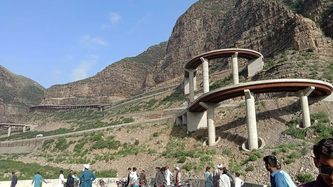
From here it climbs hard. For generations this stretch was known for its tight hairpin bends, where loaded trucks crept round corners with little room to spare. Between 2016 and 2019 the hardest section, from Rakhi Gaj over the Girdu pass towards Khar and Bewata, was rebuilt with Japanese funding. Curves were widened, and eight linked steel bridges, together about 1.5 km long, were built to carry the road across the steepest ground. They are a sight in themselves, strung high along the mountainside.
The road is now wide and well surfaced, but it is still a mountain road:
- It carries heavy traffic. Trailers and trucks bound for Balochistan and beyond use it, crawling uphill and descending slowly.
- Take the bends slowly, stay in your lane, and don't overtake on blind corners.
- Use low gears on the way down rather than riding the brakes.
- Stop only at proper lay-bys for photographs, never on a bend or on the bridges.
- Drive in daylight. The views are the point, and the road is harder in the dark.
When snow falls, long queues have formed all the way from Rakhi Gaj up to Fort Munro, with police controlling the traffic, and public holidays are busy too. Leave early.
Take in the views from the high points
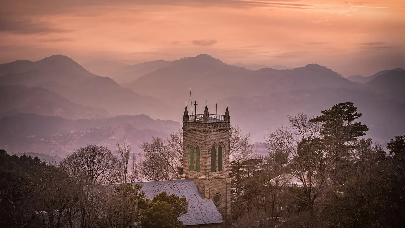
Fort Munro sits high in the range, and the reason to be here is the space around you: layer after layer of folded Sulaiman hills, and on clear days long views over the lower ground. The Koh-e-Suleman Development Authority, which has been developing the area for tourism, lists Fort Munro Top, Anari Top and Kalma Chowk among the spots it has built roads to, and those are the obvious places to start.
- Fort Munro Top is the natural first stop. Go early in the morning or for sunset, when the light across the ridges is at its best.
- Anari Top and Kalma Chowk are the other named spots on the authority's list, and worth an hour if you have a car.
- Yakbai Top and Mubarki Top, near Fort Munro, rise above 2,000 metres and see fewer visitors.
Ask locally about the state of any road before driving to the higher points, and turn back if a track looks beyond your car.
Spend an afternoon at Dama Dam
Dama Dam, also called Dames or Demis Lake, is a small lake in the hills and the centre of Fort Munro's picnic life. It is surrounded by greenery and orchards, and families come to sit by the water, walk and, when there is enough water, take a boat out.
The lake's size depends entirely on rain. After a good monsoon it fills; in a dry year it can shrink to little more than a pond. It is worth managing expectations with children who have been promised a lake.
The TDCP resort stands nearby, with a walking track down to the water, gazebos and an open-air seating area. Its restaurant is an easy place for a meal, and it serves sajji, the Baloch style of slow-roasted lamb or chicken. Even if you are not staying there, it is an easy base for an afternoon.
Walk around the old hill station
Fort Munro was founded in the late 1860s by Sir Robert Sandeman, the British frontier administrator, as a summer retreat for officials escaping the heat of the Derajat. It was named after Munro, then commissioner of the Derajat division. Despite the name there is no real fort: it was always a hill station.
A few colonial buildings survive, including Sandeman Lodge, the Commissioner's House and the district officers' residences, along with a small Christian cemetery with graves of British families. Several are still in official use, so look at them from outside and don't walk into compounds. The cemetery is small and quiet; treat it with respect.
Beyond the buildings, the pleasure is simply walking. There are paths along the hillsides and around the lake. Keep to clear paths, wear proper shoes, and don't wander onto slopes above steep drops.
Stop in the bazaar
Fort Munro's bazaar is small, a cluster of shops and eating places rather than a shopping street. It comes alive in the summer season, and many of its shops close for the winter. It is the place for a cup of tea and a simple meal after a day outdoors.
Don't expect much choice. Bring anything specific you need from Dera Ghazi Khan, and carry cash rather than relying on cards or ATMs.
Visit in winter for a chance of snow
Fort Munro is one of the very few places in Punjab where it snows. Snow falls in many winters, usually between December and February, and when it does the hill station fills with families from Multan, Dera Ghazi Khan and across South Punjab.
If you want to catch it, watch the forecast and be ready to go at short notice. Expect long traffic queues on the road up, and don't drive the bends on snow or ice without experience. Winter nights are freezing, so check that your room has proper heating before you book.
Local customs to respect
The hills around Fort Munro are home to Baloch tribes, the Leghari above all, and the area is part of the tribal belt of Dera Ghazi Khan district. It is a conservative place with a strong tradition of hospitality. A little care goes a long way.
- Dress modestly, men and women alike. Shorts and sleeveless tops draw attention.
- Never photograph women, and ask before photographing men, children or homes.
- Stay out of private land, orchards and homes unless invited. Villages and fields are not picnic spots.
- Keep music low, especially near homes and during prayer times.
- Take your rubbish back down. Litter left by visitors has prompted official clean-up drives here.
- Carry your CNIC and stop at checkposts when asked. Follow the police's instructions and don't photograph the posts.
If you are offered tea, accept it graciously if you have the time.
Safety and what to check before you go
Fort Munro is an established family destination that draws visitors from across South Punjab every summer. The wider tribal belt of Dera Ghazi Khan, though, has seen occasional militant attacks on police posts, including one in early 2025 in the north of the district, well away from Fort Munro.
Check the news and any local advisories before you set off, travel in daylight, and follow what police at the checkposts tell you. If you are a foreign national, confirm the current rules for this area before planning a visit.
On the practical side, fill your fuel tank in Dera Ghazi Khan, carry water and snacks, and expect mobile signal to be patchy on the climb. For general advice on travelling in Pakistan, see our travel guide.
Is Fort Munro worth it?
For families in South Punjab, yes. It is the nearest cool air to Multan and Dera Ghazi Khan, the drive is spectacular, and a day or a night here is a real break from the summer heat. In winter, the chance of snow within a few hours of home makes it special.
For travellers from Lahore or Islamabad, it is a long way to come for a small hill station, and Murree, the Galyat or the northern valleys offer far more for the same effort. It makes most sense as part of a South Punjab road trip, alongside Multan, the Sakhi Sarwar shrine and Dera Ghazi Khan itself, rather than as a destination on its own. If you are weighing it against the northern valleys, our guide to when to go shows which months suit which regions, and our trip planning page can help you build the route.
Frequently asked questions
What is Fort Munro famous for?
It is South Punjab's only hill station, famous for its cool summer air at about 1,970 metres, the winding N-70 road and its steel bridges, Dama Dam lake and occasional winter snow.
How far is Fort Munro from Dera Ghazi Khan?
About 85 km west on the N-70, which takes around two hours, longer behind trucks or in holiday traffic. From Multan it is about 185 km.
Is there a lake in Fort Munro?
Yes. Dama Dam, also called Dames or Demis Lake, is a small reservoir near the TDCP resort, with boating when the water level allows. It shrinks considerably in dry years.
Does it snow in Fort Munro?
Yes, in most winters, usually between December and February. Snowfall draws large crowds and long traffic queues on the road up.
Is Fort Munro safe for families?
It is an established family destination, busy with visitors every summer. Check current news for the Dera Ghazi Khan tribal areas before travelling, drive in daylight and follow instructions at checkposts.
What should I wear in Fort Munro?
Modest clothing, in respect of local custom, and a warm layer even in summer, because evenings on the ridge are cool. In winter bring heavy jackets.